Wind Drawings


Artist and architect Peter Jellitsch created this series of pen and ink drawings entitled STB based on algorithms that predict how air will move through highrise buildings.
STB means Streambody, this series is based on a motion algorithm that is used in architectural practice to simulate wind directions and the force of air that arrives at highrise buildings. I have experimented with this program, and the outcome was solid bubbles which I have then redrawn with the directions that they had. The degree denotation that my title has (for example: STB/S02/90°) is explaining the turn of the wind-force hitting the object.
 Ink on tracing paper 33 x 28 cmSTB is an amazing ink drawing series created by Peter Jellitsch, Vienna. I really like their looks, remind me of some info-graphics.Jellitsch tells us interesting information about this series;STB means Streambody, this series is based on a motion algorithm that is used in architectural practice to simulate wind directions and the force of air that arrives at highrise buildings. I have experimented with this program, and the outcome was solid bubbles which I have then redrawn with the directions that they had. The degree denotation that my title has (for example: STB/S02/90°) is explaining the turn of the wind-force hitting the object.” See more;Peter Jellitsch is a a 29 year old phd student from Vienna where he did a master in architecture at the Academy of Fine Arts in Vienna. Jellitsch is practicing somewhere between art, architecture and science.“Generally I am trying to translate digital generated stuff into analog drawings. On one hand to see which differences appear between the digital outcome and the analog one, and on the other hand, i am interested in the repetitive movements that appear when i am reproducing from digital data. My work is always repititve in terms of sequences of one project. always a series of drawings, because most of my experiments are based on digital simulations.”
Ink on tracing paper approx. 33 x 28 cm
Ink on Paper 40,5 x 26 cm
Ink on Paper 40,5 x 26 cm


Re-thinking Urban Space
From: http://birmingham.academia.edu/HollyPrescott
Holly Prescott
Thesis Title: Re-thinking Urban Space in Contemporary British Writing
Handed in for first submission in September 2011, my AHRC-funded doctoral research focuses fundamentally around the relationships between affect, memory, narrative and spatial agency in the urban spaces featured in a cross-section of contemporary British literature.
The thesis starts from a critique of the Marxist historico-materialist spatial theory, like that of French philosopher Henri Lefebvre, widely adopted in literary studies to give ‘spatial readings’ of texts. I explore the limitations of such theory however, including its neglect of those spaces which lie outside of, have been obsolete by or experience an ambivalent relationship with dominant modes of production and social relation, and also the inability of such theory to entertain the notion that spaces might achieve their own agency, beyond their actualization through human action and appropriation.
As case studies, I elaborate these ideas by looking specifically at abandoned spaces, subterranean spaces and transient (hotel) spaces, investigating how the representation of such spaces allows authors to explore city-space in ways for which Lefebvre’s scheme cannot sufficiently account, such as in the transmission of affect between spaces and human subjects, in which the urban space becomes an agent and subject in its own right. I cover a range of novelists from the more acadmeically ‘popular’ such as Iain Sinclair, Ali Smith and Monica Ali, to those who have attracted very little previous critical attention, such as Nick Royle, Conrad Williams and Tobias Hill. Overall, my project draws attention to the issue of theory in ‘spatial readings’ of texts, asking that we carefully consider the context and relevance of a spatial theory like Lefebvre’s before inflicting it upon the porous, uncontainable and often unruly urban spaces of the contemporary British novel.
In general, my research interests include: Contemporary British and American Fiction; literature and the city; London writing; Literary Birmingham; literature and memory; literature, space and time; psychogeography; cultural geography; postmodernism; urban exploration photography; subterranean descent narratives. I have presented work at postgraduate, national and international conferences and have published essays on topics such as spatial agency in the fiction of Cheshire-born author Nicholas Royle, Contemporary London Descent Narratives and birth narratives and the photography of abandoned maternity wards- a topic on which I have had an article, ‘birth-place’, published by Feminist Review. I also hold a B.A. (Hons) in English and an M.A. in Literary and Cultural Studies from Lancaster University, where I was awarded the Princess Alexandra Chancellor’s medal.
Here at Birmingham, I am co-founder of ‘Roles’, a Gender and Sexuality Interdisciplinary Research Forum, with which I have co-organised a series of postgraduate symposia on widely varied, cross-disciplinary work in the field of gender and sexuality studies. I am part of the review panel for the Birmingham Journal of Literature and Language, and also help to run the English Department’s weekly research seminar.
I am a teaching assistant in the department, and teach on the first year ‘Literature Foundation’ and second year ‘Literature in Britain after 1945’ modules. I am also co-ordinator and PGTA for an online research skills module in the School of English, Drama and American and Canadian studies, planning and running workshops and drop-in sessions for Postgraduate students in generic and research skills.
Elsewhere, I am actively involved in the annual Literary London conference, and in July 2011 was elected as Postgraduate and Early Career Representative on the committee of the new Literary London Society. I am also very interested in Outreach and Widening Participation in HE and in Postgraduate Recruitment and support provision for new and prospective Postgraduates, and currently work in both these areas at the University of Birmingham.
Unmappable / Unknowable
From: http://darc.imv.au.dk/publicinterfaces/?p=303
Mapping the Unmappable, Knowing the Unknowable
Robert Brown
University of Plymouth
‘We need to construct multi-dimensional analyses which, rather than imposing monological coherence and closure, allow parallel and conflicting representations to coexist in analysis.’
(Shields 1996, 245)
Recent discourse recognises the city as a multi-layered construct, from Marcuse’s “layered city” to Kahn’s “many cities in one city”. (Kahn 2002; Marcuse 2002) Further deliberations range on the nature of social space through an understanding of perception as occurring through a series of filters. (Borden 2002; Lefebvre 1991) Evolving thoughts on urban histories echo these pluralistic readings, as do emerging discussions in ecology and
landscape urbanism. (Czerniak 2006; Girardet 1999; Huyssen 2002) Extant in the above is the proposition that the city is comprised of a plurality of layers formed by cultural, ecological, economic, political and social actions, agents, forces and structures1. Within this context traditional notions of the city as a collection of people inhabiting some contiguous space and thus having common concerns are suspect. What was once spatially constituted locally has been subject to significant shifts in connectivity brought on by the accessibility of physical and virtual networks of exchange; concurrently, both mobility and diverse and dispersed opportunities have fostered disparate groups overlapping across multiple spaces. Moreover, this multi-layered condition is not a predetermined absolute, static, homogenous or singular, but rather is constructed, changing, heterogeneous, and operates at multiple scales simultaneously. Furthermore, it does not exist as distinct stratum; rather the layers interrelate, with overlaps, gaps, adjacencies, conflicts, connections and fusions that exist or lie potent between them.
This conceptualisation affords a joined-up approach to the making of the city. This approach grows out of an experience of community development and urban regeneration, recognising that people and/or organisations behind projects can, through working together, achieve enhanced results. (Brown 2011) Such practice echoes other emergent shifts towards “‘pluralistic’ and ‘organic’ strategies for…urban development as a ‘collage’ of
highly differentiated spaces and mixtures, rather than pursuing grandiose plans based on functional zoning of different activities.” (Harvey 1990, 40)
Working within this condition presents however two notable and interrelated challenges. Firstly, the city’s spatial and temporal complexity render it unmappable and hence unknowable. The danger is of course that the subject falls back into totatlizing conceptualisations. Yet while recognising that we can’t ever totally map or know the city, in order to operate in this context we need some mechanism that allows us to frame the city as a space of simultaneous multiplicity, and from which one both construct knowledge and carry out subsequent action. Secondly, the conventions that we have inherited are based on a Cartesian geometry – one that is fixed and singular. What are needed are new tools that will enable us to operate with the dynamic nature of the city. Within this paper I will consider these questions, and draw upon recent work within the Master of Architecture design studio at the University of Plymouth to explore a praxis of multiplicity which I have called “palimpsest”.
inherited practice
Urban representations have historically operated within a dialectic of the strategic and the experiential. The strategic is characterised by both pictorial representations and diagrammatic drawings, each aimed at giving a panoptic perspective and a sense of metacognition. The experiential in contrast is marked by graphic mechanisms aimed at conveying intimate and immediate spatial experience, notably as encountered through vision or touch. While also using the pictorial and diagrammatic, the primary intention is to simulate something of the richness of the actual experience of place.
This dialectic, while offering useful frameworks within which to operate, poses significant limitations. They are of course inherently exclusive of the other. More significantly, they each fail to engage with the full range of multiplicity that the city represents. The panoptic overview tends toward the reductive, prioritising selected viewpoints and marginalising others, while homogenising all into totalizing visions. The immediately experiential is by
contrast fragmentary, limiting connectivity between individualising narratives. Each equally fails to engage fully with the temporal; their depictions are static, frozen in place that delimit their validity. Such a representation “automatically freezes the flow of experience and in so doing distorts what it strives to represent.” (Harvey 1990, 206)
In juxtaposition to such representations, we recognize that place is subject to multiple interpretations from multiple perspectives. Further, these are malleable and permeable, shifting and evolving dependent upon the prospect taken and its underlying attitudes and values. No totalizing nor fragmentary representation therefore can truly capture and express the manifold interactions occurring between people and place which accumulate over time. Like comparable observations on the fluidity of culture, actions and events within the city are not part of singular condition, but rather exist as multiple strands which are in a constant state of flux in relation to one another.
What is needed is a wider conceptual framework in which to formulate discussion. Yet in so doing we are confronted by a vast plurality. This is a challenge echoed by Frederic Jameson in questioning whether a comprehensive knowledge is elusive, even unobtainable. (Jameson 1999) How then to make sense of this condition and articulate some accessible account? How can we build upon this to generate a field in which we can act and which will inform the design process? What are needed are not only new tools, but equally new conceptualisations that underpin them. Practitioners and theorists have called for a reconsideration of traditional praxis, and new “techniques that engage time and change, shifting scales, mobile points of view, and multiple programs.” (Allen 2002, 40)
constructed practice
As Denis Cosgrove suggests, ultimately it is impossible to represent all spatial-temporal conditions fully, but mapping as a tool allows us this illusion. He further contends that it provides a fertile way of both knowing and representing the world. (Cosgrove 2003) The goal of the mapping as proposed here, i.e., palimpsest, is not however a singular representation. Rather, it embraces plurality and aims to give presence to this. This intention thus engages intrinsically not only with spatial form, but more ephemeral considerations of meaning perspectives. Thus, it is not so much a matter of getting any supposed reality “right”, but in drawing on Andrea Kahn’s discussion of site representations, is more of a process of knowledge formation; that is, it is a way of “constructing forms of knowledge that can cope with multiple realities.” (Kahn 2005, 289)
There are several aspects key to the process of mapping in palimpsest. First is the identification and analysis within differing thematic and/or attitudinal viewpoints (i.e., various layers within the city, for example cultural). Such a focus can of course have limitations if uncritically considered; it does however enable a more incisive view and can also reveal hidden conditions, whether dormant, marginalized or neglected. A second key move is the use of juxtaposition, in which individual mappings are brought together. This operation has its intellectual roots in Edward de Bono’s arguments on lateral thinking. It offers a way of engaging with seemingly known information and phenomena with a fresh perspective, and is particularly useful “as a way to restructure existing patterns of thinking and provoke new ways.” (de Bono 1970, 11) As de Bono further suggests, this approach helps to raise awareness of alternatives, including those that may not be so obvious. (de Bono 1970) Juxtaposition equally owes a debt to discourse on “unlearning” and “transformative learning.” Though this action we can expose the constraints and limitations of our existing attitudes and ways of working. Moreover, it enables us, as Saskia Sassen might suggest, to reveal the connections of the seemingly unconnected. (Sassen 1996a; Sassen 1996b) The third key aspect is the use of narrative. Stories help us to remember and make sense of our experiences in time and place, the wider forces at play and those places themselves. They make accessible patterns, linkages and contingencies that inform the relationship between personal thought, action, experience and memory, and broader, shared narrations. Most significantly to the discussion here, these stories can be mapped, revealing boundaries, trajectories, intersections and fields occurring in time and place. (Potteiger and Purinton, 1998) The use of multiple media plays a distinct role in this mapping process. The documentation of narratives in particular draws upon a mixing of film, photography and writing to record the diversity and flux that marks inhabitation of place. The use of various digital and graphic techniques equally supports the act of juxtaposition; a creative play with the information recorded through the thematic mapping affords a simultaneous manipulation at both strategic and tactical levels, allowing various permutations and possibilities to be revealed.
The construct of palimpsest is the subject of an on-going investigation in the Master of Architecture design studio at the University of Plymouth. This inquiry has three primary aims: firstly, to explore the construct of the city as a multi-layered representation. Secondly, to test the means by which we represent this construct. Thirdly, to frame discussion for later project work (this third point is not the focus of discussion here). This exploration reveals, maps and tests how the city’s different layers synthesise, overlap, touch, reflect, displace, erase (i.e., relate to) each other. In one recent project students worked in the context of the city of Riga, exploring specific neighbourhoods which reflect particular attitudes towards city planning in place at the time of their inception. These were examined within a framework of ecological, political, socio-cultural and socio-economic layers. Two
of the neighbourhoods examined are briefly examined here. One group’s study of the Jugendstil neighbourhood, a gridded 19th Century ‘new town’ known for its extensive number of Jugendstil buildings, revealed an overlapping of cultural, economic, political and social forces, less strategically planned but no less present within the current landscape. Though seemingly one continuous part of the city, distinct disparities were found. In some
areas a convergence of high levels of car ownership and high car values, a predominance of Latvian and English signage and even menus, and well-refurbished street facades wasidentified. In other areas where Russian signage and text was found, fewer cars and of lesser value were present, and the building frontages were in a noticeable degree of disrepair. This mapping not only reflected pro-Latvian government strategic policies, but
equally revealed the extent to which the intentions of those policies had permeated through even to non-government related actions and spatial conditions. Another group’s study of the medieval Old Town unearthed a similar convergence of the cultural, economic and political. Notable in this was a coalescing of ‘tourist-friendly’ shops, restaurants and bars, officially sanctioned by the government tourist board, with ‘suggested’ tourist routes. Seemingly omitted from the authorised narrative of the Old Town were any inhabitants of Riga, whose connections with the area were limited to acts of consumption (whether as buyers or sellers). The apparent shift from a once-diversified city fabric to a singular space of tourist, leisure and retail consumption is reflected in the government’s intended longterm strategic agenda for the Old Town.
These two projects, and similar ones by their colleagues, reveal an understanding of the city that embraces the simultaneous multiplicity present there. By bringing together distinct observations, and working with them through juxtaposition and a narrative framework, they prompt us to look again through propositions underpinned by the juxtaposition of spatial and temporal narratives, and both panoptic vision and direct experience. Manoeuvring around any singular, reductive formal representation and attributed meaning, they direct our focus to the linkages between layers of time and place.
some cautionary and concluding notes
In positing palimpsest, it is crucial to recognize that what is being proposed is not the generation of some unitary theory or “new meta-disciplinary category” as Greig Crysler warns us against. (Crysler 2003) Rather, it shares more in common with de Certeau’s notion of tactics, i.e., a calculated action in the context of a terrain that already exists, in which it is but just one of many different players acting on it. (de Certeau 1984) It is critical to highlight however that the working methodology proposed is not a positivist model. Echoing Marc Treib’s critique of Ian McHarg’s ‘Design with Nature’ methods, analytical overlays might help to reveal certain criteria but they do not autonomously generate subsequent design strategies. (Treib 1996) Nor is this approach intended to reveal some sense of an absolute truth. Moreover, it recognises that any approach carries with it a certain bias; as Corner observes, ‘how one “images” the world literally conditions how reality is both conceptualized and shaped.’ (Corner 1999, 153)
The intention of palimpsest as a practice is to expose junctions and voids between spatialtemporal layers that might provide a site in which to act. This conception does not mean to deny that the city is ultimately is unmappable and unknowable as a totality, but rather that the city consists of a multiplicity of narratives, each composed of a range of performances, perspectives, processes and relationships. It acknowledges that these at times coalesce and at other times conflict in place. The intention is to explore how these layers relate, and the potential their convergences and divergences offer as site of design. Ultimately, it is not about defining some singular vision, but rather ‘the primary aim…is to pull out the positive threads which enable a more lively appreciation of the challenge of space.’ (Massey 2005, 15)
notes
1. Actions refers to tactical operations and events in the everyday, carried out by agents (whether as individuals, institutions or organisations acting separately or communally) in the context of wider forces of contextual conditions and as influenced by structures of institutional legislation and policy or socio-cultural norms.
references
Allen, Stan, 2000. Practice – Architecture, Technique and Representation. Amsterdam: G & B Arts International.
Borden, Ian, et. al. 2002. ‘Things, Flows, Filters, Tactics’, in, I. Borden, et. al., eds., The Unknown City, The MIT Press, Cambridge.
Brown, Robert, 2011. ‘Connectivity in the Multi-Layered City: Towards the Sustainable City’, in Open House International, Spring.
Corner, James, 1999. ‘Eidetic Operations and New Landscapes’, in J. Corner, ed., Recovering Landscape – Essays in Contemporary Architecture. New York: Princeton Architectural Press, pp. 153 – 169.
Crysler, C. Greig, 2003. Writing Spaces – Discourses of Architecture, Urbanism, and the Built Environment, 1960 – 2000. New York: Routledge.
Cosgrove, Denis, 2003. ‘Conclusion – Historical Perspectives on Representing and Transferring Spatial Knowledge, in M. Silver and D. Balmori, eds., Mapping in the Age of Digital Media. Chichester: Wiley-Academy, pp. 128 – 137.
Czerniack, Julia, 2006. ‘Looking Back at Landscape Urbanism: Speculations on Site’, in C. Waldheim, ed., The Landscape Urbanism Reader, New York: Princeton Architectural Press.
De Bono, Edward, 1970. Lateral Thinking. London: Penguin Books.
De Certeau, Michel, 1984. The Practice of Everyday Life. Berkeley: University of California Press, pp. 155 – 172.
Girardet, H., 1999. Creating Sustainable Cities. Dartington: Green Books.
Harvey, David, 1990. The Condition of Postmodernity. Malden: Blackwell Publishers.
Huyssen, Andreas, 2002. Present Pasts – Urban Palimpsests and the Politics of Memory. Stanford: Stanford University Press.
Jameson, Frederick, 1999. ‘Cognitive Mapping’, in A. Kumar, ed., Poetics / Politics – Radical Aesthetics for the Classroom. New York: St. Martin’s Press.
Kahn, Andrea, 2002. ‘Imaging New York’, in P. Madsen and R. Plunz, eds., The Urban Lifeworld – Formation, Perception, Representation. London: Routledge.
Kahn, Andrea, 2005. ‘Defining Urban Sites’, in C. Burns and A. Kahn, eds. Site Matters. New York: Routledge, p. 281 – 296.
Lefebvre, Henri, 1991. The Production of Space, trans. D Nicholson-Smith. Malden: Blackwell Publishing.
Marcuse, Peter, 2002. ‘The Layered City’, in P. Madsen and R. Plunz, eds., The Urban Lifeworld – Formation, Perception, Representation. London: Routledge.
Massey, Doreen, 2005. For Space. Los Angeles: Sage.
Potteiger, Matthew and Purinton, Jamie 1998. Landscape Narratives. New York: John Wiley & Sons.
Sassen, Saskia 1996a. ‘Rebuilding the Global City: Economy, Ethnicity and Space’, in A. King, ed., Re-Presenting the City – Ethnicity, Capital and Culture in the 21st Century Metropolis. New York: New York University Press, pp. 23 – 42.
Sassen, Saskia, 1996b ‘Analytic Borderlands: Race, Gender and Representation in the New City’,”in A. King, ed., Re-Presenting the City – Ethnicity, Capital and Culture in the 21st Century Metropolis. New York: New York University Press, pp. 183 – 202.
Treib, Marc, 1996. ‘Nature Recalled’, in J. Corner, ed., Recovering Landscape – Essays in Contemporary Landscape. New York: Princeton Architectural Press, pp. 29 – 43.
Shields, Rob, 1996. ’A Guide to Urban Representation and What to Do About It.’, in A. King (ed) Re-Presenting the City – Ethnicity, Capital and Culture in the 21st Century Metropolis. New York: New York University Press, pp. 227 – 252.
Unmappable
From: http://katmcmahon.wordpress.com/2011/04/04/stan-allan-mapping-the-unmappable/
Spatial Experimentations
Stan Allen: mapping the unmappable
Stan Allen’s “Mapping the unmappable on notation” addresses the important interconnectedness between the city and architecture. It further notates the architects role, procedures and methodology when constructing drawings, maps and plans of future projects and buildings. Throughout the essay the author makes comments on the changing roles of the importance of drawings within in the creative process. In the beginning of the design process the architect’s intentions are expressed through notated drawings, which ultimately act as the map to the design, and thus they hold all relevance. Allen states that drawings are “uniquely capable of producing something new from something else”. Thus, drawings mould the future architectural work. Despite this important point, drawings hold no relevance once the building is constructed, as the final material work trumps the construction drawings, plans and notations.
The main concept of the article is centrally based around the overall importance of notation, and how this acts as language in the architect’s world. The author ultimately states that drawings as themselves can’t represent everything- and hence notation is vital in order to address the unexpected and unpredictable in relation to the real and constructed work. Notation can address what drawings ultimately can’t through delivering the precise measurements and aspects of architecture. Drawings would not be complete without notations on materials, measurements and light aspects, and thus Stan Allen makes the point of how notation works as the architect’s language, especially seen on page 35 when he states that “notational language was developed in response rather to the need for participation of many hands in construction”. Allen divides the importance of architecture into separate points. He states that “notations always describe a work that is yet to be realised” meaning that notation promotes optimism and potentiality. “Notation goes beyond the invisible in order to engage the invisible aspects of architecture”, finding relationships amongst the various parts of the city. Thirdly, he addresses that “notation includes time as a variable” addressing the measurement of unfolding time. He lastly states that “notions presume a social context”, which help the designer map the complex and indeterminate theatre of everyday life.
The article also addresses the changing aspects of architecture, and how designers have to mould their works to the new city. Stan Allen juxtaposes the old and the new stating that “historically, architecture of the city embodied collective memory through a structure of finite definition…today the technologies of communication, information exchange and war…have produced a condition in which the urban site is not longer simply geographic”. This hence impacts the designer freedom as cities today are not separate in their entirety, and thus architects need to integrate their designs into the societal context and surrounding.
Allen thus addresses the changing nature of the roles of an architect throughout time.
Vent Stack
From BLDGBLOG

[Image: The Holland Tunnel Land Ventilation Building].
… and sometimes in the heart of the city. After all, there are also weather systems artificially generated inside the earth by construction projects and large-scale pieces of urban infrastructure, whole subterranean climatologies of moving air that would not otherwise exist without the implanting hand of architecture, as if surgically grafted there. Atmospheric cut-and-cover. A weather reserve beneath the sidewalk.
In any case, the idea that a region’s climate—its seasonal weather systems and thermal particularities—might become something more than mere background through a simple act of musicalization—that you could install Sauvageot orchestras in places all over the world to turn storms into symphonies—is amazingly suggestive for future design projects. From low-pressure systems in central Russia to the Santa Ana winds of suburban Los Angeles, architecture becomes a musical generator, an acoustic ornament activated by the sky.
Interpretation – Based Spatiality
From BLDGBLOG:

[Image: A collage of various buildings by Robert Scarano, from photos by Gabrielle Plucknette for the New York Times].
After reading today that a New York appeals court has upheld a ban on architect Robert Scarano, preventing him from practicing in the city, I found this fascinating anecdote published a few months ago about one of the tactics Scarano has used to get his developments cleared by the Department of Buildings. Quoting the New York Times at length:
It’s the summer of 2008. A young couple decides to buy an 800-square-foot apartment in a new condo building on the gentrifying outer edge of a fashionable Brooklyn neighborhood. The buyers go to close on the place, and as they’re signing away half a million dollars, the building’s developer, keeping a wary eye on the hovering lawyers, leans over and whispers something. There’s a second bathroom in the apartment, he says, one that does not appear on the floor plan—its doorway is concealed behind an inconspicuous layer of drywall. At first, the buyers think the developer is kidding. This is before the crash, near the peak of the market, and no one’s giving away a square inch. But the developer says no, he’s dead serious, just look. So a few days after they buy the place, the couple takes a sledgehammer to their wall.
Like something out of House of Leaves—or a kind of architectural Advent calendar, in which various walls are knocked down at specific times of the year to reveal whole new rooms and corridors behind them—the building contained more space than its own exterior had indicated.
Later, the article’s author goes on to attend a party in another of Scarano’s buildings: “‘There’s a secret room,’ [the party’s host] told me, conspiratorially. Up on the mezzanine level, next to a pair of D.J.’s turntables, he knocked on a wall. It sounded hollow.”
I have to admit that this totally blows my mind. Imagine another room within that room whose doorway is also sealed behind drywall—and then other rooms within that room, and further corridors and stairs and entrances. Tap, tap, tap—you navigate by sound, knocking deeper and deeper into an architectural world you only reveal by means of careful deconstruction. Amidst this labyrinth of drywalled rooms, you realize the true extent of your property, which extends so far beyond what you originally thought was your building that you end up, at one point, standing in another zip code.

[Image: The underground city of Derinkuyu].
In a way, I’m reminded of the massive underground city of Derinkuyu, which, as Alan Weisman explains in The World Without Us, was discovered entirely by accident:
No one knows how many underground cities lie beneath Cappadocia. Eight have been discovered, and many smaller villages, but there are doubtless more. The biggest, Derinkuyu, wasn’t discovered until 1965, when a resident cleaning the back wall of his cave house broke through a wall and discovered behind it a room that he’d never seen, which led to still another, and another. Eventually, spelunking archeologists found a maze of connecting chambers that descended at least 18 stories and 280 feet beneath the surface, ample enough to hold 30,000 people—and much remains to be excavated. One tunnel, wide enough for three people walking abreast, connects to another underground town six miles away. Other passages suggest that at one time all of Cappadocia, above and below the ground, was linked by a hidden network. Many still use the tunnels of this ancient subway as cellar storerooms.
In any case, for Scarano it was not always about literally hiding extra rooms inside a building; it was often just a matter of using certain words—like basement—instead of others—like cellar—to hide his intentions. For instance, “Scarano tried to build a two-story addition to the roof of [an] old warehouse by transferring floor area from the building’s lowest level, which he planned to convert to parking, to the top of the roof. But the zoning code distinguished between a basement (which is partly above ground, defined as habitable, and therefore counted toward the floor-area ratio) and a cellar (which is underground and uninhabitable). Opponents accused Scarano of trying to finesse the difference, and eventually the Department of Buildings declared the space a cellar. New height limits have been established in the neighborhood, and the partly built addition is coming down.”
Or this: Scarano “adapted the zoning rules that applied to warehouse conversions. Under certain circumstances, the code classified loft mezzanines as storage space, not floor area, and Scarano assured developers their new building plans could slip through this loophole.”
It’s hermeneutics—as if the spatial expansion of whole neighborhoods is really just a graph of certain words used in different contexts. As if vocabulary itself materializes, precipitating out as alternative spatial futures for the city. Indeed, the New York Times writes, “in Scarano’s view, the city’s code was a Talmudic document, open to endless avenues of interpretation. Through a variety of arcane strategies, he could literally pull additional real estate out of the air.”
I’ve long been a fan of David Knight and Finn Williams, two London architects with an encyclopedic knowledge of that city’s building permissions and zoning codes (I highly recommend their book SUB-PLAN: A Guide to Permitted Development, as well as Knight’s recent guest post on Strange Harvest). The following image, taken from that book, is just one example of the type of interpretation-based spatiality so often abused by Scarano.

[Image: From SUB-PLAN: A Guide to Permitted Development by David Knight and Finn Williams].
Whether or not hiding entire rooms behind drywall is part of London’s “permitted development” is something we’ll have to ask Knight and Williams.
Creative Data

- the y-axis shows population. Note the logarithmic scale
- the x-axis for the bubbles shows the number of vacant homes per population
- the outer circle of the bubble shows the total number of homes
- the inner bubble shows the vacant number of homes
- each bubble has a line that connects the bubble to yet another scale: the population / total home ratio
- you can use the left- and right arrow keys to browse through all the states (make sure that the Applet has the focus; if not, click once on the Applet with your mouse to give it focus).
- if you move your mouse over a bubble, you can highlight an individual bubble, and at the top right you can see some exact numbers for your selection
There are some interesting things to look for:
- counties that have more homes than people
- or, counties that have more than 50% vacant homes
Enjoy!(Click the fullscreen button to see the live Applet. The live Applet is 8Mb due to the size of the data, so just wait until the data has been loaded)
Algorithmic data
From: University of Florida Sparse Matrix collection
Graphs: Gallery of the University of Florida Sparse Matrix Collection
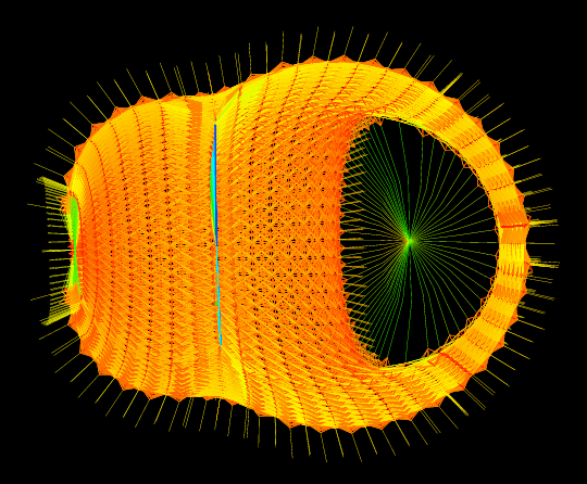
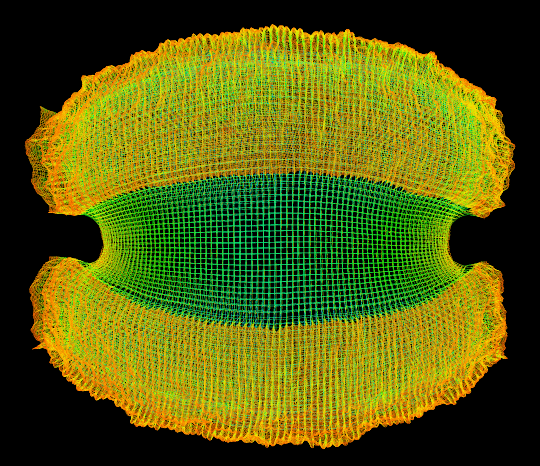
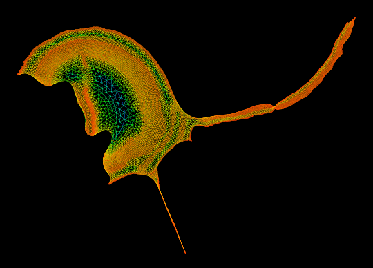
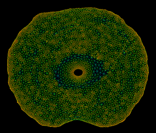
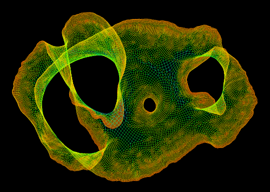
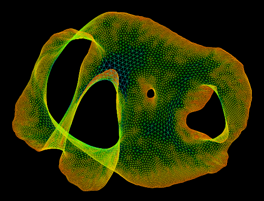
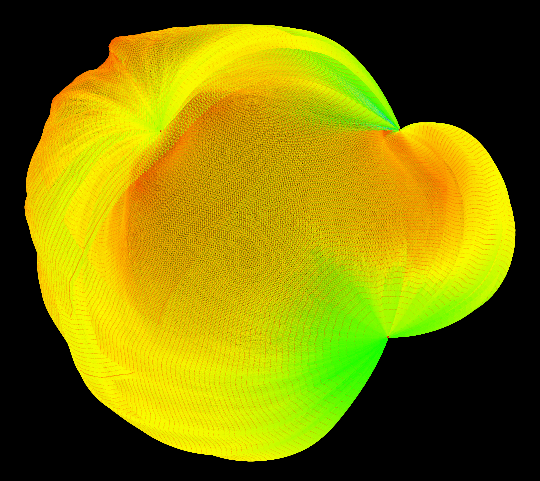
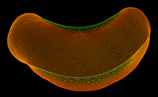
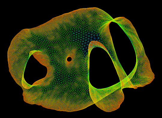
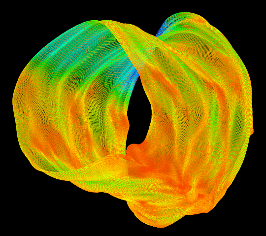
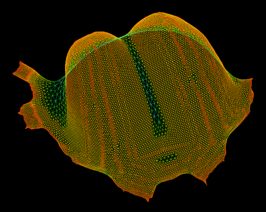
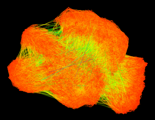
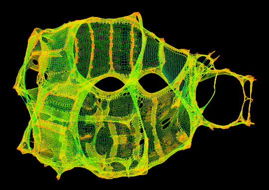
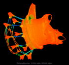
Graph visualization is a way to discover and visualize structures in complex relations. What sort of structures are people who do large scale computation studying? We can get a glimpse by visualizing the thousands of sparse matrices submitted to the University of Florida Sparse Matrix collection using sfdp algorithm . The resulting gallery contains the drawing of graphs as represented by 2408 sparse matrices in this collection. Each of these sparse matrices (a rectangular matrix is treated as a bipartite graph) is viewed as the adjacency matrix of an undirected graph, and is laid out by a multilevel graph drawing algorithm. If the graph is disconnected, then the largest connected component is drawn. The largest graph (Schenk@nlpkkt240) has 27,993,600 vertices and 366,327,376 edges. A simple coloring scheme is used: longer edges are colored with colder colors, and short ones warmer. The graphs are in alphabetical order. Use the “Search” link to find graphs of specific characters.







Scraper Sitting
From: Lebbeus Woods
SLUMS: to the stars


A lot of attention is being paid to squatters taking over an unfinished skyscraper in Caracas, Venezuela, and rightly so. It is both a morality tale from which we can draw many harsh lessons about our contemporary global society, and a prophesy of the future. Surely, with vacant land running out in the vast cities that migrants from rural areas are now flocking to by the millions and in every part of the world, it is inevitable that slums will occupy abandoned, unfinished or unleased skyscrapers. The harshest lesson of this phenomenon is that slums are radically out of the control of governments and private institutions that we have no choice but to look to for treating the existence and the effects of this human scourge. Without some measure of control or at least slowing the spread of poverty and slums, it is conceivable that in the next few decades they will begin to overwhelm organized society and eventually push it to the brink of a new Dark Age. In such an age, it will not only be public services that will begin to collapse from overuse, much of it illegal, but social systems of every kind, from education to art, as the financial burden of paying for the problems created by a vast population that pays no taxes will make many of civilized society’s essential activities unsustainable. This is a grim and frightening prospect indeed and one that is already beginning to happen. The takeover of the Caracas skyscraper is not just an oddity. Rather, it is a first drop of rain in a coming storm caused when the global financial system falters, even a little, and a financier-developer must abandon a project for lack of funds. A crack has opened up and it is immediately filled by people desperate to find shelter and establish a community, people who have every right to them but have been excluded from those provided by established society. These people have no choice but look for cracks in the social edifice and, when they find them, move quickly and decisively. As mainstream society falters more under the increasing weight of the impoverished and excluded, more cracks will appear and be filled. It will be an incremental process, but inexorable. Unless, that is, the powers-that-be in our present society begin to address the root causes of poverty.
Another lesson to be learned from the Caracas story is that all those who have been hoping for a social revolution to emerge from the dispossessed squatters and slum-dwellers—the poor—had better think again. What these people want is not a new, egalitarian society founded on ideals of social justice, but only what most others already have—a consumer society with all the bells and whistles and toys. Clearly, the Caracas tower is not a breeding ground for radical social change. It is an unintended parody of the society that created the squatters’ dire situation to begin with.
LW
.


Scanning the Mist


We have been speculating on the capabilities of 3D scanning.
We thought it might be interesting to see if the scanner could detect smoke and mist. It did and here are the remarkable results! These scans acted as a test for the later site specific work ‘Slow Becoming Delightful.’


Desert Aqua-Net Plan
From: SHIMIZU CORPORATION
Creating Lakes in the Desert: A Proposal for Creating a Network of Canals and Exploring New Ways to Inhabit Our Planet
The Desert Aqua-Net Plan is a concept for making use of the desert, which currently accounts for some one-third of the Earth’s total land area.
According to this idea, multiple manmade lakes will be created in depressed areas of deserts, after which artificial islands will be built on the lakes. Filled with seawater introduced through canals, the lakes will then be connected to form a water network.
By creating waterways in the desert and transforming arid and semiarid areas into inhabitable land, this plan (which is still in the simulation stage) ultimately seeks to build cities on manmade islands that have been formed on seawater lakes.

Outputting the Results
From: http://cnx.org/content/m12467/latest/

The above graphical output method is the result of our attempts to present an intuitive representation of our data. The goal is to produce an output which is most useful for someone completely unfamiliar with graphical methods yet intimately familiar with music. Thus, we graph each window as an image with colors assigned to the various values of the data inside the window. The result is something that looks surprisingly like a musical score. The more “intense” or colorful a particular region seems, the more likely it is to be a note played within that window. The chromatic scale serves to display the merits of this startling technique with distinction.
The first graph below this paragraph is the graphical interpretation of Stravinsky’s Three Pieces for Clarinet using this method for processing our data described in this section. It serves the same purpose as the preceding Stravinsky graphs.
The most useful application of this graphical method, however, is that one may readily view several notes playing at once. This form is best embodied in the final two graphs. To first gather some sense of how to interpret the graph when multiple instruments are playing, the second graph below this paragraph shows a stripped-down version of the output from our program when it is fed the first 90.703 seconds (4,000,000 samples) of Barber’s Adagio for Strings as played by a clarinet choir. A choir in its most general sense is merely the gathering of multiple like-familied instruments. That is, all sorts of vocal instrumentation (soprano, alto, tenor, bass) form the most standard interpretation of choir. Thus, a clarinet choir is one in which several members of the clarinet family (Eb, Bb, A, Alto/Eb, Bass, Contrabass, etc.) play in one ensemble. The final graph on this page displays the output for Barber’s Adagio For Strings in all its glory.
MUSICAL DATA FROM SOFTWARE – BINARY CODES?
TRANSLATE MUSIC INTO SCORE


Mersey Tornado
From: Pruned

As part of the 2012 Cultural Olympiad, artist Anthony McCall will be spinning an artificial, mile high tornado in Liverpool. Called Column, this swirling micro-climate will be created “by gently rotating the water on the surface of the [River] Mersey and then adding heat which will make it lift into the air like a water spout or dust devil.”
Outside with the “[in]coherent convection” of the elements and without the controlled environment of some cavernous atriums, no doubt McCall and his engineering team will encounter some complications. But we’re hoping the final piece will look as legible as the image, or at least on favorable days.
US/Canada
From: The Center for Land Use Interpretation
Life On The Line At Derby Line, Vermont
Part Of The Ongoing CLUI Investigation into The Borderlands Of The USA

[From the west the international border enters the library’s reading room at the corner bay window.
CLUI photo.]
International boundaries are places of abrupt transition, where a conceptual cartographic line can manifest itself physically in many ways. Along the US/Canada border, it is often in the form of a low fence or a cut-line through the trees, running along the path of the border. If roads head to the border in a perpendicular fashion, from either side, and do not hit a natural obstacle like a river, they are usually blocked by earthen berms, posts, guardrail, or overgrowth. If the road goes through the border, it usually has an inspection station, one for each country, on either side of the line.
In the case of the town/s of Derby Line, Vermont/Stanstead, Quebec, the border runs right through the community, cutting through the street grid, and even buildings as well, creating an unusual international zone, where behavior is affected in some interesting ways.
In the two sided town of Derby Line/Stanstead there are two streets that cross the line without any checkpoints. Technically, any time anyone crosses the international line, they are subject to having to report, in person, to a port of entry inspection station for the country they are entering. This makes traffic on the streets that cross the line without a checkpoint, Maple Street/Rue Ball and Pelow Hill/Rue Lee fairly light, as it is more convenient to cross at Main Street/Rue Dufferin, where checkpoints are often set up for “drive thru” service.
Pedestrians on the sidewalk are also technically required to report as soon as they cross the line. Visiting someone on the other side of the line, even if the building is next door, means walking around to the inspection station first, or risk being an outlaw. Playing catch on Maple Street/Rue Ball would be an international event, and would break no laws presumably, so long as each time the ball was caught, the recipient marched over to customs to declare the ball.
When the international line crosses through a building, a different set of rules applies. Residents of the small apartment building in Derby Line/Stanstead do not need to report if they cross the line inside the building. They only need to report if they leave out the side of the building that opens on to a different country than the one they entered the building from. The building’s interior ends up being an international space, a bubble in the otherwise nearly infinitely thin international line.
The most prominent building on the line is the Haskell Free Library and Opera House. It was built intentionally on the border in 1901, as a gift to the community, and a symbol of international harmony. The entrances, one leading into the library, and the other heading up the stairs to the opera house/theater, however, are in the United States.
And though there are no restrictions on movement within the building, the placement on the border can lead to complications. The planning of a recent renovation project at the Library/Opera House took three years due to the conflicting construction, fire safety and historic preservation regulations of the two countries. Some of the public bathrooms, for example, sit on the border that runs diagonally through the building, and plumbers from the US and Canada had to be involved to make sure the work met their respective building codes. A fire escape for the theater was located on the Canadian side, but had to be recognized by the Americans, even though it wasn’t in their jurisdiction. If there were a fire in the opera house, then the evacuees would have to head immediately to the immigration station up the road.
The line painted on the floor inside the library and opera house is more than just a novelty. Apparently it was required in order to show which portions of the structure and furnishings would be covered by the separate Canadian and American insurance policies.

The border continues, dividing the World Book in half, depending on how it is shelved. . .

. . .and makes an inquiry at the reception desk an international exchange.

Upstairs, the theater has a line running diagonally across the seating area. The stage is in Canada. CLUI photos

Microclimate
A microclimate is a local atmospheric zone where the climate differs from the surrounding area. The term may refer to areas as small as a few square feet (for example a garden bed) or as large as many square miles (for example a valley). Microclimates exist, for example, near bodies of water which may cool the local atmosphere, or in heavily urban areas where brick, concrete, and asphalt absorb the sun’s energy, heat up, and reradiate that heat to the ambient air: the resulting urban heat island is a kind of microclimate.
Another contributing factor to microclimate is the slope or aspect of an area. South-facing slopes in the Northern Hemisphere and north-facing slopes in the Southern Hemisphere are exposed to more direct sunlight than opposite slopes and are therefore warmer for longer.
The area in a developed industrial park may vary greatly from a wooded park nearby, as natural flora in parks absorb light and heat in leaves, that a building roof or parking lot just radiates back into the air. Advocates of solar energy argue that widespread use of solar collection can mitigate overheating of urban environments by absorbing sunlight and putting it to work instead of heating the foreign surface objects.[citation needed]
A microclimate can offer an opportunity as a small growing region for crops that cannot thrive in the broader area; this concept is often used in permaculture practiced in northern temperate climates. Microclimates can be used to the advantage of gardeners who carefully choose and position their plants. Cities often raise the average temperature by zoning, and a sheltered position can reduce the severity of winter. Roof gardening, however, exposes plants to more extreme temperatures in both summer and winter.
Tall buildings create their own microclimate, both by overshadowing large areas and by channelling strong winds to ground level. Wind effects around tall buildings are assessed as part of a microclimate study.
Microclimates can also refer to purpose made environments, such as those in a room or other enclosure. Microclimates are commonly created and carefully maintained in museum display and storage environments. This can be done using passive methods, such as silica gel, or with active microclimate control devices.
San Francisco is a city with microclimates and submicroclimates. Due to the city’s varied topography and influence from the prevailing summer marine layer, weather conditions can vary by as much as 9°F (5°C) from block to block. [1]
The region as a whole, known as the San Francisco Bay area can have a wide range of extremes in temperature. In the basins and valleys adjoining the coast, climate is subject to wide variations within short distances as a result of the influence of topography on the circulation of marine air. The San Francisco Bay Area offers many varieties of climate within a few miles. In the Bay Area, for example, the average maximum temperature in July is about 64 °F (18 °C) at Half Moon Bay on the coast, 87 °F (31 °C) at Walnut Creek only 25 miles (40 km) inland, and 95 °F (35 °C) at Tracy, just 50 miles (80 km) inland. [2]
The Los Angeles and San Diego areas are also subject to phenomena typical of a microclimate. As such, the temperatures can vary as much as 18°F (-8°C) between inland areas and the coast, with a temperature gradient of over one degree per mile (1.6 km) from the coast inland. Southern California has also a weather phenomenon called “June Gloom or May Grey”, which sometimes gives overcast or foggy skies in the morning at the coast, but usually gives sunny skies by noon, during late spring and early summer.
Calgary, Alberta is also known for its microclimates. Especially notable are the differences between the downtown and river valley/flood plain regions and the areas to the west and north. This is largely due to an elevation difference within the city’s boundaries of over 1000 ft, but can also be attributed somewhat, to the effects of the seasonal Chinooks. [3]
Halifax, Nova Scotia also has numerous microclimates. Coastal temperatures and weather conditions can differ considerably from areas located just 5-15km inland. This is true in all seasons. Varying elevations are common througout the city, and it is even possible to experience several microclimates while travelling on a single highway due to these changing elevations.
Santiago, Chile is also subject to microclimates, but is not as well known for it.
Known for its wines, the Ticino region in Switzerland benefits from a microclimate in which palm trees and banana trees grow.
Gran Canaria is called “Miniature Continent” for its rich variety of microclimates.
Microscale Meteorology
Microscale meteorology is the study of short-lived atmospheric phenomena smaller than mesoscale, about 1 km or less.[1] These two branches of meteorology are sometimes grouped together as “mesoscale and microscale meteorology” (MMM) and together study all phenomena smaller than synoptic scale; that is they study features generally too small to be depicted on a weather map. These include small and generally fleeting cloud “puffs” and other small cloud features.[2] Microscale meteorology controls the most important mixing and dilution processes in the atmosphere.[3] Important topics in microscale meteorlogy include heat transfer and gas exchange between soil, vegetation, and/or surface water and the atmosphere caused by near-ground turbulence. Measuring these transport processes involves use of micrometeorological (or flux) towers. Variables often measured or derived include net radiation, sensible heat flux, latent heat flux, ground heat storage, and fluxes of trace gases important to the atmosphere, biosphere, and hydrosphere.
Cloudy with a Chance of Certainty
As part of the exhibition, ‘The Last Newspaper,’ at the New Museum.
Weather is important news. A Ford Foundation-sponsored 2006 survey found that people regard the weather as the news of greatest concern (followed by national and international events). The high demand for weather information is confirmed by a Pew Research Center study in which it ranks among the news categories of most interest consistently for the past three decades. Weather is even news that is highly sought after online. The Weather Channel’s http://www.weather.com is one of the top fifteen most visited sites, having about the same amount or more traffic than major sources of general news, like CNN, the New York Times, MSNBC, and the BBC.
But even though it is a matter of interest, weather reporting is rarely a matter of consequence. We are interested in knowing climatic conditions because they impact us directly. The weather personally affects what we wear, our commute, how the workday goes, and what we do on weekends; and being aware of what the weather will be let’s us plan accordingly. Yet, some would consider it not news at all because unlike the reporting of world affairs, politics, economics, the war or health, the daily reporting of weather isn’t information about events of great consequence. The reported facts are immediately relevant though they bear little significance on the larger course of human interactions. But that’s not to say that the weather itself is unimportant.
Although we spend a lot of time following weather news, there isn’t a lot of news about the consequences of weather. Only when meteorological pressures depart from slight fluctuations and approach extremes that potentially cause damage does weather reporting describe its collective impact. Yet, the weather greatly affects us everyday and our project, Cloudy With a Chance of Certainty, presents an ongoing report of the consequences of its unpredictability on cities. Weather influences the workings of cities, altering the flow of their traffic infrastructure, the use of their energy resources, and the productivity of their industries. Knowing what the weather will be helps cities to prepare for climatologic surprises and minimize disruption. However, even with advanced technological forecasting, the weather is uncertain and our hazy knowledge of the situation has meaningful urban costs as shown in the three display panels. Panel One provides the current temperature of twenty-four US cities. Panel Two represents short-term weather uncertainty expressed by the change in the daily closing price for Chicago Mercantile Exchange Weather Futures traded for each of the cities over one month, along with the sum of the difference between each city’s daily forecasted and actual temperature for one month. Panel Three provides a preliminary estimate of the cities’ GDP output based upon the affects of weather changes on utilities, communication, construction, manufacturing, wholesale trade, agriculture, mining, and ‘financial, insurance, and real estate’ sectors.
Credit: Jeffrey Inaba / C-Lab
Reforestation of the Thames Estuary

While studying at the Bartlett School of Architecture in London, recent graduate Tom Noonan produced a series of variably-sized hand-drawings to illustrate a fictional reforestation of the Thames estuary.

Stewarding, but also openly capitalizing on, this return of woodsy nature is the John Evelyn Institute of Arboreal Science, an imaginary trade organization (of which we will read more, below).

The urban scenario thus outlined—imagining a “future timber and plantation industry” stretching “throughout London, and beyond”—is like something out of Roger Deakin’s extraordinary book Wildwood: A Journey Through Trees (previously described here) or even After London by Richard Jeffreys.
In that latter book, Jeffreys describes a thoroughly post-human London, as the ruined city is reconquered by forests, mudflats, aquatic grasses, and wild animals: “From an elevation, therefore,” Jeffreys writes, “there was nothing visible but endless forest and marsh. On the level ground and plains the view was limited to a short distance, because of the thickets and the saplings which had now become young trees… By degrees the trees of the vale seemed as it were to invade and march up the hills, and, as we see in our time, in many places the downs are hidden altogether with a stunted kind of forest.”
Noonan, in a clearly more domesticated sense—and it would have been interesting to see a more ambitious reforestation of all of southeast England in these images—has illustrated an economically useful version of Jeffreys’s eco-prophetic tale.

[Image: “Lecture Preparations” by Tom Noonan, courtesy of the architect].
From Noonan’s own project description:
- The reforestation of the Thames Estuary sees the transformation of a city and its environment, in a future where timber is to become the City’s main building resource. Forests and plantations established around the Thames Estuary provide the source for the world’s only truly renewable building material. The river Thames once again becomes a working river, transporting timber throughout the city.
It is within these economic circumstances that the John Evelyn Institute of Arboreal Science can establish itself, Noonan suggests:
- The John Evelyn Institute of Arboreal Scienc eat Deptford is the hub of this new industry. It is a centre for the development and promotion of the use of timber in the construction of London’s future architecture. Its primary aim is to reintroduce wood as a prominent material in construction. Through research, exploration and experimentation the Institute attempts to raise the visibility of wood for architects, engineers, the rest of the construction industry and public alike. Alongside programmes of education and learning, the landscape of the Institute houses the infrastructure required for the timber industry.
 [
[
And the Institute requires, of course, its own architectural HQ.

Noonan provides that, as well. He describes the Institute as “a landscape connecting Deptford with the river,” not quite a building at all. It is an “architecture that does not conform to the urban timeframe. Rather, its form and occupation is dependent on the cycles of nature.”
- The architecture is created slowly—its first years devoid of great activity, as plantations mature. The undercroft of the landscape is used for education and administration. The landscape above becomes an extension of the river bank, returning the privatised spaces of the Thames to the public realm. Gaps and cuts into the landscape offer glimpses into the monumental storage halls and workshops below, which eagerly anticipate the first log harvest. 2041 sees the arrival of the first harvest. The landscape and river burst in a flurry of theatrical activity, reminiscent of centuries before. As the plantations grow and spread, new architectures, infrastructures and environments arise throughout London and the banks of the Thames, and beyond.
The drawings are extraordinary, and worth exploring in more detail, and—while Noonan’s vision of London transformed into a working forest plantation would have benefitted from some additional documentation, such as maps*—it is a delirious one.

Considering the ongoing overdose of urban agriculture imagery passing through the architecture world these days, it is refreshing simply to see someone hit a slightly different note: to explore urban forestry in an aesthetically powerful way and to envision a world in which the future structural promise of cultivated plantlife comes to shape the city.
Phytoremediation
From Brownfields to Greenfields: A Field Guide to Phytoremediation
|
by Kaja Kühl
November 10th, 2010 |
Underutilized or vacant space in the city can be a source of creative inspiration for urban agriculture, public parks, housing, community space, and the occasional mini-golf course. But prior to any contemplation of productive interventions into these sites, their environmental health and safety must be considered. Contaminated lots are known as brownfield sites, and the remediation necessary before development can take place is often a lengthy and expensive process. In PlaNYC, Mayor Bloomberg has identified brownfield remediation as a key initiative to the healthy development of New York, but urban designer Kaja Kühl (and her fellow researchers Lisa Brunie, Erik Facteau and Jay Tsai) was interested in finding smaller scale, cost-effective approaches to the problem. Here, Kühl presents A Field Guide to Phytoremediation, a handbook on how to remove contaminants from land using plants. Read on, and if you have property that might benefit from this approach, contact Kühl to help turn her research into action. -V.S.

According to the Department of City Planning’s most recent data, 7.1% of New York City’s land is vacant and, for the most part, underutilized. This is a rate much lower than the national average of 15% (in some cities the rate of vacant land is as high as 45%). However, taken together, these properties amount to approximately 11,000 acres of underutilized land — roughly the size of Manhattan (not counting streets). Imagine: across the five boroughs there is enough available land to fill Manhattan, with the potential to grow fresh food, create new parks or build affordable housing. But many of these vacant sites are potentially contaminated by previous industrial uses or leftover building materials, especially lead-based paint. Contamination and the potential health hazards to people who live, work or play on or near such sites become subject to oversight and regulation only in the event of a rezoning permitting residential uses. In those cases, a site receives an e-designation, which identifies it as potentially hazardous due to previous industrial uses. Once designated, site owners are obligated to submit to a process of site investigation and clean up.
 50% of all vacant lots in New York City are smaller than 2,500sf and are owned by individuals. Click to enlarge.
In May of 2009, Mayor Bloomberg signed the New York City Brownfield and Community Revitalization Act, a milestone in the City’s commitment to cleaning up brownfields for productive reuse in accordance with PlaNYC. Citing the scarcity of land in New York City and the anticipated influx of one million new residents by 2030, PlaNYC identified the importance of cleanup and redevelopment of properties that are abandoned and underutilized due to the presence or perceived presence of contamination. As part of this effort, the City has created the Office of Environmental Remediation, which oversees the environmental review of brownfield sites and offers assistance to property owners on the path to a Green Property Certification and potential redevelopment.
50% of all vacant properties in the city are smaller than 2,500sf and individually owned. 80% are smaller than 5,000sf. Remediation, typically in the form of excavation of the contaminated soil, is costly, despite programs, assistance and grants now available. As a result, these small properties lie vacant for years, underutilized and toxic, their value further diminished by the appearance of abandonment and potential contamination.

We created a Field Guide to Phytoremediation to illustrate how property owners can use these years to their advantage and initiate a slow but cost-effective clean-up process using nature as their ally to add 11,000 acres of productive, usable land to the City‘s healthy environment.
Phytoremediation is the use of plants to remove contaminants from the environment. By harnessing the natural capabilities of plants we can remediate toxic soils, groundwater, surface water, and sediments. Phytoremediation is a low-cost alternative to traditional brownfield clean-up. Instead of removing tons of toxic soil and filling the site with new clean soil, plants remove contaminants from the soil and store it within their plant tissue. In some cases, the plants themselves then have to be removed as hazardous waste, other plants break down the toxins and eliminate them altogether.
 Click to enlarge.
Contaminants successfully removed in field studies have included heavy metals, radionuclides, chlorinated solvents, petroleum hydrocarbons, polychlorinated biphenyls (PCBs), pesticides and explosives. In order to successfully remediate toxins in soil or water, the appropriate plant groups have to be planted and monitored. Different plants have different remediative qualities. Plants offer an aesthetic as well as an environmental value to the city beyond the phytoremediation process. Improved air quality and reduction of storm water run-off are among the additional benefits of planting on sites that would otherwise be underutilized until funding for soil removal becomes available.
 The costs associated with remediating lead contamination on a 2,500sf lot through phytoextraction using Indian Mustard can be reduced to 10% of those using common methods of excavation and fill.
.
The steps below describe a one-year process of testing, planting, monitoring and harvesting. Depending on the level of contamination, this cycle can be repeated for several years until levels of metal or PCBs in the soil reach the minimum recommended by the NYS Department of Environmental Conservation.
 |
1. COLLECT A SOIL SAMPLE Gather soil samples by taking them from at least 4 different areas per every 400sf of space. Samples should come from approximately 6 inches below the surface and should not contain any gravel, grass, trash, etc. You can mix the samples to form a composite sample of your entire lot. |
 |
2. SEND IT TO A LAB Brooklyn College and Cornell University provide inexpensive soil testing services (approximately $30 for heavy metal tests). The NY State Department of Health also offers a list of certified professional labson its Wadsworth Center website. Fill a zip-lock bag with your soil and send it to the lab together with information about your site. You will get a report in about 2 weeks. |
 |
3. CREATE A REMEDIATION STRATEGY From the test results, determine if and how you should remediate contaminants. See the chart at the end of this post to determine which plants would best help you clean up your lot and how many you will need. |
 |
4. START PLANTING Most of the seeds you will need are sold online. Sow and germinate them in a small container and water them regularly. Transplant them to your site when they are about 3“ high and after the last spring frost. Manage them as garden plants and watch them grow. |
 |
5. HARVEST AND RE-PLANT After about fourteen weeks, your plants will be saturated with heavy metals, PCBs or other toxins. Harvest the entire plant, including the roots, stems and leaves, and repeat this growing cycle as often as climate permits. |
 |
6. DISPOSE AS HAZARDOUS WASTE Some plants are hyperaccumulators. They store the toxins within their plant tissue and, after this process, will themselves be toxic. Check for the location of the Special Waste Drop-Off site in your borough and dispose of them as hazardous waste. Keep them away from children and animals. |
 |
7. RE-TEST YOUR SOIL At the end of the growing season, re-test the soil to track the improvements. You can also test the plant material if you are curious about the change. Depending on the level of contamination at the site, this planting process may have to be repeated over 2-3 years. |
 |
8. GET A GREEN PROPERTY CERTIFICATION The New York City Office of Environmental Remediation, which oversees the City’s brownfield clean-up program, offers Green Property Certifications. This certificate signifies that a property has been investigated, cleaned, and is protective of both public health and the environment. To qualify, you can sign up for the NYC Brownfield Cleanup Program. |
.
The table below gives examples of levels of acceptable soil contamination for certain recreational, residential or food production uses (as recommended by the NY State Department of Environmental Conservation) and suggests plant material most effective in remediating each contaminant.

.
We would love to help and put this research into action. So, whether you are an individual property owner or community group with little budget but plenty of energy and a vacant lot that might be contaminated, get in touch!
.
This project was originally submitted to the One Prize: From Mowing to Growing competition in May 2010. Lisa Brunie, Erik Facteau and Jay Tsai assisted in research for the field guide.
.
SOURCES:
1. US Environmental Protection Agency. “Re: Contaminant Focus.” Contaminated Site: Clean-Up Information. US EPA Office of Superfund Remediation and Technology Innovation, Washington, DC, 7 Jan. 2010. Web. 22 Apr. 2010.
2. New York State Department of Environmental Conservation. “Re: 375-6-8 Soil Cleanup Objective Tables.” Subpart 375-6: Remedial Program Soil Cleanup Objectives. NYS DEC, Albany, NY, 14 Dec. 2006. Web. 22 Apr. 2010.
3. Wikipedia, The Free Encyclopedia. “Re: Hyperaccumulators Table – 1 and 3.” Redirected from, Phytoremediation, Hyperaccumulators. Wikimedia Foundation, Inc. San Francisco, CA, 14 Apr. 2010. Web 22 Apr. 2010.
4. U.S. EPA. 1996. Soil Screening Guidance: User‘s Guide. Office of Emergency and Remedial Response, Washington, DC. EPA/540/R95/128.
5. Schippers, R.R. & Mnzava, N.A. Brassica juncea (L.) Czern. [Internet] Record from Protabase. van der Vossen, H.A.M. & Mkamilo, G.S. (Editors). PROTA (Plant Resources of Tropical Africa / Ressources végétales de l’Afrique tropicale), Wageningen, Netherlands. 2007. Web. 22 Apr. 2010.
6. Duke, James A. Brassica juncea (L.) Czern. Handbook of Energy Crops. unpublished. Center for New Crops & Plant Products, Purdue University, 1983. Web. 22 Apr. 2010.
7. Shayler, Hannah, Murray McBride and Ellen Harrison. “Re: Guide to Soil Testing and Interpreting Results.” Cornell Waste Management Institute. Department of Crop & Soil Sciences, Ithaca, NY, 15 Apr. 2009. Web. 22 Apr. 2010.
8. Environmental Science Analytical Center. Soil Testing Brochure. Department of Geology, Brooklyn College, Web. 22 Apr. 2010.
9. Washington State Department of Ecology. Dirt Alert – Soil Sampling Guidance for Owners, Operators and Employees of Small Properties Where Children Play. Publication #06-09-099. Olympia, WA, Sep. 1999. Web. 22 Apr. 2010.
10. New York City Department of City Planning (Land use summary, 2007)
11. Michael A. Pagano and Ann O’M. Bowman: Vacant Land in Cities, Brookings Institution Report, 2001
.
Kaja Kühl is an urban designer and principal of youarethecity, a research, design and planning practice interested in creating dialogue about the urban environment. She is an Adjunct Associate Professor at Columbia University.
The views expressed here are those of the author only and do not reflect the position of Urban Omnibus editorial staff or the Architectural League of New York.
Utopia London
Via the director Tom Cordell, news of his new documentary Utopia London:
“The film observes the method and practise of the Modernist architects who rebuilt London after World War Two. It shows how they revolutionised life in the city in the wake of destruction from war and the poor living conditions inherited from the Industrial Revolution. This film is their story. Utopia London travels through the recent history of the city where the film maker grew up. He finds the architects who designed it and reunites them with the buildings they created.”
“These young idealists were once united around a vision of using science and art to create a city of equal citizens. Their architecture fused William Morris with urban high-rise; ancient parkland with concrete.”
“Utopia London examines the, social and political agendas of the time in which the city was rebuilt. The story goes on to explore how the meaning of these transformative buildings has been radically manipulated over subsequent decades. Inspired by the optimism of the past it poses the question; where do we go from here and now?”
I recently wrote about the book Nairn’s London, and this will do little to move me on from thinking about the old place, particularly as the UK’s architectural future seems potentially more depressing than ever. In this light, Cordell’s film is timely indeed, seeking to highlight the potential in progressive architecture with a social conscience, evidence of which is still just about visible, dotted around the UK, from Robin Hood Gardens to Park Hill, Brunswick to Barbican.
Living Architecture
Engineered Bacteria Can Fill Cracks In Aging Concrete

Researchers at the University of Newcastle in the UK have created a new kind of concrete glue that can patch up the cracks in concrete structures, restoring buildings that have been damaged by seismic events or deteriorated over time. But the glue isn’t an adhesive or some kind of synthetic material; the researchers have custom-designed a bacteria to burrow deep into the cracks in concrete where they produce a mix of calcium carbonate and a special bacteria glue that hardens to the same strength of the surrounding concreate.
Who is Jack Gasnick?
From URBABLURB
A real character, it would seem: A quick web search uncovered a 1994 Times profile that starts with the angling in the basement adventure. (Funny the folks at the Times couldn’t find anything more about this in their archives.)
The article locates “the pickerel” escapade in the basement of a hardware store at 992 2nd Avenue sometime in 1955 and clearly identifies post-hurricane flooding as the precipitating cause. But, amazingly, it turns out that this guy’s brush with subterranean sea-life is not all he’s famous for. Jack Gasnick wrote letters to editors all over town, in which, by turns, he told stories about Marilyn Monroe, Kathrine Hepburn and Irving Berlin (“the stingiest man I ever saw”), all of whom regularly partonized his East Side hardware store.

[Photo by Berenice Abbott-1936 via NYPL Digital Archive]
In the early 1970’s — unbelievably, given how influential Gordon Matta-Clark has become in the last few years — Gasnick began buying and collecting “gutterspace,” or small slivers of land left over from zoning or surveying errors. He said that after a little while he couldn’t stop: “It’s like collecting stamps; once you’ve got the fever, you’ve got the fever.”
He bought a slice in Corona just behind Louis Armstrong’s house, a piece near Jamaica Bay where he once filled a pale with sea-horses, and yet another adjacent to the Fresh Kills landfill where he claims an abandoned sea Captain’s house still stood… On the weekends, he would sometimes drive out to the tiny parcels and help the milkweed and laurel grow, tend to the turtles, and sit down for a picnic. “This jump of mine from flower pot to apple tree bears witness to the fact that it doesn’t cost much for an apartment-living guy to get a share of the good environment,” he wrote in 1974. To be exact, it cost between $50 and $250. But the taxes he had to pay were enough of a hassle that he gave away (or otherwise lost track of) all the pieces by 1977.
And believe it or not that’s not all. According to the Wikipedia entry on the longest-lasting lightbulb, the very same Jack Gasnick — owner of Ganisck Supply at 53rd Street and 2nd Avenue — was also the owner of the third oldest, continually running lightbulb on the planet. Apparently, though, it’s a distinction he vehemently protested. In 1981, the entry says, he wrote Dear Abby and denounced the oldest, or “alleged” oldest, running bulb in Livermore, California as a fraud.
Could he be the fraud? The lightbulb thing appears to check out: according to both Wikipedia and Roadside America, he holds third place for a lightbulb that ran continually from 1912 until 2003, when his building was demolished to make way for a tower of luxury condos. But another letter-to-the-editor in 1981 might cause you to think he’s prone to exageration:
“When I used to talk to Marilyn Monroe on those Thursday nights over the six-foot bar at Bill Chan’s Gold Coin, she once mentioned The Seven Year Itch. I have good friends like Sidney Skolsky, Earl Wilson, Humphrey Bogart and Billy Wilder,’ I recall her saying, ‘but the nicest is Tom Ewell, gentle, kind and worried.’ And here is Miss Monroe’s tribute to Jack Lemmon, for she added that it was a tossup when Billy Wilder in 1954 chose Ewell over Lemmon for the lead.”
Then again, maybe he was just a good talker. Jack, if you’re still around, here’s to you.

GPS Pigeon

Conceived by Beatriz da Costa, a professor of arts, computation, and engineering at the University of California, Irvine, PigeonBlog “enlists homing pigeons to participate in a grassroots scientific data gathering initiative designed to collect and distribute information about air quality conditions to the general public. Pigeons are equipped with custom-built miniature air pollution sensing devices enabled to send the collected localized information to an online server without delay. Pollution levels are visualized and plotted in real-time over Google’s mapping environment, thus allowing immediate access to the collected information to anyone with connection to the Internet.”
So rather than remaining an urban nuisance, pigeons coalesce into a network of ambient monitoring devices.
Which makes one wonder what other sort of urban animals can be recruited as bloggers, letting us know the particulars of their day, uploading mobile cam photos to Flickr of street scenes or rush hour traffic on the freeways or that four-alarm fire in downtown, all done in real-time. Can we soon expect stray cats and dogs, sewer rats, and cockroaches to be thought of as critical infrastructure rather than something to be designed out of the landscape?
http://www.pigeonblog.mapyourcity.net/
Urban Soundmaps
Media and Materiality 2010
http://wordsinspace.net/2010/Fall/mediamateriality/?p=525
Over the past decade, a great deal of sound mapping projects in the cities have emerged along with a growing scholarly and artistic interest in the relation between sound and urban experiences with a feat of communication technologies. Locative media devices made the audience participatory sound mapping possible. Most of projects use Google Maps API, which provides free service for non-commercial purpose websites, for a platform of sharing recorded sounds. On the map, the locations in which recordings are taken place have a signpost, showing the connection of place and sound in a visual way.
Capturing distinctive sounds in cities, the exhibitions try to materialize the everyday urban life in a sonorous form, rather than in a visible form that has been dominant for a long time. It is interesting to see how sounds become materialized on virtual spaces by digital recording and preservation and mediate urban experiences based on certain places. Also, they provide a totally different form of embodied experience compare to listening to audio CDs of sound archiving. Audiences become participants in the process, manifesting the characteristics of the urban spaces defined by sounds that they experience in everyday life.
I examine three sound mapping projects designed to foster participatory experience. Although they aim to invite audiences’ participation and makes exhibitions collaborative, rather than controlled, the ways in which audience’s level of participation varies according to the curators/artists’ design of the space. Even depending on the same map application, curators/artists make different choices in terms of framing, tagging, mixing, etc. in order to crystallize their concepts and ideas on urban sounds and urban experience.
Examples:
1. Sound-seeker http://www.nysoundmap.org/
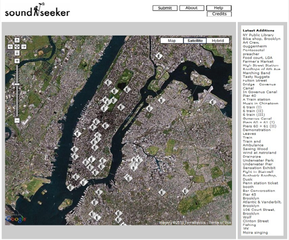
Sound-seeker is a map based participatory sound recording project in New York City area since 2006. It’s a part of NYSoundmap project of The New York Society for Acoustic Ecology (NYSAE). According to their statement, the project aims to “[reach] across the city’s geographic, economic, educational, cultural and racial divides,” which eventually constitutes “a historical record and a subjective representation of the city” by recording and sharing sounds via the internet. The structure of this project is quiet simple. Participants can record sounds and submit them via email and mail CD or minidisk. The map presents where the sounds are recorded. Simply clicking on one of the pins on the map, audiences can listen to the sound. Recorded sounds are varied. Many individuals, including the artists who participated in the project, recorded sounds which might have special resonance in them. Listening to each sound itself could be a meaningful experience.

However, their map setting as satellite by default seems problematic because the ways in which satellite based map is not automatically in sync with the time when the sound was recorded. Although it’s interesting to see the visual image of place, the audience should be reminded that the satellite images have taken at a different time. Otherwise, it might give incorrect information and could affect how one receives the sound.
NYSAE’s objective, an integration of city’s geographic, economic, educational, cultural and racial divides through recording and listening to sounds, fails to provide logical explanations and significance of various sounds for its own purpose. In what ways does a sound recording capture such aspects at the first place? What sorts of sounds deliver a representative value of the city? I think they need to contexualize their work with more developed and a better setting for such exhibition they intended; otherwise it might appear an open platform archive (with low participation), contrary to its own purpose of an exhibition.
2. Soundcities (www.soundcities.com)

Different from Sound-Seeker, a collaboration-based work, Soundcities is developed mostly by one artist, a.k.a. Stanza. Although the project also is designed to invite public participation for archiving sounds, much of listed recordings have already done by him. Organized by one artist with a clear direction, the exhibition maintains consistency. Stanza recorded sounds in many different cities, trying to define representative sounds of each city and culture for 12 years. According to the instruction on the website, Soundcities is the first online open source sound map (2000) and sound database (2004) of cities. It is an independent online exhibition and does not have external funding or connection to institutions.
Stanza mentions that the project aims to “create an aural experience that evokes place,” exploring “how the sounds reflect [cities’] identities and re-impose characteristics back onto the location or environment” based on the inert musical compositions of sounds. He recorded laughing, talking, street music, etc. at almost every cities so that this project provides the archives of everyday life sounds from various cities, illustrating distinctive cultural identities. On the other hand, the musical composition of urban sounds is tagged into the following categories: ambient, rhythm, beat, boredom, noisy etc.
Overall, the exhibition organized well along with the artist’s intention of recording urban sounds. Also, by establishing the exhibition first with artists’ works and then opening to the audiences to be participated in, consistency of the exhibition could remain afterwards. This project shows a good example of a Net Art, which an artist works as a curator for the sake of the exhibition.
3. sound@media – Seoul sound map (http://som.saii.or.kr/campaign) + YOU.MIX.POEM (http://som.saii.or.kr/ymp/)
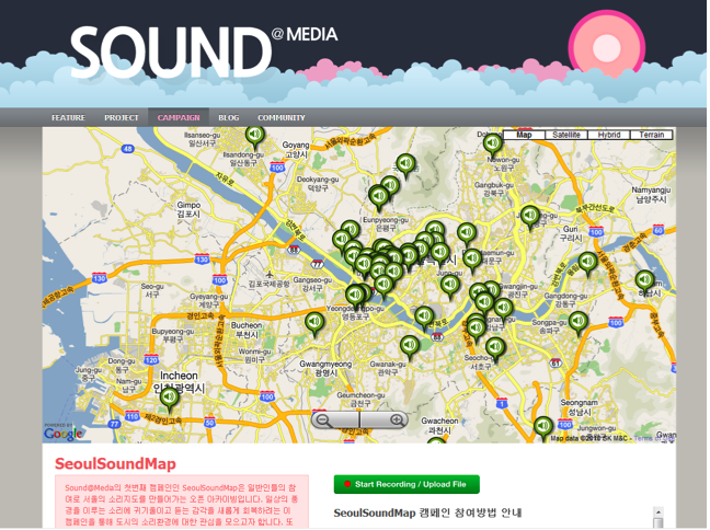
Sound@Media is a “webzine/on-line project featuring audio culture and sound artistic practices in Seoul, initiated by Saii, funded by Seoul Foundation of Arts and Culture.” They launched a Seoul sound map project as a “campaign,” with its aim to bring attention to sounds in mundane life and build up an open source sound archive in Seoul, 2010. The way of sound mapping is pretty similar to other projects. What is distinctive of their project is that they provide listings of various urban sounds on which a new sound project is based.
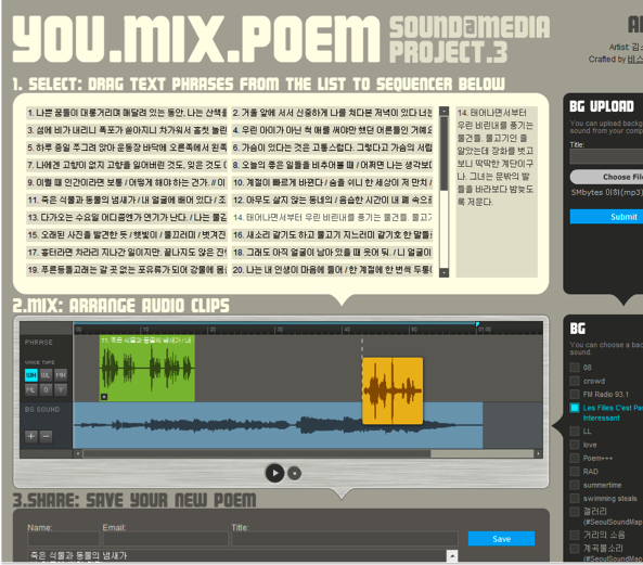
YOU.MIX.POEM project, drawing from mundane background sounds of Seoul Soundmap provides a great example of participatory sound arts. YOU.MIX.POEM composes of two different sections – recorded poetry and background sounds from Seoul Soundmap is designed to invite anyone to utilize with these resources and create their own work. The curators of YOU.MIX.POEM developed poetry readings in different voices (gender, age). Curators, in collaboration with web designers, utilize a popular form of time-based editing applications so that one can easily get access to the application for mixing. The objective of this project, featured in their website introduction, is to bring gift economy with no cost as well as to foster opportunities for lay people audience to take part in sound art and share one another for free, thereby celebrating digital age.
Shown in their website, numerous people have participated and listed their new creative sound artwork. They do not just blast fanfares of digital age but more importantly provide detailed guidance and examples so that one can actively engage in the concrete, accessible, and fun creative ideas for participatory sound artworks. Thus, Sound@Media truly becomes an exemplary Net art what Christiane Paul (2006, 85) describes “a space for exchange, a collaborative creation and presentation that is transparent and flexible”.
Paul, Christiane, 2006 “Flexible contexts, democratic filtering and computer-aided curating: Models for online curatorial practice”, Attribution-ShareAlike 2.5.
Experimental Geography: From Cultural Production to the Production of Space
Read at: The Brooklyn Rail by Trevor Paglen

When most people think about geography, they think about maps. Lots of maps. Maps with state capitals and national territories, maps showing mountains and rivers, forests and lakes, or maps showing population distributions and migration patterns. And indeed, that isn’t a wholly inaccurate idea of what the field is all about. It is true that modern geography and mapmaking were once inseparable.
Renaissance geographers like Henricus Martellus Germanus and Pedro Reinel, having rediscovered Greek texts on geography (most importantly Ptolemy’s Geography), put the ancient knowledge to work in the service of the Spanish and Portuguese empires. Martellus’s maps from the late 15th Century updated the old Greek cartographic projections to include Marco Polo’s explorations of the East as well as Portuguese forays along the African coast. Reinel’s portolan maps are some of the oldest modern nautical charts. Cartography, it turned out, was an indispensable tool for imperial expansion: if new territories were to be controlled, they had to be mapped. Within a few decades, royal cartographers filled in blank spots on old maps. In 1500, Juan de la Cosa, who accompanied Columbus on three voyages as captain of the Santa Maria, produced the Mappa Mundi, the first known map to depict the New World. Geography was such an important instrument of Portuguese and Spanish colonialism that early modern maps were some of these empires’ greatest secrets. Anyone caught leaking a map to a foreign power could be punished by death.
In our own time, another cartographic renaissance is taking place. In popular culture, free software applications like Google Earth and MapQuest have become almost indispensable parts of our everyday lives: we use online mapping applications to get directions to unfamiliar addresses and to virtually “explore” the globe with the aid of publicly available satellite imagery. Consumer-available global positioning systems (GPS) have made latitude and longitude coordinates a part of the cultural vernacular. In the arts, legions of cultural producers have been exercising the power to map. Gallery and museum exhibitions are dedicated to every variety of creative cartography; “locative media” has emerged as a form of techno-site-specificity; in the antiquities market, old maps have come to command historically unprecedented prices at auction. Academia, too, has been seized by the new powers of mapmaking: geographical information systems (GIS) have become a new lingua franca for collecting, collating, and representing data in fields as diverse as archaeology, biology, climatology, demography, epidemiology, and all the way to zoology. In many people’s minds, a newfound interest in geography has seized popular culture, the arts, and the academy. But does the proliferation of mapping technologies and practices really point to a new geographic cultural a priori? Not necessarily. Although geography and cartography have common intellectual and practical ancestors, and are often located within the same departments at universities, they can suggest very different ways of seeing and understanding the world.
Contemporary geography has little more than a cursory relationship to all varieties of cartography. In fact, most critical geographers have a healthy skepticism for the “God’s-Eye” vantage points implicit in much cartographic practice. As useful as maps can be, they can only provide very rough guides to what constitutes a particular space.
Geography is a curiously and powerfully transdisciplinary discipline. In any given geography department, one is likely to find people studying everything from the pre-Holocene atmospheric chemistry of northern Greenland to the effects of sovereign wealth funds on Hong Kong real estate markets, and from methyl chloride emissions in coastal salt marshes to the racial politics of nineteenth-century California labor movements. In the postwar United States, university officials routinely equated the discipline’s lack of systematic methodological and discursive norms with a lack of seriousness and rigor, a perception that led to numerous departments being closed for lack of institutional support. The end of geography at Harvard was typical of what happened to the field: university officials shut down its geography
department in 1948, as CUNY geographer Neil Smith tells it, after being flummoxed by their “inability to extract a clear definition of the subject, to grasp the substance of geography, or to determine its boundaries with other disciplines.” The academic brass “saw the field as hopelessly amorphous.” But this “hopeless amorphousness” is, in fact, the discipline’s greatest strength.
No matter how diverse and transdisciplinary the field of geography may seem, and indeed is, a couple of axioms nevertheless unify the vast majority of contemporary geographers’ work. These axioms hold as true for the “hard science” in university laboratories as for human geographers studying the unpredictable workings of culture and society. Geography’s major theoretical underpinnings come from two related ideas: materialism and the production of space.
In the philosophical tradition, materialism is the simple idea that the world is made out of “stuff,” and that moreover, the world is only made out of “stuff.” All phenomena, then, from atmospheric dynamics to Jackson Pollock paintings, arise out of the interactions of material in the world. In the western tradition, philosophical materialism goes back to ancient Greek philosophers like Democritus, Anaxagoras, and Epicurus, whose conceptions of reality differed sharply from Plato’s metaphysics. Later philosophers like Thomas Hobbes, David Hume, Ludwig Feuerbach, and Karl Marx would develop materialist philosophies in contradistinction to Cartesian dualism and German idealism. Methodologically, materialism suggests an empirical (although not necessarily positivistic) approach to understanding the world. In the contemporary intellectual climate, a materialist approach takes relationality for granted, but an analytic approach that insists on “stuff” can be a powerful way of circumventing or tempering the quasi-solipsistic tendencies found in some strains of vulgar poststructuralism.
Geography’s second overarching axiom has to do with what we generally call “the production of space.” Although the idea of the “production of space” is usually attributed to the geographer-philosopher Henri Lefebvre, whose 1974 book La Production de l’Espace introduced the term to large numbers of people, the ideas animating Lefebvre’s work have a much longer history.Like materialism, the production of space is a relatively easy, even obvious, idea, but it has profoundimplications. In a nutshell, the production of space says that humans create the world around them and that humans are, in turn, created by the world around them. In other words, the human condition is characterized by a feedback loop between human activity and our material surroundings. In this view, space is not a container for human activities to take place within, but is actively “produced” through human activity. The spaces humans produce, in turn, set powerful constraints upon subsequent activity.
To illustrate this idea, we can take the university where I’m presently writing this text. At first blush, the university might seem like little more than a collection of buildings: libraries, laboratories, and classrooms with distinct locations in space. That’s what the university looks like on a map or on Google Earth. But this is an exceptionally partial view of the institution. The university is not an inert thing: it doesn’t “happen” until students arrive to attend classes, professors lock themselves away to do research, administrative staff pays the bills and registers the students, state legislators appropriate money for campus operations, and maintenance crews keep the institution’s physical infrastructure from falling apart. The university, then, cannot be separated from the people who go about “producing” the institution day after day. But the university also sculpts human activity: the university’s physical and bureaucratic structure creates conditions under which students attend lectures, read books, write papers, participate in discussions, and get grades. Human activity produces the university, but human activities are, in turn, shaped by the university. In these feedback loops, we see production of space at work.
Fine. But what does all of this have to do with art? What does this have to do with “cultural production?”
Contemporary geography’s theoretical and methodological axioms don’t have to stay within any disciplinary boundaries whatsoever (a source of much confusion at Harvard back in the mid-1940s). One can apply them to just about anything. Just as physical geographers implicitly use the idea of the production of space when they inquire into the relationship between human carbon emissions and receding Antarctic ice shelves, or when human geographers investigate the relationships between tourism on Tanzanian nature preserves, geography’s axioms can guide all sorts of practice and inquiry, including art and culture. A geographic approach to art, however, would look quite different than most conventional art history and criticism. The difference in approach would arise from the ways in which various disciplines rely on different underlying conceptions of the world. A geographer looking into art would begin with very different premises than those of an art critic.

The Salt Pit (Shomali Plains northeast of Kabul, Afghanistan). Photo by Trevor Paglen.
To speak very generally, the conceptual framework organizing much art history and criticism is one of “reading culture,” where questions and problems of representation (and their consequences) are of primary concern. In the traditional model, the critic’s task is to describe, elaborate upon, explain, interpret, evaluate, and critique pre-given cultural works. In a certain sense, the art critic’s role is to act as a discerning consumer of culture. There’s nothing at all wrong with this, but this model of art criticism must (again, in a broad sense) tacitly assume an ontology of “art” in order to have an intelligible starting point for a reading, critique, or discussion. A good geographer, however, might use her discipline’s analytic axioms to approach the problem of “art” in a decidedly different way.
Instead of asking “What is art?” or “Is this art successful?” a good geographer might ask questions along the lines of “How is this space called ‘art’ produced?” In other words, what are the specific historical, economic, cultural, and discursive conjunctions that come together to form something called “art” and, moreover, to produce a space that we colloquially know as an “art world”? The geographic question is not “What is art?” but “How is art?” From a critical geographic perspective, the notion of a free-standing work of art would be seen as the fetishistic effect of a production process. Instead of approaching art from the vantage point of a consumer, a critical geographer might reframe the question of art in terms of spatial practice.
We can take this line of thinking even further. Instead of using geographic axioms to come up with an alternative “interpretive” approach to art (as I suggested in the previous paragraph), we can use them in a normative sense. Whether we’re geographers, artists, writers, curators, critics, or anyone else, we can use geographic axioms self-reflexively to inform our own production.
If we accept Marx’s argument that a fundamental characteristic of human existence is “the production of material life itself” (that humans produce their own existence in dialectical relation to the rest of the world), and, following Lefebvre (and Marx) that production is a
fundamentally spatial practice, then cultural production (like all production) is a spatial practice. When I write an essay such as this, get it published in a book, and put it on a shelf in a bookstore or museum, I’m participating in the production of space. The same is true for producing art: when I produce images and put them in a gallery or museum or sell them to collectors, I’m helping to produce a space some call the “art world.” The same holds true for “geography”: when I study geography, write about geography, teach geography, go to geography conferences, and take part in a geography department, I’m helping to produce a space called “geography.” None of these examples is a metaphor: the “space” of culture isn’t just Raymond Williams’s “structure of feeling” but, as my friends Ruth Wilson Gilmore and Clayton Rosati underline, an “infrastructure of feeling.”
My point is that if one takes the production of space seriously, the concept applies not only to “objects” of study or criticism, but to the ways one’s own actions participate in the production of space. Geography, then, is not just a method of inquiry, but necessarily entails the production of a space of inquiry. Geographers might study the production of space, but through that study, they’re also producing space. Put simply, geographers don’t just study geography, they create geographies.
The same is true for any other field and any other form of practice. Taking this head-on, incorporating it into one’s practice, is what I mean by “experimental geography.”
Experimental geography means practices that take on the production of space in a self-reflexive way, practices that recognize that cultural production and the production of space cannot be separated from each another, and that cultural and intellectual production is a spatial practice. Moreover, experimental geography means not only seeing the production of space as an ontological condition, but actively experimenting with the production of space as an integral part of one’s own practice. If human activities are inextricably spatial, then new forms of freedom and democracy can only emerge in dialectical relation to the production of new spaces. I deliberately use one of modernism’s keywords, “experimental,” for two reasons. First is to acknowledge and affirm the modernist notion that things can be better, that humans are capable of improving their own conditions, to keep cynicism and defeatism at arm’s length. Moreover, experimentation means production without guarantees, and producing new forms of space certainly comes without guarantees. Space is not deterministic, and the production of new spaces isn’t easy.
In thinking about what experimental geography entails, especially in relation to cultural production, it’s helpful to hearken back to Walter Benjamin, who prefigured these ideas in a 1934 essay entitled “The Author as Producer.”
While he worked in exile from the Nazis in Paris during much of the 1930s, Benjamin’s thoughts repeatedly turned to the question of cultural production. For Benjamin, cultural production’s status as an intrinsically political endeavor was self-evident. The intellectual task he set for himself was to theorize how cultural production might be part of an overall anti-Fascist project. In his musings on the transformative possibilities of culture, Benjamin identified a key political moment in cultural works happening in the production process.
In Benjamin’s “Author as Producer”, he prefigured contemporary geographic thought when he refused to assume that a cultural work exists as a thing-unto-itself: “The dialectical approach,” he wrote, “has absolutely no use for such rigid, isolated things as work, novel, book. It has to insert them into the living social context.” Right there, Benjamin rejected the assumption that cultural works have any kind of ontological stability and instead suggested a relational way of thinking about them. Benjamin went on to make a distinction between works that have an “attitude” toward politics and works that inhabit a “position” within them. “Rather than ask ‘What is the attitude of a work to the relations of production of its time?’” he wrote, “I should like to ask, ‘What is its position in them?’” Benjamin, in other words, was identifying the relations of production that give rise to cultural work as a crucial political moment. For Benjamin, producing truly radical or liberatory cultural works meant producing liberatory spaces from which cultural works could emerge. Echoing Marx, he suggested that the task of transformative cultural production was to reconfigure the relations and apparatus of cultural production, to reinvent the “infrastructure” of feeling in ways designed to maximize human freedom. The actual “content” of the work was secondary.
Experimental geography expands Benjamin’s call for cultural workers to move beyond “critique” as an end in itself and to take up a “position” within the politics of lived experience. Following Benjamin, experimental geography takes for granted the fact that there can be no
“outside” of politics, because there can be no “outside” to the production of space (and the production of space is ipso facto political). Moreover, experimental geography is a call to take seriously, but ultimately move beyond cultural theories that equate new enunciations and new subjectivities as sufficient political ends in themselves. When decoupled from the production of new spaces, they are far too easily assimilated into the endless cycles of destruction and reconstitution characterizing cultural neoliberalism, a repetition Benjamin dubbed “Hell.”
The task of experimental geography, then, is to seize the opportunities that present themselves in the spatial practices of culture. To move beyond critical reflection, critique alone, and political “attitudes,” into the realm of practice. To experiment with creating new spaces, new ways of being.
What’s at stake? Quite literally, everything.
When most people think about geography, they think about maps. Lots of maps. Maps with state capitals and national territories, maps showing mountains and rivers, forests and lakes, or maps showing population distributions and migration patterns. And indeed, that isn’t a wholly inaccurate idea of what the field is all about. It is true that modern geography and mapmaking were once inseparable.
Renaissance geographers like Henricus Martellus Germanus and Pedro Reinel, having rediscovered Greek texts on geography (most importantly Ptolemy’s Geography), put the ancient knowledge to work in the service of the Spanish and Portuguese empires. Martellus’s maps from the late 15th Century updated the old Greek cartographic projections to include Marco Polo’s explorations of the East as well as Portuguese forays along the African coast. Reinel’s portolan maps are some of the oldest modern nautical charts. Cartography, it turned out, was an indispensable tool for imperial expansion: if new territories were to be controlled, they had to be mapped. Within a few decades, royal cartographers filled in blank spots on old maps. In 1500, Juan de la Cosa, who accompanied Columbus on three voyages as captain of the Santa Maria, produced the Mappa Mundi, the first known map to depict the New World. Geography was such an important instrument of Portuguese and Spanish colonialism that early modern maps were some of these empires’ greatest secrets. Anyone caught leaking a map to a foreign power could be punished by death.
In our own time, another cartographic renaissance is taking place. In popular culture, free software applications like Google Earth and MapQuest have become almost indispensable parts of our everyday lives: we use online mapping applications to get directions to unfamiliar addresses and to virtually “explore” the globe with the aid of publicly available satellite imagery. Consumer-available global positioning systems (GPS) have made latitude and longitude coordinates a part of the cultural vernacular. In the arts, legions of cultural producers have been exercising the power to map. Gallery and museum exhibitions are dedicated to every variety of creative cartography; “locative media” has emerged as a form of techno-site-specificity; in the antiquities market, old maps have come to command historically unprecedented prices at auction. Academia, too, has been seized by the new powers of mapmaking: geographical information systems (GIS) have become a new lingua franca for collecting, collating, and representing data in fields as diverse as archaeology, biology, climatology, demography, epidemiology, and all the way to zoology. In many people’s minds, a newfound interest in geography has seized popular culture, the arts, and the academy. But does the proliferation of mapping technologies and practices really point to a new geographic cultural a priori? Not necessarily. Although geography and cartography have common intellectual and practical ancestors, and are often located within the same departments at universities, they can suggest very different ways of seeing and understanding the world.
Contemporary geography has little more than a cursory relationship to all varieties of cartography. In fact, most critical geographers have a healthy skepticism for the “God’s-Eye” vantage points implicit in much cartographic practice. As useful as maps can be, they can only provide very rough guides to what constitutes a particular space.
Geography is a curiously and powerfully transdisciplinary discipline. In any given geography department, one is likely to find people studying everything from the pre-Holocene atmospheric chemistry of northern Greenland to the effects of sovereign wealth funds on Hong Kong real estate markets, and from methyl chloride emissions in coastal salt marshes to the racial politics of nineteenth-century California labor movements. In the postwar United States, university officials routinely equated the discipline’s lack of systematic methodological and discursive norms with a lack of seriousness and rigor, a perception that led to numerous departments being closed for lack of institutional support. The end of geography at Harvard was typical of what happened to the field: university officials shut down its geography
department in 1948, as CUNY geographer Neil Smith tells it, after being flummoxed by their “inability to extract a clear definition of the subject, to grasp the substance of geography, or to determine its boundaries with other disciplines.” The academic brass “saw the field as hopelessly amorphous.” But this “hopeless amorphousness” is, in fact, the discipline’s greatest strength.
No matter how diverse and transdisciplinary the field of geography may seem, and indeed is, a couple of axioms nevertheless unify the vast majority of contemporary geographers’ work. These axioms hold as true for the “hard science” in university laboratories as for human geographers studying the unpredictable workings of culture and society. Geography’s major theoretical underpinnings come from two related ideas: materialism and the production of space.
In the philosophical tradition, materialism is the simple idea that the world is made out of “stuff,” and that moreover, the world is only made out of “stuff.” All phenomena, then, from atmospheric dynamics to Jackson Pollock paintings, arise out of the interactions of material in the world. In the western tradition, philosophical materialism goes back to ancient Greek philosophers like Democritus, Anaxagoras, and Epicurus, whose conceptions of reality differed sharply from Plato’s metaphysics. Later philosophers like Thomas Hobbes, David Hume, Ludwig Feuerbach, and Karl Marx would develop materialist philosophies in contradistinction to Cartesian dualism and German idealism. Methodologically, materialism suggests an empirical (although not necessarily positivistic) approach to understanding the world. In the contemporary intellectual climate, a materialist approach takes relationality for granted, but an analytic approach that insists on “stuff” can be a powerful way of circumventing or tempering the quasi-solipsistic tendencies found in some strains of vulgar poststructuralism.
Geography’s second overarching axiom has to do with what we generally call “the production of space.” Although the idea of the “production of space” is usually attributed to the geographer-philosopher Henri Lefebvre, whose 1974 book La Production de l’Espace introduced the term to large numbers of people, the ideas animating Lefebvre’s work have a much longer history.Like materialism, the production of space is a relatively easy, even obvious, idea, but it has profoundimplications. In a nutshell, the production of space says that humans create the world around them and that humans are, in turn, created by the world around them. In other words, the human condition is characterized by a feedback loop between human activity and our material surroundings. In this view, space is not a container for human activities to take place within, but is actively “produced” through human activity. The spaces humans produce, in turn, set powerful constraints upon subsequent activity.
To illustrate this idea, we can take the university where I’m presently writing this text. At first blush, the university might seem like little more than a collection of buildings: libraries, laboratories, and classrooms with distinct locations in space. That’s what the university looks like on a map or on Google Earth. But this is an exceptionally partial view of the institution. The university is not an inert thing: it doesn’t “happen” until students arrive to attend classes, professors lock themselves away to do research, administrative staff pays the bills and registers the students, state legislators appropriate money for campus operations, and maintenance crews keep the institution’s physical infrastructure from falling apart. The university, then, cannot be separated from the people who go about “producing” the institution day after day. But the university also sculpts human activity: the university’s physical and bureaucratic structure creates conditions under which students attend lectures, read books, write papers, participate in discussions, and get grades. Human activity produces the university, but human activities are, in turn, shaped by the university. In these feedback loops, we see production of space at work.
Fine. But what does all of this have to do with art? What does this have to do with “cultural production?”
Contemporary geography’s theoretical and methodological axioms don’t have to stay within any disciplinary boundaries whatsoever (a source of much confusion at Harvard back in the mid-1940s). One can apply them to just about anything. Just as physical geographers implicitly use the idea of the production of space when they inquire into the relationship between human carbon emissions and receding Antarctic ice shelves, or when human geographers investigate the relationships between tourism on Tanzanian nature preserves, geography’s axioms can guide all sorts of practice and inquiry, including art and culture. A geographic approach to art, however, would look quite different than most conventional art history and criticism. The difference in approach would arise from the ways in which various disciplines rely on different underlying conceptions of the world. A geographer looking into art would begin with very different premises than those of an art critic.
To speak very generally, the conceptual framework organizing much art history and criticism is one of “reading culture,” where questions and problems of representation (and their consequences) are of primary concern. In the traditional model, the critic’s task is to describe, elaborate upon, explain, interpret, evaluate, and critique pre-given cultural works. In a certain sense, the art critic’s role is to act as a discerning consumer of culture. There’s nothing at all wrong with this, but this model of art criticism must (again, in a broad sense) tacitly assume an ontology of “art” in order to have an intelligible starting point for a reading, critique, or discussion. A good geographer, however, might use her discipline’s analytic axioms to approach the problem of “art” in a decidedly different way.
Instead of asking “What is art?” or “Is this art successful?” a good geographer might ask questions along the lines of “How is this space called ‘art’ produced?” In other words, what are the specific historical, economic, cultural, and discursive conjunctions that come together to form something called “art” and, moreover, to produce a space that we colloquially know as an “art world”? The geographic question is not “What is art?” but “How is art?” From a critical geographic perspective, the notion of a free-standing work of art would be seen as the fetishistic effect of a production process. Instead of approaching art from the vantage point of a consumer, a critical geographer might reframe the question of art in terms of spatial practice.
We can take this line of thinking even further. Instead of using geographic axioms to come up with an alternative “interpretive” approach to art (as I suggested in the previous paragraph), we can use them in a normative sense. Whether we’re geographers, artists, writers, curators, critics, or anyone else, we can use geographic axioms self-reflexively to inform our own production.
If we accept Marx’s argument that a fundamental characteristic of human existence is “the production of material life itself” (that humans produce their own existence in dialectical relation to the rest of the world), and, following Lefebvre (and Marx) that production is a
fundamentally spatial practice, then cultural production (like all production) is a spatial practice. When I write an essay such as this, get it published in a book, and put it on a shelf in a bookstore or museum, I’m participating in the production of space. The same is true for producing art: when I produce images and put them in a gallery or museum or sell them to collectors, I’m helping to produce a space some call the “art world.” The same holds true for “geography”: when I study geography, write about geography, teach geography, go to geography conferences, and take part in a geography department, I’m helping to produce a space called “geography.” None of these examples is a metaphor: the “space” of culture isn’t just Raymond Williams’s “structure of feeling” but, as my friends Ruth Wilson Gilmore and Clayton Rosati underline, an “infrastructure of feeling.”
My point is that if one takes the production of space seriously, the concept applies not only to “objects” of study or criticism, but to the ways one’s own actions participate in the production of space. Geography, then, is not just a method of inquiry, but necessarily entails the production of a space of inquiry. Geographers might study the production of space, but through that study, they’re also producing space. Put simply, geographers don’t just study geography, they create geographies.
The same is true for any other field and any other form of practice. Taking this head-on, incorporating it into one’s practice, is what I mean by “experimental geography.”
Experimental geography means practices that take on the production of space in a self-reflexive way, practices that recognize that cultural production and the production of space cannot be separated from each another, and that cultural and intellectual production is a spatial practice. Moreover, experimental geography means not only seeing the production of space as an ontological condition, but actively experimenting with the production of space as an integral part of one’s own practice. If human activities are inextricably spatial, then new forms of freedom and democracy can only emerge in dialectical relation to the production of new spaces. I deliberately use one of modernism’s keywords, “experimental,” for two reasons. First is to acknowledge and affirm the modernist notion that things can be better, that humans are capable of improving their own conditions, to keep cynicism and defeatism at arm’s length. Moreover, experimentation means production without guarantees, and producing new forms of space certainly comes without guarantees. Space is not deterministic, and the production of new spaces isn’t easy.
In thinking about what experimental geography entails, especially in relation to cultural production, it’s helpful to hearken back to Walter Benjamin, who prefigured these ideas in a 1934 essay entitled “The Author as Producer.”
While he worked in exile from the Nazis in Paris during much of the 1930s, Benjamin’s thoughts repeatedly turned to the question of cultural production. For Benjamin, cultural production’s status as an intrinsically political endeavor was self-evident. The intellectual task he set for himself was to theorize how cultural production might be part of an overall anti-Fascist project. In his musings on the transformative possibilities of culture, Benjamin identified a key political moment in cultural works happening in the production process.
In Benjamin’s “Author as Producer”, he prefigured contemporary geographic thought when he refused to assume that a cultural work exists as a thing-unto-itself: “The dialectical approach,” he wrote, “has absolutely no use for such rigid, isolated things as work, novel, book. It has to insert them into the living social context.” Right there, Benjamin rejected the assumption that cultural works have any kind of ontological stability and instead suggested a relational way of thinking about them. Benjamin went on to make a distinction between works that have an “attitude” toward politics and works that inhabit a “position” within them. “Rather than ask ‘What is the attitude of a work to the relations of production of its time?’” he wrote, “I should like to ask, ‘What is its position in them?’” Benjamin, in other words, was identifying the relations of production that give rise to cultural work as a crucial political moment. For Benjamin, producing truly radical or liberatory cultural works meant producing liberatory spaces from which cultural works could emerge. Echoing Marx, he suggested that the task of transformative cultural production was to reconfigure the relations and apparatus of cultural production, to reinvent the “infrastructure” of feeling in ways designed to maximize human freedom. The actual “content” of the work was secondary.
Experimental geography expands Benjamin’s call for cultural workers to move beyond “critique” as an end in itself and to take up a “position” within the politics of lived experience. Following Benjamin, experimental geography takes for granted the fact that there can be no
“outside” of politics, because there can be no “outside” to the production of space (and the production of space is ipso facto political). Moreover, experimental geography is a call to take seriously, but ultimately move beyond cultural theories that equate new enunciations and new subjectivities as sufficient political ends in themselves. When decoupled from the production of new spaces, they are far too easily assimilated into the endless cycles of destruction and reconstitution characterizing cultural neoliberalism, a repetition Benjamin dubbed “Hell.”
The task of experimental geography, then, is to seize the opportunities that present themselves in the spatial practices of culture. To move beyond critical reflection, critique alone, and political “attitudes,” into the realm of practice. To experiment with creating new spaces, new ways of being.
What’s at stake? Quite literally, everything.
J.G. Ballard & Architectures of Control
http://www.ballardian.com
Author: Dan Lockton • Jan 3rd, 2008 •
by Dan Lockton

Ernõ Goldfinger’s Trellick Tower, London W10. “I built skyscrapers for people to live in there and now they messed them up — disgusting.” Photo by See Wah, used under Creative Commons licence).
One of the many ‘obsessions’ running through Ballard’s work is what we might characterise as the effect of architecture on the individual. This is more than playful psychogeography: Ballard dissects architectural influence on his characters with technical precision, both intricate and dynamic, captured at 24 frames per second through a 35 mm lens but replayed in slow-motion, frozen and magnified, projected on the featureless concrete barrier bounding the mainstream carriageway.
I use ‘architecture’ here in a wide sense, including the whole of the constructed environment – physical, technological and social – because while, for example, High-Rise very clearly explores the way that architectural decisions can directly impact on human behaviour, some of Ballard’s more recent works such as Running Wild, Millennium People and Kingdom Come concentrate more on the effects of constructed social and psychological environments on their inhabitants/users, and Crash of course examines intimately the interface between technology and our bodies, and how the technological landscape shapes our own obsessions. Indeed, the phrase “psychological effects of technological, social or environmental developments” in the Collins English Dictionary definition of ‘Ballardian’ is, while necessarily broad, impressively concise.
However, the argument is somewhat more complex: to a large extent, much of Ballard’s work makes it clear that he considers the seeds of behavioural change to be latent within every participant and merely drawn out by the environments and situations in which he or she is placed. Concrete Island, some of the elements of The Atrocity Exhibition, ‘The Terminal Beach’, ‘The Enormous Space’, ‘Motel Architecture’ and others all take this to the characteristically Ballardian level of actually reflecting the participants’ mental state in the environment itself:
…throughout The Atrocity Exhibition, the nervous systems of the characters have been externalised as part of the reversal of the interior and exterior worlds. Highways, office blocks, faces and street signs are perceived as if they were elements in a malfunctioning central nervous system.”
The Atrocity Exhibition, annotated edition (JGB’s notes on ‘Algebra of the Sky’).
More and more, the island was becoming an exact model of his head… Identifying the island with himself, he gazed at the cars in the breaker’s yard, at the wire-mesh fence, and the concrete caisson behind him. These places of pain and ordeal were now confused with pieces of his body.
…
I am the island.Concrete Island, chapter 9.

Culver St, Salisbury, Wiltshire. Photo by Tom Goskar (used under Creative Commons licence).
In terms of conventional ‘architecture’, it is the landscape of highways, the blockhouse and the multi-storey car park (many of them “very large structures”) which recur throughout Ballard’s work, with aspects of their geometries (canted decks, angles between walls, and so on) both a cipher for the possibilities of human relations and a method of reinforcing the obsessive thought-processes of the characters involved.
The architecture also acts as a structure for the story — few writers incorporate the affordances and disaffordances of their fiction’s settings so tightly into the plot as Ballard does: this is especially obvious in High-Rise (and less so in Kingdom Come) where a single edifice is the focus of both the overall plot and everything that happens within it, but even ‘detective story’ details such as (in Super-Cannes) Sinclair searching for and finding Greenwood’s dried blood inside the drainpipe below the top deck of the (multi-storey) car park are integrated inescapably into the nature of Ballard’s narrative. Would the events of, say, Super-Cannes or Cocaine Nights engage the reader to the same extent if the architecture of the locations, both physical and psychological, were not so obsessively explained and expounded?
My own area of research relates to what might be called ‘design with intent’, or, more dramatically, ‘architectures of control’, a term most notably used by Stanford law professor Lawrence Lessig to describe the way in which systems (such as the internet) regulate and shape users’ behaviour through the embedded ‘code’ of the system itself, orders of magnitude more powerful than any external legal regulation. Ballard explores consumerism-driving behaviour-shaping most notably in ‘The Subliminal Man’, where, alongside subliminal advertising on giant roadside signs designed to spur ever-faster product replacement cycles, a system of rubber studs embedded in the road surface, the pattern of which is regularly changed, enforce regular tyre replacement by causing damaging resonance — “increasing the safety and efficiency of the expressway… [and also] the revenues of the car and tyre manufacturers.”
Architectures of control in the built environment work on different scales, from the large-scale layouts of cities and campuses to encourage or discourage certain behaviour, to mundane small-scale examples such as benches designed with central armrests to prevent the homeless sleeping on them, anti-skateboarding features on walls and even rough paving to make it uncomfortable to sit down or for barefooted protestors to congregate. Similar ideas have been expressed in different fields, at different times, by different people: for example, for Bruno Latour and Madeleine Akrich, the emphasis is very much on the designer (or architect) ‘inscribing’ intent into a system or environment, prescribing and proscribing what behaviours will be produced, but the architectural effects explored in Ballard’s work are, more often than not, divorced from conscious intent on the part of the architects – part of Ballard’s usual “recognition of unconscious forces” [1] (my emphases):
Take a structure like a multi-storey car park, one of the most mysterious buildings ever built. Is it a model for some strange psychological state, some kind of vision glimpsed within its bizarre geometry? What effect does using these buildings have on us? Are the real myths of this century being written in terms of these huge unnoticed structures?
‘Crash!’ voiceover, 1971.
In most roles the machine assumes a benign or passive posture – telephone exchanges, engineering hardware, etc. The twentieth century has also given birth to a vast range of machines – computers, pilotless planes, thermonuclear weapons – where the latent identity of the machine is ambiguous even to the skilled investigator.
‘Crash!’ in The Atrocity Exhibition.

Under the Westway. Photo by Drew Leavy (used under Creative Commons licence).
Ballard in no way tries to imply that the architects and civil engineers who envisaged the Westway, Western Avenue and London’s Motorway Box intended to create or inspire the events of Crash or Concrete Island, but the fact that Maitland (Concrete Island) is, professionally, an architect, is surely significant. Where Ballard does allow us to examine an architect meeting the consequences of his work — Royal in High-Rise — there is an apparent lack of conscious reflection by the architect on the actual architectural effects involved but something of an implication of intent, at least in terms of the whole thing being a perverse experiment on the part of its creator (much like Crawford in Cocaine Nights and Penrose in Super-Cannes, or even Vaughan, the “TV scientist” in Crash).
Oscar Newman’s Defensible Space
The spectacular view always made Laing aware of his ambivalent feelings for this concrete landscape. Part of its appeal lay all too clearly in the fact that this was an environment built, not for man, but for man’s absence.
High-Rise, chapter 2.
It’s interesting to note Ballard’s own recognition of embedded (or ‘inscribed’) code in architectural design in ‘A Handful of Dust’ [2], an article for the Guardian (emphases mine), where the idea of the planned community also rears its head:
But the modernists maintained that ornamentation concealed rather than embellished. Classical columns, pediments and pilasters defined a hierarchical order. Power and authority were separated from the common street by huge flights of steps that we were forced to climb on our way to law courts, parliaments and town halls… So modernism was a breath of fresh air and possibility. Housing schemes, factories and office blocks designed by modernist architects were clear-headed and geometric, suggesting clean and unembellished lives for the people inside them.
‘A Handful of Dust’, The Guardian, 20. iii. 2006.
This idea is further explored in the notes on ‘Locus Solus’ in the annotated version of The Atrocity Exhibition, (and, specifically with the planned/gated community theme, in ‘The Largest Theme Park in the World’, Cocaine Nights, Super-Cannes, Millennium People and Running Wild):
…the peculiar geometry of those identical apartment houses [along the Mediterranean coast] seems to defuse the millenarian spirit. Living there, one is aware of the exact volumes of these generally white apartments and hotel rooms. After the more sombre light of northern Europe, they seem to focus an intense self-consciousness on the occupants.
The Atrocity Exhibition, annotated edition (JGB’s notes on Locus Solus).
Tasers and other defence paraphernalia on sale in a Cannes shopping centre, 2005. Photograph by Dan Lockton.
In Super-Cannes, however, there is an explicit link drawn with the totalitarian potential of architectural determinism as a method of social control, which brings Ballard closer to more ‘conventional’ dystopian territory. It’s not comparable with the wartime horrors of Empire of the Sun, but is in keeping with the dark conspiratorial undercurrents of the book (my emphases):
Thousands of people live and work here without making a single decision about right and wrong. The moral order is engineered into their lives along with the speed limits and the security systems.
Super-Cannes, chapter 29.
Surveillance cameras hung like gargoyles from the cornices, following me as I approached the barbican and identified myself to the guard at the reception desk… High above me, fluted columns carried the pitched roofs, an attempt at a vernacular architecture that failed to disguise this executive-class prison. Taking their cue from Eden-Olympia and Antibes-les-Pins, the totalitarian systems of the future would be subservient and ingratiating, but the locks would be just as strong.
Super-Cannes, chapter 15.
This last quote is one of my favourites from all of Ballard’s work, and it’s notable from the ‘architectures of control’ perspective to see the strains of latent suburban fascism being explored in the recent Kingdom Come, entwined with the planned manipulation of populations through mass media and the advertising which Pearson devises; it will be interesting to see if Ballard continues exploring this area of modern totalitarianism, whether he can further develop this perspective, and what direction he takes next.
While this brief article merely scratches the surface of Ballard’s interest in architectural effects on people, I hope it shows that this area, in many forms, is a running theme throughout much of his work — a fascinating thread, evolving yet consistent in its depth, over fifty-plus years of writing.
Dan Lockton, 2008.
Mapping Conversation

Cabinet Magazine:
Issue 2 Mapping Conversations Spring 2001
Utterance Is Place Enough: Mapping Conversation
Frances Richard
The map image is a synthesis of spatially and temporally registered gestalten, each a synthesis in its own right. No degree of thematic constriction can silence the conversation among map signs.
—Denis Wood, The Power of Maps
A map is a picture, a rendering in two-dimensional space of three-dimensional topography ordered through the filter of four-dimensional experience. A map establishes spatial relations between landmarks, commits these relationships to a particular scale, and aligns the resulting picture so that a viewer (reader, orienteer) can enter it. Its use-value lies in articulating connections: “You Are Here,” “This Is the Place.” Such connections may be situated anywhere along a continuum of quantitative accuracy, from the pristine measurements of a United States Geological Survey plat to the sketch you scribble for a friend so she can find your house from the subway. Like naming and counting, mapping is a method for articulating the existence of things—an operation causing chosen features to rise like newborn islands from the chaotic welter of experience, fixing them in time-space and bestowing (or foisting) upon them a significance that allows these features to be found again, to be approached from new angles while still holding them in the context of previous encounters. Maps index reality in layers.
And conversation? Setting aside the various media in which one might occur—the language of flowers, body language, Morse code—a conversation is a more-or-less unscripted verbal exchange, an ostensibly non-hierarchical talk shared by two or more participants. It is a group endeavor, a multivocal whole that will break down if one voice dominates unduly, or if too many fade away. Conversations do not always happen in real time, but time is inextricable from conversations because they are inherently improvisatory. If every member knows beforehand what each is going to say, speech becomes rote exhibition, not exchange. Sociolinguists are fond of noting that the etymological root of conversation is the Latin convertere, to turn around. To succeed as conversation, shared speech requires such back-and-forth, with its intrinsic unpredictability (being unpredictable, of course, is not the same as being interesting). In their turns, conversants spin a discourse. Their talk creates a mesh of specifically phrased ideas, a tissue of inter-pretation and response in which thought moves from latent to kinetic. Conversation generates reality as temporary and co-operative.
A language is therefore a horizon, and style a vertical dimension, which together map out for the writer a Nature, since he does not choose either.
—Roland Barthes, Writing Degree Zero
Between “mapping” and “conversation” a third term migrates, now acknowledging the inscribed, representative character of the map, now gesturing to the elementally linguistic condition of conversation. How does “mapping conversation” differ from “writing”? Map and written text are artifacts, experience once (at least) removed. The conversation is experience up front. In its objecthood, the map detaches from whatever landscape it purports to render; it slips into its own register as a freestanding unit, a self-enclosed area operating by reflexively validated rules. The tropes of mapping—including scale, legend, color, the use of contour isobars and other conventions for translating three-dimensional elevation into two dimensions—are no less stylized than the parameters of any other discourse. The cartographer has a Nature too, derived from scientific tradition and perceptual habit, more or less unchosen, not the least bit “natural.” The map is a particular kind of story about reality.
The cooperative unpredictability of conversation forms around its speakers a terrain. Its words are audible and obvious. The dynamic shapes limned by the progressions of those words are subtler. The modulations of tone, timing, and implication form an uneven surface, a topology of group exchange. To write conversation is a word:word transformation—no extra light is shed on shape. In mapping, terrain becomes obvious, the sine qua non, while the semiotic maneuvers undergirding its representation drift into background. To map location is a space:space transformation—no extra light is shed on language. But map!=land, just as conversation!=words. Mapping conversation differs from writing because it literally indexes language as shape. It arranges words across an armature of space.
I call [these drawings] “narrative structures” because each consists of a network of lines and notations which are meant to convey a story, typically about a recent event of interest to me like the collapse of a large international bank, trading company, or investment house.
—Mark Lombardi, “The Recent Drawings: An Overview”
I am mapping the political and social terrain in which I live. Shall we cut it there?
—Mark Lombardi, video conversation with Andy Mann, February 28, 1997
The drawings are graceful, intriguing, eminently readable—but also pleasing to the eye as abstract webs, spangles, clusters. Done in black ink with red accents, on cream or white paper, they signify “diagram” from a distance, well before anything legible enters the viewer’s mind. Anticipating textual focus, the glancing eye understands that some plethora of information is being schematized, presented for maximum accessibility. Unconsciously indoctrinated within the symbol system of (possibly pseudo-) scientific notation, we approach these images expecting to be led through a thicket of data toward a factually supported conclusion. And this is exactly what happens—sort of.
Investing the time required to move from looking at to reading a Lombardi drawing, we depart from the generic “information structure” established by a two-dimensional arrangement of arrows and circles, and enter a “narrative structure” with specific characters, settings, events, and chronologies. What story is being told? Several overlays of interpretation power up together. Most obviously, we are shown that Henry Kissinger, or the Vatican Bank, or Charles Keating, or Flushing (NY) Federal Savings, have been involved in double-dealing, shady finance, inter-national scams. We get dates, patterns of influence, types of transactions. Do we believe?
The answer is probably yes. But this Q&A is a gateway to other layers of the story. Lombardi spends years researching his narratives; every item is culled from the public record as available in books, wire service reports, magazines, etc.; every mark we see is supported by thousands of cross-referenced notes on alphabetized index cards. In other words, like most maps, these drawings posit themselves as truthful documentation, field-tested and verifiable, presented only for the edification of an interested public. In writing terms, Lombardi plays the lone reporter, relentlessly ferreting out secrets and compiling devastating dossiers on the big boys from the modest war-room of his file-strewn apartment. We accept that Kissinger, et.al. are guilty as charged, and the subtextual hum of real-life fact gives the images poignancy and force. But in a sense it would not matter if the whole panorama of Lombardi’s narrative were fabricated from his imagination. Just as his sweeping curves and dotted lines adapt a pre-existing vocabulary of corporate graphing, the archetypes of crusading informer and corrupt V.I.P. are readymades from our cultural milieu, and we receive them as such—the artist makes a remarkable case, but we probably “knew” this stuff already. Growing up post-Watergate, inured to the idea that no one gets rich or maintains power without resorting to espionage, intimidation, and payola, we expect revelations of high-level venality. Lombardi’s work provides them. The visual elegance of his phrasing is analogous to the oratory of a great muckraker, the comeliness of David as he gears up for Goliath. Their ostensibly neutral or indexical format protects the drawings from looking like agitprop—they are too strange and beautiful for that, and yet their social and political content is direct. Free to enjoy the form and be disturbed by the content, we are brought into Lombardi’s orbit as confidants. We become his interlocutors, people on whom the nuance of his project is not lost.
As conversation, then, Lombardi’s diagrams speak in multiple directions. Following the patterns he has traced, from Rome to Havana, Iraq to Tennessee, we can practically hear the buzz of covert phone calls and smoke-filled-room agreements, the blur of accents, guffawed satisfaction and growled threats. We are flies on the wall, bugs in the drapes, righteous surveillants. Moreover, Lombardi shows himself in notational conversation with his sources, eliciting and weaving together disparate voices. As audience, we stand before the work in dialogue with it and our internal chronicles, recalling scraps of news we’ve picked up elsewhere, orienting our attention to take in what Lombardi is telling us.
Mapmaking emerges to facilitate the control of social processes in rapidly expanding societies.
—Denis Wood, The Power of Maps
To create their series “Argument Drawings,” the artists Janet Cohen, Keith Frank, and Jon Ippolito map their own discussions, graphing in color-coded lines the twists and reversals of talks on such topics as “the impossibility of distinguishing art you think is historically important from art you like” and “the danger of Bill Gates.”1 To diagram casual, private interaction in this functionalist way raises issues about the creative potential of argument, and the shift from chat to chart is a clever joke, a toying with the tropes of number-crunching. But the drawings do not leap into statistical overload. They retain the scale of the friendship they delineate. There are three artists; there are the red, green, and blue lines. It is easy to imagine having this conversation your-self; easy, as a viewer, to pretend, “I’ll be the blue,” as if choosing a marker in a board game, easy to enter the map without feeling a time/space distortion press in upon your conception of yourself.
Normally, this is not the case in map-making. Cartographic historian Denis Wood describes a difference between mapping and mapmaking, which corresponds to the degree of centralization and division of labor established in a given society. Mapping, he proposes, is a fundamental act of human cognition. Mapmaking is a function of bureaucracy. In mapping, then, the act of tracing and remembering landscape is its own reward, a total process that does not need to culminate in an external, circulating text called “the map.” Held within the shared consciousness of people who know and use their land intimately, the knowledge construct also remains at a human scale, articulated in direct proportion to the bodies who have gathered and continue to navigate by it.
During field work in 1989, one Inuk elder told me that he had drawn detailed maps of Hiquligjuaq from memory, but he smiled and said that long ago he had thrown them away. It was the act of making them that was important, the recapitulation of environmental features, not the material objects themselves.2
The Inuk elder describes what would normally happen in conversation, where it is the act of voicing that is important, the recapitulation of thought. To append conversation with a material document like the “Argument Drawings” is excessive, a baroque intrusion into an organic event—which is the artists’ point.

Cohen, Frank, Ippolito, Agree to Disagree (Marriage is a great way to ruin a relationship), 1995. Courtesy of the artists.
The difference between internal memory-map and surveyed document also runs parallel to the anthropological (and literary-critical) distinction between storytelling and writing, wherein the artifactual, written text signals a loss of communal interrelation-ship, a shift away from the conversational nature of oral transmission around the fire. According to this particular master narrative of culture, the sign disconnects from the referent—the hill becomes an inkblot and the lore becomes typography—in order to consolidate power in a stratified society. The novel is said to have created the bourgeoisie; in the same way, the map creates property. But Wood also enumerates instances of what might be called subversive mapmaking, the most famous of which is probably the Peters projection map of the world, which allots to each continent a graphic area proportionate to the area it occupies on the globe. By correctly showing Africa larger than North America and Greenland smaller than South America, the Peters projection “distorts” the familiar Mercator projection, stretching it vertically, as though the landmass had sagged, in order to correct the politically-inflected connotations of a world-view in which North America and Europe are the biggest, at the center.
Both the “Argument Drawings” and Lombardi’s work subvert mapmaking in this way. But while Cohen, Frank, and Ippolito keep their maps “actual size” as it were, Lombardi takes on byzantine cases typified by astronomical numbers—of players, of dollars, of references. The Inuk elder who draws his map and then discards it is similar to Cohen, Frank, and Ippolito in that his process retains an intimate scale. He is comparable to Lombardi in that he is managing a gigantic fund of information—a whole region, with its bays and inlets, weather-patterns and wildlife. The difference, obviously, is that the Inuk mapper has no reason to “subvert” a process that supports his existence.
When Wood says that mapmaking arrives with the founding of the centralized state, he implies that the map splits away from the body via the alienation caused by the growth of industrial capital. In capitalism (so goes another master narrative of culture), the work of art becomes commodified, causing a loss of aura that corresponds to the alienated worker’s loss of identification with his or her production. The Inuk elder is imagined as existing in visceral proximity to his landscape—in conversation with it—but organized, science-based mapmaking inspects and records that land while no longer depending on real-time, back-and-forth survival on it: In other words, mapmaking is no longer conversational. In the mass-produced map, a represented landform loses “its presence in time and space, its unique existence at the place where it happens to be.”3 Subversive mapmaking tries to reassert the map as a dialogic tool, tries to revive the aura of presence and integration symbolized by the Inuk elder’s memory. But artists like Cohen, Frank, Ippolito, and Lombardi (or Arno Peters, for that matter) can only do this in a self-conscious way. The exchange enacted by subversive map-making no longer takes place between inhabitant and landscape, but between reader and reader, both homeless to a certain degree, sojourners in alien terrain.
The “Argument Drawings” recuperate presence through insouciant personality, by privileging the artists’ own more-or-less unremarkable experience. Lombardi’s handling of the problem of alienation and aura is more complicated. Near the end of his life, he was experimenting with using the Internet as a research aid, and with computer-generated versions of his drawings. The exponential increase in archive-access and the corresponding facilitation of copying and adding to existing pieces would have altered his process significantly.4 But perhaps more importantly, computer-assisted versions of Lombardi’s works would have eroded their nature as unique, handmade interventions into the web of sinister transactions that have become synechdochical for the powerlessness of average citizens. Lombardi’s drawings testify to the overwhelming task of continually reasserting personal perspective in a political and social environment that is not only rapidly expanding, but increasingly imagined as totally digitized, decentered, and manipulable. By illustrating the difficulty one person has in mastering the movements of global capital, his drawings also remind us that the huge distortions of scale endemic to such wealth tend to scramble into nonsense, unless a single interested intelligence sorts them out.
The Conversation Map system is a Usenet newsgroup browser that analyzes the text of an archive of newsgroup messages and outputs a graphical interface that can be used to search and read the messages of the archive. The Conversation Map system incorporates a series of novel text analysis procedures that automatically compute a set of social networks detailing who is responding to and/or citing whom in the newsgroup; a set of discussion themes that are frequently used in the newsgroup archive; and a set of semantic networks that represent the main terms under discussion, and some of their relationships to one another…The Conversation Map system computes and then graphs out who is “talking” to whom, what they are “talking” about, and the central terms and possible metaphors of the conversation.
—Warren Sack, “Conversation Map: An Interface for Very Large-Scale Conversations”
Gigabytes of streaming data and considered, individual opinion; global networks and personal voice: The Interface for Very Large-Scale Conversations (VLSCs) developed by Warren Sack through the Center for Advanced Visual Studies at MIT attempts to order the cacophony of enormous listserv discussions. The interface consists of four parts, or rather, it offers four interrelated filters through which to sort the accumulated messages of a given newsgroup. The social, thematic, semantic, and “message thread” filters isolate and foreground different aspects of the VLSC content, making it possible for a researcher to zero in on chosen facets of the material while de-emphasizing others.
For example, the archive profiled in Sack’s introductory web page, soc.culture.albanian, analyzes more than 1200 messages posted between 16 April and 4 May 1999, a period in which the war in Kosovo was at its height. In the Social Network, we see a graphic model of the frequency with which individual posters spoke and were responded to. With a click of the mouse, we can see who was posting opinions that drew flurries of response, and who was crying in the wilderness at the periphery. Since the Social Network recognizes reciprocal statements only (A quotes B; later B refers to A), those whose messages were not reciprocally engaged do not appear. Basic social math applies—if no one picks up on what you say, you tend to drop out of the conversation. Soliloquy is not “social.”
The menu of Discussion Themes and the Semantic Network sort for what is called “cohesion”—instances of verbal adjacency and association that suggest thematic and semantic import. Algorithms for distilling these “lexical cohesions” are derived from computational linguistics and quantitative sociology:
Specifically, two terms are “talked about in similar ways” if they are often used with the same verbs, appear together with the same nouns, and share a large number of adjectives with which they are both modified… If [two terms] are used in similar ways by the discussants (e.g. “You’re wasting my time,” “You’re wasting my money,” “You need to budget your time,” “You need to budget your money”), then the two terms will show up close to one another in the graphically displayed Semantic Network, and so indicate the presence of a literal or metaphorical similarity between the terms (e.g. “Time is money”).5
In the thematic and semantic panels, the problem of schematizing meaning is solved via simple grammatical parsing, where the equation “time is money” takes as its least common denominator the modular interchangeability of the two nouns. In the last of Sack’s four display panels, the Message Thread Archive, the schematic operation is more complicated. Message Threads symbolize the linked progressions of statement, response, and counter-response that compose evolving segments of the VLSC—this panel offers a chronological overview of the entire archive. Here the mapping procedure moves beyond linguistic adjacency—which comes bundled, as it were, with its own application for sorting, i.e. the rules of English grammar. Diagramming the relationship between successive messages, Sack finds himself fully immersed in the unpredictable realm of actual conversation, and the organic nature of his explanatory metaphors reflects this:
Conceptually, a thread is a “tree” in which the message is the “root” and links between the responses are “branches.” Graphically, a “thread tree” can be plotted as a “spider web” in which the initial post is placed in the middle, responses to the initial post are plotted in a circle around the initial post, responses to the responses are plotted around that, etc. One of the nice features of plotting the “thread trees” as “spider webs” is that, at least in theory, any size “tree” can be plotted within a given amount of space.6
In other words, by playing on the formal similarity between different kinds of ramifying structure (root and branch system; spider web; they-told-two-friends-and-so-on) very large-scale meaning can be shrunk to fit the screen of your Palm Pilot. Underlying this concept is not only a practical methodology for translating prose into symbol, but an implicit assertion about communication as a sequence of traceable pathways, issuing in more or less orderly fashion from a single, knowable starting point.
Sack does not offer a rationale for the practical applications of his program—perhaps because, to anyone who has tried to follow a newsgroup, its uses should be obvious. Critics, theorists, and students of any stripe who want to digest the content of a particular VLSC must quickly be drowned in data without some formula for prioritizing what they read. Net users may be pioneering technological practice, but they are also in the same position as every adventurer in new territory since the Sumerians. Without a means of recording acreage and bushels harvested, the management of a population explosion across a fertile delta is impossible—hence clay tablets, algebra, and (it is postulated) some of the first maps. With only sail and sextant, the ocean must remain for generations splotched with blank swaths, where there may be monsters. Imagine mapping the entire Atlantic coastline from Maine to Florida, traveling on foot, with handheld instruments—as the US Army Corps of Engineers did in the 1850s—to such a degree of accuracy that satellite images laid over them fit precisely. Consider the dizzying number of measurements, calculations, and notations made by surveyors that did not need to be made again in future years by naval officers, fishermen, shipping merchants, and wayfarers—travelers whose transit along the eastern seaboard had stimulated, and now benefited from, the development of the Coastal Survey maps.
The polydirectional exchange of listserv conversation is a comparably emergent phenomenon: Sack’s project unfolds a tiered grid on which this collective polemic can be tracked. Electronic communication is often theorized in terms of a return to epistolary or conversational consciousness, and the opportunity of discussing, say, the Kosovo situation with political scientists, Balkan historians, NATO-watchers, Albanian teachers, and Serb journalists represents a previously unimaginable crucible for spontaneous intercultural and inter-disciplinary debate. The existence of such a collective is so fascinating that the interface seems transparently beneficial, a labor-saving device without which important knowledge would smear into static. Sack’s high-tech browser and Mark Lombardi’s painstakingly low-tech works on paper thus perform similar procedures on the information glut, but their interventions point to opposite feelings about that information. The group Lombardi examines is a suspect elite, and the conversations are presumed to be exploitative and self-serving, ripe for the whistle-blower. News-group and chat-room speech, in contrast, is imagined as vox populi in action. The VLSC map does not expose a closed coterie; it expands an egalitarian fellowship.
Nevertheless, the much-touted democratic connectivity of cyberspace is a prime example of Denis Wood’s rapidly expanding society—that is, a society in which mechanisms for stratification develop apace with the logarithmic expansion of enfranchisement. We are already entering a period where ubiquitous access, nonstop e-commerce, and increasing regulation encourage nostalgia for the rough-and-ready days of geek/hacker prospectors and cyber-cowboys. New frontiers do not resolve into habitual settlement without new maps, and the despoliation brought by crowds is only lamented after a site is on the map so that crowds can find it. Whether you view new maps as helpful tools, as Sack does, or weapons of control, like Wood, or even as organs of resistance à la Lombardi, depends on your perspective as a dweller in the opening environment.
Utterance is place enough.
—Ralph Waldo Emerson
As Lombardi’s phrase “narrative structures” tacitly admits, the mapped conversation is a constructed fantasy, a quixotic and intentional mix-up between quantitative and qualitative analysis. Maps belong (or seem to belong) in the domain of numbers and objective physicality, while conversation is a quintessentially subjective, immaterial process. It may be that projects juxtaposing the two invite failure, since they attempt to index the ineffable. But it might be said that we try to do that all the time. Mapping conversation is more unusual, but no more absurd, than composing written descriptions of smells or taking photographs of the Grand Canyon. In a sense, the scalar audacity with which Mark Lombardi and Warren Sack seek to bring their vast fields of study into tangible proximity with individual readers exemplifies the hubris and pathos of all signifying—art, politics, and utterance included. If representation solidifies one and dematerializes the other, what is the difference between a moment and a place?
- Janet Koplos, “‘The Argument Drawings’ at Wynn Kramarsky,” Art In America, November, 1997, pp. 130-31.
- Wood, p. 40. The author is quoting research conducted by Robert Rundstrom.
- Walter Benjamin, “The Work of Art in the Age of Mechanical Reproduction,” in Illuminations, (New York: Schocken Books, 1968), p. 220.
- Lombardi discusses these concerns in a videotaped studio visit with Andy Mann, February 28, 1997.
- Sack, http://www.media.mit.edu/~wsack/toc.html (link defunct—Eds.):”Detailed Introduction”
- Sack, ibid.
The Solitary Life of Cranes
Eva Weber: The Solitary Life of Cranes
Part city symphony, part visual poem, The Solitary Life of Cranes explores the invisible life of a city, its patterns and hidden secrets, seen through the eyes of crane drivers working high above its streets.
Within the loose structure of a day, starting with the drivers climbing up at dawn and ending with them coming down after a nightshift, the film observes the city as it awakens with a bustle of activity, through the lull of midday and the manic rush in the evning, until it calms down again deep into the night.
From their airy towers, they do not only have the best overview of the construction site and some of the most impressive panoramic views of the city but also an unparalleled insight into any of the buildings surrounding them.
—————————————————————————————————————————————————————————————–
Journeyman Shorts: City Of Cranes
—————————————————————————————————————————————————————————————–
Reinventing Concrete


Notes for extending (RE EDIT):
Every morning without fail, inside the railings separating his home and my public right of way, a barrel-bellied bulk of a man stood massaging his shar-pei skull. We had a relationship of sorts – a quick nod in the early hours as our cycles crossed. I was sad to find, one morning that he and his neighbours had moved on.
One day two caravans, two vans, one car and a bus were situated on a large concrete area under the A104. The next day, they were gone. One in a line of successive groups that have taken over the fenced void of no-mans-land that sits underneath the busy main road.
So what now? Are they slowly circumnavigating the inner city? Forming temporary residence in unwanted plots of concrete alongside canal paths and behind bus depots? The search for S.L.O.A.P. sending them in patterns around the middle spread of the city where tower blocks meet dual carriageways, housing estates meet scrapyards, infrastructure and residential layer over one another. I wonder how many years it would take to navigate full cycle.
Previous to their occupation the area had been used as a skate-spot. Concrete barriers dropped to stop vehicle entry tipped and relocated to form obstacles. Bucket mixed cement easily transforming central reservation barriers into quarter pipes. Wax application morphing concrete road-blocks into perfect ‘grind’ targets. Amazing what you can do with a bit of wax and a leaf blower. [swimming pools/east coast US/dogtown]
At some point this group also got moved on, or just got bored. Venturing on into unknown locations to momentarily possess a concrete bank until over-used or exhausted. [Seek and Destroy]. Moving within circumferences from their local spot, another layer of ‘terrain vague’ pioneers re-inventing forgotten space.
The space now sits in a moment of flux – the ground is clear. Concrete bollards and blocks (previously tables, benches, grind obstacles, chopping blocks and one morning a T’ing off point for a rather bored young man with a rather large piece of timber and a squash ball), accumulated rubbish, leaf/tree/plant debris, the broken folded chair and breezeblock bbq’s are all gone. The space is huge and apparently reclaimed.
JT
The New Geography
bookforum.com
The New Geography
A Roundtable
Jeffrey Kastner, Tom McCarthy, Nato Thompson, and Eyal Weizman
The present epoch will perhaps be above all the epoch of space. We are in the epoch of simultaneity: we are in the epoch of juxtaposition, the epoch of the near and far, of the side-by-side, of the dispersed. We are at a moment, I believe, when our experience of the world is less that of a long life developing through time than that of a network that connects points and intersects with its own skein.
—Michel Foucault, “Of Other Spaces,” 1967
The practice of geography is by its nature a ticklish, paradoxical enterprise. It is at once the study of objects and of subjects, of things and of behaviors, of the world around us as a phenomenon producing human activity and produced by it. A realization of the generative potential in such dichotomies—between the material and the symbolic, between places as conceived and places as experienced, between spatial and temporal models of existential understanding—has long influenced the academic discipline of geography. And in today’s world, where the familiar order of things seems increasingly contingent and fluid, destabilized by political and military turmoil, economic upheaval, and rapid technological development, a similar impulse among artists, writers, architects, and other cultural producers to interrogate and reimagine conventional notions of the physical and social landscape we inhabit grows only more vivid.
Each of the participants in this roundtable has developed innovative and unique practices that engage questions of space. Tom McCarthy’s role, since 2000, as a conceptual provocateur in the “semi-fictitious avant-garde network” known as the International Necronautical Society (INS) finds literary expression in his first novel, Remainder (2007), in which an unnamed protagonist, almost killed by a piece of high-tech debris that falls from the sky, awakens from a coma with his worldview permanently altered. Obsessed with finding a sense of heightened authenticity in the world around him, he’s driven to replay, to literally reenact, certain resonant moments that challenge his (and the reader’s) notions of space and time, as well as the kinds of activities—mundane and exceptional—that necessarily take place in both constructs. Nato Thompson’s work as a curator and writer has consistently examined the potential of social space as an arena for the artistic production of meaning. He persistently probes the idea, as he’s written, that, “ultimately, all phenomena resolve themselves in space. Cultural and material production are not simply abstract ideas, but are forces that shape who and what we are, and they do so in places we can walk to, intervene in, and tour.” Architect and theorist Eyal Weizman, meanwhile, has long focused his scholarship on the relationship between architecture and planning and the intractable social, political, and military conflicts between Palestinians and Israelis. Weizman is the author of Hollow Land (2007), which, he writes, “looks at the ways in which the different forms of Israeli rule inscribed themselves in space, analyzing the geographical, territorial, urban and architectural conceptions and the interrelated practices that form and sustain them.”
The four of us, two in London and two in New York, held a conversation within the spatially indeterminate surroundings of the Internet over the course of a week early last February from which the following transcript is taken.
—JEFFREY KASTNER
JEFFREY KASTNER: The initial inspiration for this conversation was that each of your practices involves novel forms of engagement with ideas around “geography”—an expansive and fluid topic, to be sure, but one that (following its linguistic roots, literally “writing the earth”) might be most usefully understood here as an examination of relationships between spatial and discursive practices. Could each of you talk a little bit about your work via this notion of “writing” into existence certain alternative modes of understanding things like mapping, navigation, position/perspective, and the connections between ideologies and the built environment?
TOM MCCARTHY: Writing the earth is absolutely what my work is about: the violence of inscription. I remember flying over the Nazca Lines in Peru as a teenager and seeing this whole cosmogony laid out in earth-scraped geometries and symbols, then reading, a little later, the section in Of Grammatology where Derrida pooh-poohs Lévi-Strauss’s claim that the Nambikwara tribe, who mark the earth in similar fashion to the Nazca, don’t have writing. This type of original inscription is where it all begins for me: It opens up the possibility of literature, politics (the classical polis, after all, is no more than a space demarcated by boundary lines), history—the lot.
In my novel Remainder, there’s a forensic aesthetic, the sense that “everything must leave some kind of mark.” The protagonist spends lots of his time reading these marks or, more precisely, slotting himself into them, like a gramophone needle into a groove, and replaying them through reenactments. Under the banner of the INS, my collaborators and I have looked at issues of cartography, returning to moments of brute inscription: Melville’s Queequeg, for example, copying the tattoos from his body onto his coffin, recarving what’s already carved across his flesh—in this case (as for the Nazca), a cosmogony, a map of the earth and heavens, and a meta-map as well, what Melville calls “a mystical treatise on the art of attaining truth.”
NATO THOMPSON: “Experimental Geography,” the show I recently curated, includes artistic practices that consider humans’ relationship to the earth. They range from category-defying groups, like the Center for Land Use Interpretation, Multiplicity, and the Center for Urban Pedagogy, to what I would call more ambiguous practices, like the work of Francis Alÿs and Ilana Halperin. Of course, within this framework there was also room for a myriad of countercartographic practices. But ultimately, the exhibition came out of a simple observation: An extremely com- plicated discipline is emerging, and a new formula is required to understand it.
I borrowed the term experimental geography from my friend Trevor Paglen, whose doctoral work at UC Berkeley combines the tools of urbanism and cultural geography with those of contemporary art. Using both tool sets (and the fields that inform them) allows him to consider knowledge as a complicated performance. Deploying reflexivity and an awareness of the aesthetics of truth telling, his work provides an interesting point of departure for thinking about the land.
EYAL WEIZMAN: I also find useful the cartographic/linguistic idea of writing and reading the earth, undertaken on many scales, although when I examine the logic and performance of spatial violence, there are also things outside the text. Almost all spatial conflicts have rearticulated, in different ways, a certain principle: To be governed, the city/territory must be constantly redesigned. This doesn’t only mean a search for a stable and governable urban form or organization, but also that the constant transformation of space is the way conflicts are played out. Unpredictability and the appearance of anarchy are part of this violent logic of disorder. The nature of the transformation obviously includes the complementary acts of strategic form making: construction and destruction but also the rechanneling of movement—walling and unwalling that are practiced on different scales, from the geopolitical to the domestic—and interference in the symbolic and lived orders of space.
Violence is a kind of performance that does not take place within the fixed grids of space, but actually remakes it. For example, the destruction of homes and other built structures could be understood as an active form of space making, having a cumulative effect on the creation of new spaces and affecting people through trauma. The grid of roads that destroyed homes as it was carved through the fabric of the refugee camps of Gaza has been remade every few years since Ariel Sharon did it for the first time in 1971—a demonstration of the way the military sees the elasticity of space as a mechanism of control. Elastic space does not mean that it is less lethal or that it is to be thought of as benign, but that it is constantly remade, reflecting military and political realities and resistance to them. If the in-consistencies of politics (as with all other aspects of life) are registered in the contours of spaces, then formal and topological analysis is useful in comprehending political/military processes otherwise hidden because of their slower temporalities.
JK: I’m curious to know to what degree you think your disparate approaches dovetail, either theoretically or practically, and on what terms. I wonder if the frag-mentation and elasticity underlying a supposedly stable, static sociospatial envi-ronment, which Eyal discussed, are also at work in Tom’s and Nato’s projects—in the interventions of the INS into systems of communication and bureaucracy and in the psychogeographic distortions of Tom’s novel; in Nato’s “Experimental Geography” exhibition and his “Interventionists” show, which was accompanied by a catalogue titled Users’ Manual for the Creative Disruption of Everyday Life. There’s a sense of political stakes in these projects, even though it’s perhaps not as immediate as it is in some of Eyal’s work.
TM: This notion of “disruption” might be key. The INS did an elaborate project at the Institute of Contemporary Arts in London, where we broadcast a string of messages over the radio, around the clock. They were short lines of poetry or, perhaps, provocations to do something: Each one began with the words “Calling all agents,” a line we took from William Burroughs. The other influence was Jean Cocteau’s film Orphée, in which a dead poet transmits lines of text over the radio. Cocteau got the idea from the wireless messages sent by the British to the French Resistance during World War II: They’d transmit these lines of poetry, most of which meant nothing, but one in every thousand of which meant “Now blow up the bridge!” or “Now assassinate the colonel!” So you’ve got this overlay of the aesthetic, the technological, and the political—territories of occupation and resistance, acts (again) of violence. The historical template is compelling: I like the notion that both occupiers and occupied listened to these lines during the war and that any one of them had the potential to make something catastrophic happen. All poetry should contain that potential, somehow.
NT: I often think that people’s interest in geography (or space, for that matter) came out of a malaise of theory. Academics and artists, particularly those with any desire for social change, wanted to literally ground the abstractions of postmodernism. In this sense, many Marxist geographers would claim that of course ideas happen in space, that subjectivity is produced in space. We can walk to a building that houses a biotech firm, an art museum, or a CIA front company, and we can say that the discursive spaces of biotech, art, and militarism are produced in part at these sites. This is what makes these disruptions so interesting and the idea of occupation that Tom alludes to so compelling. When we consider spatial metaphors in terms of a strategic methodology for how to produce meaning in the world, we use terms like occupation, squatting, trespassing, disrupting, and intervening—all strategies for developing a tangible resistance to formations of meaning. Physical borders are important to transgress because they are representations of power and control that move far beyond space, into the production of a public.
EW: I want to retell an anecdote from the land of elastic control. In 2004, the first cases were filed in which Palestinian farmers took the state of Israel to the local high court of justice. When their lawyer, Mohammad Dahlah, presented the appeal, he used maps and slide presentations to describe the case in all its geographic com-plexities, including a particular issue with the location of olive groves on a slope facing the 1949 border. After listening for a while, the judges said they didn’t understand and asked the petitioners to come back with a model. The petitioners commissioned a company that produces military-training models to make the model and then drew two lines on it: one in red (the path along which the Ministry of Defense contractors had started to build the wall) and the other in blue (their suggestion for a line that, although built within the occupied area, was a little less invasive and left the groves with the villagers).
When the model was finally called for, the porters didn’t know where to place it. Somebody finally brought a table from the cafeteria and placed it in front of the judges’ bench, but they couldn’t see it. So for the first time ever, they stepped down and also asked the parties to step closer. It thereafter seemed that the “object quality” of the model and the situation introduced a new type of legal choreography; the usual legal structure was disrupted, which also changed the discourse and its content. The legal dis-cussion about an alternative, “less invasive” path was undertaken with all parties—judges, villagers, activists, and lawyers for both sides—“navigating the terrain” and demonstrating their points while bending over the model.
The parties designed a new path then and there. The groves stayed with the villagers, but for me, the model is the clearest material embodiment of the “lesser evil” doctrine that sometimes allows human rights lawyers to argue on behalf of Palestinians about the excess of violations without challenging the framing conditions. So I find several relevant things here: First, that the model operated not only as a representation but as an object around which a certain dis-cussion was organized, and second, that the “flexibility” of the wall is what allowed the “participation” of the villagers in the design of the mechanism of their dispossession and their “improvement”—which, in weakened form, is pretty much the case with planning in many contemporary cities.
TM: That’s a great story. It reminds me of what Thomas Hirschhorn did at Documenta some years back: this big papier–mâché landscape mapping the thought of Georges Bataille. Your example is much more socially direct, of course—although, interestingly, Hirschhorn made his model in collaboration with an immigrant-worker community on the outskirts of Kassel. Both examples make tangible a set of abstract arguments (justice, law, agency, etc.).
But then maps are always arbitrary and contested. The Situationists understood this arbitrariness and its implications. That’s why they remade maps by superimposing Algeria on France. The Surrealists, too. Their world map is hilarious: The United States is gone completely, and Mexico (thanks to the presence there of Frida Kahlo) is huge. My favorite map is Lewis Carroll’s from The Hunting of the Snark: It’s pure white, “a perfect and absolute blank.”
NT: It’s interesting to think about the way in which spatializing theoretical discussions resolves them in a different manner. This maneuver features prominently in Multiplicity’s project Solid Sea 03: The Road Map, which took place around Jerusalem. By mapping in time and space the road trip of a person carrying an Israeli passport and of one carrying Palestinian identity papers, they were able to show the differences in the experience of space. It’s a fascinating method for making physical and personal these deeply geopolitical conditions. The Center for Urban Pedagogy also uses maps in order to get children to consider methods for trash removal in their cities.
I am particularly intrigued by the idea of making abstract phenomena concrete, in order to consider political solutions to large-scale conditions of injustice. There are, of course, other forms of aesthetic interrogation that I would not put in this category. I suspect some of Tom’s examples of imagi-native cartography would fall under this. To go from an aesthetic interrogation of spatial production in a city to actual policy is a peculiar moment worth thinking about in depth. For example, Trevor Paglen’s work on secret prisons in the United States (while clearly not the sole effort) was part of a large movement to make visible the consequences of the Bush administration’s secret policies.
TM: I think it’s all political. How can a map ever not be? The Hunting of the Snark, to use my earlier example, one that I suspect you’d relegate to the category of the “merely” aesthetic, isn’t just comic entertainment: It’s about the catastrophic collapse of a project that’s at once imperial (setting out across the ocean to capture something), economic (the crew includes a banker and a broker, equipped with a railway share), ontological (what is a snark, anyway?), and so on. Really good art and literature is always political—perhaps all the more so the less directly it seems to be. In a way (I’m being provocative here, but I believe this, too), engaging with the symbolic order directly, with the realm of meaning, hacking right into its source code, is more radical than taking meaning for granted in order to simply make a statement.
NT: I am of two minds on this. First, I agree that everything is political, in the sense that it exists in the world. I also agree that works in the symbolic order can have interesting political consequences. But I am sure we would all agree that not all things working in the symbolic order in fact do have them. I must say that cultural production has made hacking into the symbolic order in any way that has meaningful political results increasingly difficult. I suspect that’s why approaches in geography become more interesting as the symbolic order increasingly becomes a site for capital’s voracious appetite. The question perhaps is, How do problems in space resolve themselves in the symbolic order? Or, conversely, How do skirmishes in the symbolic order resolve themselves in space?
TM: But my point is that the symbolic order is itself political—indeed, the very possibility of political consciousness resides there. (How could you have political thought or action without meaning?) I think perhaps the “resolution” bit is the sticking point here. Art doesn’t resolve anything: I’ll gladly accept that. Instead, it intensifies the problems, producing surplus meanings left, right, and center. That in itself is subversive—subversive toward any dom-inant regime of understanding or interpretation, at the very least.
JK: This distinction between the symbolic and the tangible has obviously long been at the center of conversations about the differences between “artistic” and “political” practices. I doubt we’re going to put it to rest here, but I think we can all agree that the spatial environment is a particularly promising site for working on these prob-lems. Perhaps as a way to bridge this, I can cite a passage from Hollow Land, where Eyal talks about the spatial organization of the occupied territories as “a kind of ‘political plastic,’ or as a map of the relation of all the forces that shaped it”—an array that includes official governmental bodies, the military, corporations, and so forth, but also more discursive things like the media and political activists. What’s intriguing to me about this is not the idea of the map as a symbolic representation of real space, but the notion of actual space itself as a map of the forces acting within it.
EW: I agree that the physical terrain/built environment could itself be thought of as a map. This is obviously a property not of the object/landscape but of the way we decode it. If territories are shaped by a multiplicity of diffused practices and forces, then we could try to read the way these abstract dynamics have slowed into form. I agree with what I sensed as Nato’s skepticism, namely that nothing is political in itself merely because power relationships are at work through it. Maybe we should reserve the term politics for more fundamental actions that change the way social forces come into play, rather than direct participation in the play of forces that structure a situation according to a dominant language.
TM: I’m very taken by this notion of physicality and plasticity. I love the example of the explorer Ernest Shackleton setting out to conquer and map the blank, uncharted space of the southern polar region, and how that very blank space itself, the tabula rasa of sea, turned material: The water froze around him and first trapped, then crushed, his ship. It’s like Deleuze’s notion of haptic space, which he opposes to classical distance and perception. His example is the Eskimo in snow: A spot on which his vision alights could be five miles away or a flake in front of his nose; space becomes tangible, close-up, all around you; you don’t dominate it with your gaze and your perspective anymore.
For me, this type of materiality lies at the heart of the practice of poetry. The prose poems of the mid-twentieth-century French writer Francis Ponge, for example, all revolve around a simple question, How do we depict things through language? He describes trying to “express” an orange, express being a word that has the dual sense of both representing and squeezing. When you do this, you may get some juice out of the orange (which, being globe-shaped, is a stand-in for the world), but you’ll always leave a husk behind, and the orange, given back over to its own plasticity, will resume, or partially resume, its original shape. Matter will always elude attempts to abstract it: There will always be a remain-der. According to this line, what most resists dominant mappings is not alternative map-ping but rather the territory itself, its sheer materiality. Perhaps with Eyal’s story, what was really going on was not people using the model to impose their readings on the land, but rather, through the model, letting the physical landscape mold their understanding and decisions: They became passive in front of its materiality.
EW: I think that Tom’s description of abstract space turning material also captures what war does to space. The historian Stephen Kern thought that WWI should be understood as the shuttering of space and time, and he described the combined effects of camouflage and artillery as the collapsing of the geometric order of front lines and territories. Gertrude Stein described bomb-ings that blended disfigured landscapes with the remains of machines, buildings, and people in terms of Cubism’s undoing of the difference between object and background.
I think that beyond the various justifications Israeli officials have given throughout the years for their destruction of the refugee camps, there is a certain consistent logic. The war against the refugees is undertaken by the reshaping of their built environment. This is done with a combined power to both destroy and affect the construction. It was incredible to hear politicians last winter speaking about “reconstruction” in Gaza while the bombing was still taking place. Destruction is often followed by development attempts that combine welfare and architecture to replace the refugee camp with “housing projects.” One of the aims is to break the historical, spatial, and social continuity of the camp and, with it, the collective political identity of the refugees. So, again, a violently imposed spatiality becomes part of an attempt to affect political subjectivities.
In March of last year, Daniel Tucker (the editor of a great journal on space in Chicago called AREA) and I took a trip to Baltimore, New Orleans, Chicago, Los Angeles, and New York City as part of a large project I worked on for Creative Time called “Democracy in America.” We met in round-table discussions with artists who considered their work a form of activism. What became apparent was that urban renewal and the restructuring of cities was clearly the largest issue in every city. These conditions of “the camp” and reconstruction along racial and demographic lines are endemic to cities across the globe. I believe Ayreen Anastas referred to it as the Israelization of the globe. This might wash over some important dis-tinctions, but I do think that these conditions of political spatialization have the potential to unite a vast array of social-justice move-ments. It’s an interesting line of political dis-cussion that can connect the concerns of Palestinians and Israelis to the gentrification battles in Barcelona, São Paulo, New Orleans, Bedford-Stuyvesant in Brooklyn, and Pilsen in Chicago.
EW: Although Foucault’s point about the twentieth century being the era of space rather than of time was rhetorical, I still think we should speculate about what political forms of agency are enabled by the foregrounding of spatial practices. For architects—who believe themselves the makers of space—thinking about space in an active and politically enabling manner requires being attuned to the indeterminate nature of political processes. This was one of the reasons for founding the Centre for Research Architecture at Goldsmiths, which is made up of spatial practitioners—architects, artists, activists, filmmakers, and curators—who are invited to work in a roundtable mode on approaches to research and polit-ical intervention.
With all the love for a multidisciplinary, peer-to-peer culture, I am still rather careful about not undoing expert knowledge as a gesture of democratization and liberation, and I am also not sure how much I am in agreement with a Lefebvrian tripartite division of space or the turning to local practices and daily practices as sites of resistance to power. There is one space as there is one world, and countercartography (also a term I am not sure about—as if cartography is, by itself, the domain of evil powers rather than a tool of action) must not necessarily adopt a less technologically ambitious, more mundane feel that only reinforces the imposed division of colonizer/colonized or state/people. I also think that placing rights versus power could sometimes end up as an appeal for the moderation of power’s excess and replace more fundamental questioning. So a right to the city must be articulated as a program, rather than a critique, and this means it should work not only from the bottom up.
NT: I think this question of what forms of political agency are enabled by foregrounding space is an important one. I suspect the answer, to some degree, dovetails with the concern over specifying local practices as a site of resistance to power. When we found that many artists and activists were working on gentrification issues (a sort of umbrella statement for a myriad of urban issues), I think it was specifically the ability to maneuver agency toward a precise concern. The fact that a specific corner or housing complex becomes a site of resistance can provide a much more tangible framework for action. This, of course, came out of a post-9/11, post-antiglobalization country where many activists had turned toward the local after the fracturing (in the United States) of a large-scale political movement. The opportunity to connect the conditions of power within local issues of space to larger geopolitical conditions of spatial production does have an (almost inevitable) appeal.
Finally, I would also like to add that I am sympathetic to considering forms of spatial production from the vantage of policy (that is to say, not always from below), but I am wary of conditions of oppression that tend to result from any type of logic other than bot-tom up. Often, by the time we have reached the level of architecture or city planning, the questions that are being answered have little to do with the majority of the inhabitants being affected. Recently, one of the founders of the Center for Urban Pedagogy became a planner for the City of Newark. cup dedi-cates itself to a radical pedagogy of urbanism, and I am interested and excited at the possibility of someone like this stepping into the shoes of someone like Robert Moses. What will happen?

Ville Invisible
From http://www.leakystudio.com
Paris: Invisible City | Paris: Ville Invisible existed firstly as a french publication written by Bruno Latour with photography from Emilie Hermant and designed by Susanna Shannon. The book presents us with a new way to approach sociology, namely through a series of of ‘dis-locals’, or small elements of the functioning of the city that are not apparent when using conventional sociological approaches. The book takes us through a simultaneous photographic and written exploration of Paris, and leaves with a question as to what holds this collection of dis-locals in tact – what is the binding Plasma?
The web version of the book which exist for both English and French speaking audiences uses the chapters in the book as differentiators of sorts, which allows for varying interface possibilities. The first section of traversing, uses an ambigous image navigation system, similar to the feeling of wandering and being surprised by the images you see as you turn a corner in the city. The entire screen contains hit zones which generate an animated image sequence, resting upon one, which is the destination.
The second section [proportioning] refers to a lateral scaling, where every image appear the same size, even though the actual scale of the images is greatly varied. Through the lateral movement of the images as they enter the screen, when gain a short glimpse at the relations between the images, before one fills the entire screen, thereby showing only a fragment of the sequence. Movement is lateral.
The third sequence [dimensioning] takes us through an archive where there is the movement of leafing through old files and documents. In this leafing through one image comes abruptly after the other and dominates our view – hiding the other either recently passed or near to come. When transferring this sensibility into a web platform the act of clicking was too certain a gesture to activate the interface, so the user simply runs their mouse across the tabs of the ‘files’ in order to swap positions and have a new image dominate over the other. Movement is leafing through, or for a screen environment, z-depth swapping.
The last sequence takes us back to a panorama, an updated version. in this sequence the question is posed as to what the connective plasma is in this configuration of ‘dis-locals’ we just experienced. Since this space is undefined, the user is free in this section to modify the rhizome structure which binds the images together. Upon activating a node of the structure, the background image switches to correspond to the selected node. Movement: sprawling and variable.
This project was slightly revised in 2007, for inclusion in the Airs de Paris exhibition at Centre Pompidou, Paris.
Urban Sound Institute
http://www.urbansound.org/eng/project_item.php?url=usit_intothenoise.xml
INTO NOISE
Art Based musical, architectonic and acoustic investigations of contemporary urban spaces, Urban Sound Institute 2008-10, funded by the Swedish Research Council.
The project aims to critically challenge conceptions of noise as undifferentiated urban drones, and investigate it as a rich material with concealed details.
To understand sounds as hidden micro-events within noise, the project will extract sonic elements, model their relations to surroundings and elaborate their spatial subtleties through artistic experiments. The goal is to increase possibilities to articulate variations in noise, improve sound design and develop musical-architectonic-acoustic qualities of urban space, as spatial compositions.
Art experiments and theoretical reflection will also investigate how awareness of sound can contribute to more differentiated conceptions of public space, and affect architectural thinking. The research group Urban Sound Institute, uniting Chalmers Architecture, Konstfack and the Academy of Music and Drama, Göteborg, has competence in musical composition, architecture/urban design, soundart, sound design and technical acoustics.
Investigations combine art experiments on urban sites, acoustic measuring, explorative work at Konstfack sound laboratory and pedagogical workshops and courses. The project expects to render a rich material to be displayed and discussed successively in several forms of representation – sound productions, site specific installations, film, art exhibitions, workshops etc. Important new knowledge is also expected through development of theories, concepts and methods on sound environment and sound design.
Barrier Kult
“THE MILITANT AND VICIOUS WORSHIP OF THE TIGHT TRANSITION ALTAR – THE BARRIER.”
BA.KU. interview. http://www.payinginpain.com
youtube video here

photo found at http://www.concreteskateboarding.com
Abstract Concrete: Francisco López and the Ontology of Sound
Cabinet Magazine : Issue 2 Mapping Conversations Spring 2001
Abstract Concrete: Francisco López and the Ontology of Sound
Christoph Cox
5 October 1948, Paris
In August of 1944, Pierre Schaeffer, announcer for Radiodiffusion Française, celebrated the liberation of Paris by playing a recording of “La Marseillaise” to an ecstatic France.1 Four years later, Schaeffer heralded the liberation of music. Under the title “A Concert of Noises,” Schaeffer broadcast a set of “Études” he had composed entirely from recordings of train whistles, spinning tops, pots and pans, canal boats, percussion instruments, and a lone piano. In contrast with traditional musique abstraite, which passed through the detours of notation, instrumentation, and performance, Schaeffer called his new music musique concrète—music built from the sounds of the world and assembled directly by the hands of the composer via the manipulation of phonograph discs or the splicing of magnetic tape. Schaeffer gleefully abandoned the space of the concert hall, celebrating the fact that radio and recording made possible a new experience of sound. He termed the experience (following Edmund Husserl’s procedure of “phenomenological reduction,” which aimed at isolating the pure datum of experience) “reduced listening” or (following the Pythagoreans, whose initiates, the “akousmatikoi,” listened to the master from behind a veil) “acousmatic listening.”
Schaeffer’s profound influence on late 20th-century music led in two directions. On the one hand, along with John Cage, his experiments fostered musical post-modernism. His concrète procedures would later be developed and perfected by hip-hop DJs from Grandmaster Flash to Q-Bert and sampling artists from John Oswald to David Shea. “Acousmatic listening” would soon become the norm, as telephones, Muzak, Walkmen, and car stereos filled the sonic spaces of everyday life with disembodied sound. On the other hand, Schaeffer himself saw another set of possibilities in the “acousmatic” world of musique concrète: the affirmation of a metaphysical impulse characteristic of Romanticism and High Modernism. By recording sounds, altering them (slowing them down, speeding them up, reversing them, chopping off their attack or decay), and playing them back over radio or phonograph, Schaeffer hoped to isolate a world of pure sound cast adrift from the sources of its production and indepenent from the domain of the visual. What began in the quotidian and the commonplace was, by a set of mechanical procedures and instruments, cast into another ontological realm.2
8 July 2000, Queens, New York
“I have a completely passional and transcendental conception of music,” remarks the Spanish sound artist Francisco López after his DJ set at P.S.1. “Of course, I have lots of ideas about the world and politics and whatever, but I think these things shouldn’t contaminate, shouldn’t pollute the music. I’m very purist.”3
Manipulating two turntables, a Powerbook, and a mixer, López has just subjected a blindfolded audience to deafening blocks of granulated noise composed, it turns out, of Death Metal recordings sliced, diced, and piled up ad infinitum. López is perfectly comfortable on a DJ platform; but his guiding æsthetic is hardly the postmodernist pastiche of the hip-hop turntablist. On the contrary, López is a resolute modernist who unabashedly deems his work “absolute music” and talks earnestly about summoning the “ineffable.”
Though he draws his material exclusively from field recordings and found sound, López is a musical abstractionist obsessed with sonic substance. He is critical of what he calls the “dissipative agents” of music, which is anything that distracts attention from the pure matter of sound: language, text, image, referentiality, musical form and structure, technique and process, instru-mental virtuosity, etc. His compositions are dramatic and elegant, abounding with sonic subtlety and intricacy and exploring the extremes of aural perception. Often an hour in length, they unfold slowly; layering, juxtaposing, fading, and dissolving slabs of sound that rumble and rasp, buzz and hiss, grate and whir. The recent Untitled #89 (Or/Touch), for example, begins with minutes of silence and gradually builds into a mælstrom of metallic or insectile hums that pulse and swirl, albeit just within earshot.
Musical modernism is generally associated with academic composition, for which López has nothing but contempt and which he considers moribund and obsolete. But López is a key figure in a new modernism—a neo-modernist underground populated by an international network of DJs, experimental musicians, and sound artists (among them Bernhard Günter, Masami Akita, Christian Fennesz, and Zbigniew Karkowski) working with the pure matter of sound and reanimating crucial moments in the history of audio experimentation.
4th Century, b.c.e., along the River Ilisus, outside of Athens
In Plato’s Phædrus, the “sweet song of the cicadas’ chorus” prompts Socrates to recall a musical and philosophical myth. The cicadas were once human beings, recounts Socrates. When the Muses first introduced song, these men and women were so overtaken with the joy of singing that they forgot to eat and drink and soon perished. As a gift, the Muses transformed them into cicadas, insects capable of singing continuously without nourishment. Upon their death, the cicadas were obliged to report to each of the Muses a list of those human beings that had honored them. To Calliope and Urania, oldest among the Muses, the cicadas reported those who had lived the rarest and noblest of human lives: the philosophical life, one dedicated to the apprehension of pure Being abstracted from its worldly instantiations and connections.4
Rainy season, 1995–1996, Costa Rica
Trained as an academic entomologist, López’s conversion to his musical vision took place in the rain forests of Latin America. The notes to his 1997 recording, La Selva (V2_Archief) offer this account:
La Selva, like many other tropical rain forests… is indeed quite a noisy place. The multitude of sounds from water (rain, water courses), together with the incredible sound web created by the intense calls of insects or frogs and plant sounds, make up a wonderfully powerful broadband sound environment of thrilling complexity. The resulting sound textures are extremely rich, with many sound layers that merge and reveal themselves by addition or subtraction, challenging perception and also the very concept of individual sounds.
López continues:
There are many sounds in the forest but one rarely has the chance to see the sources of most of them. In addition to the fact that a multitude of animals are hidden in the foliage, the foliage also hides itself, keeping away from our sight a myriad of plant sound sources… Many animals in La Selva live in this acousmatic world, in which the rule is not to see their conspecifics, predators or preys, but just to hear them. This acousmatic feature is best exemplified by one of the most characteristic and widespread sounds in La Selva: the strikingly loud and harsh song of the cicadas. During the day, this is probably the most typical sound that naturally stands in the foreground of the sonic field. One can perceive it with an astonishing intensity and proximity; many times you hear the cicada in front of your face. Yet, like a persistent paradox, you never see it.5
1964, Central Brazil/Paris
The paradoxes of musique concrète baffled the anthropologist Claude Lévi-Strauss, a contemporary of Schaeffer. In the course of justifying the traditional symphonic scheme through which he presented his analysis of Bororo mythology, Lévi-Strauss wrote:
There is a striking parallel, between the ambitions of that variety of music which has been paradoxically dubbed concrete and those of what is more properly called abstract painting. By rejecting musical sounds and restricting itself exclusively to noises, musique concrète puts itself into a situation that is comparable, from the formal point of view, to that of paint-ing of whatever kind: it is in immediate communion with the given phenomena of nature. And like abstract painting, its first concern is to disrupt the system of actual or potential meanings of which these phenomena are the elements. Before using the noises it has collected, musique concrète takes care to make them unrecognizable, so that the listener cannot yield to the natural tendency to relate them to sense images: the breaking of china, a train whistle, a fit of coughing, or the snapping of a tree branch.6
It is a parallel and paradox embraced by López and deployed in his polemics against John Cage and acoustic ecologist R. Murray Schafer.7 Like Cage, López urges the dissolution of conventional distinctions between music and noise, composition and reception. Yet, for López, Cage too quickly abdicated the role of creative artist, substituting “chance” procedures that continued Western art music’s obsession with methodology and structure to the neglect of its true essence: sonic substance itself. Like Schafer, López calls our attention to the richness of the sonic environment and considers the world “the best sound generator there is.” Yet, for López, Schafer, too, neglects sonic matter in his ecological focus on the relationship of sound to place, health, and communication. Acoustic Ecology and the Nature Sounds movement also foster what López considers a false or restricted conception of nature: nature as a bucolic refuge from human civilization. Acoustic Ecologists, in their Rousseauist fantasy, seem to forget that nature is also noisy and violent, the province of crashing waterfalls, howling hurricanes, and screeching monkeys.
“I like frog sounds as much as I like machine sounds,” López replies. “And I use both in my work. The question is not: Do the sounds come from nature or come from machines? To me, the point is that the sounds by themselves have their own entity. From that point of view, it doesn’t matter if you’re working with frogs in the jungle or with machines in the city. If you’re interested in the sounds, you can combine these two things and can also focus on the specific sound matter you’re getting from those sources.” Paraphrasing René Magritte, López warns his listeners “La Selva is not La Selva.”8 To Cage and Schafer, López replies: “Let us Schaefferians have the freedom of a painter.”9
Autumn 1964, Brooklyn, New York
López is deeply critical of Western culture’s obsession with the visual. Yet he contin- ually draws on metaphors from the visual arts, which clearly provide the model for his ideal of sonic abstraction. In conversation, he is likely to explain his concrète proce-dures by analogy with sculpture or photo-graphy. To focus the listener’s attention on sound alone, he abandoned composition titles in 1997 and began releasing his work in clear slimline cases all but devoid of verbal and visual information. This strategy recalls that of abstract expressionist and minimalist painters and sculptors, who freed their arts from figural representation so that they could explore their real stuff: color and shape, space and mass.
Like López, Morton Feldman hoped that his music approximated the sublime stasis of an abstract canvas. Though he worked closely with Cage, his mentor and friend, Feldman’s æsthetic was more profoundly shaped by his association with the painters Phillip Guston, Willem DeKooning, Mark Rothko, and Franz Kline. “[T]here was a deity in my life,” Feldman told an inter-viewer, “and that was sound. Everything else was after the fact.” Working at the height of serialism, Feldman confounded the systematizers with his delicate, drifting compositions, in which sounds came and went free of melody, rhythm, aim, or goal. The story goes that Karlheinz Stockhausen once chased Feldman around a conference, hounding him with the question, “Mort, what’s your system?” Feldman is said to have replied simply, “I don’t push the sounds around.” Commenting on Stock-hausen’s colleague, Pierre Boulez, Feldman spat: “Boulez…is everything I don’t want art to be. It is Boulez, more than any other composer today who has given system a new prestige—Boulez who once said in an essay that he is not interested in how a piece sounds, only in how it is made. No painter would talk that way.”10
1936, Santa Fe, New Mexico
In a 1958 article written for It Is, a short-lived magazine dedicated to abstract art, Feldman repeated his condemnation of Boulez and instead celebrated the music of another Frenchman:
Noise is a word of which the aural image is all too evasive… But it is noise that we really understand. It is only noise which we secretly want, because the greatest truth usually lies behind the greatest resistance… And those moments when one loses control, and sound like crystals forms its own planes, and with a thrust, there is no sound, no tone, no sentiment, nothing left but the significance of our first breath—such is the music of Varèse.11
Two decades earlier, Edgard Varèse had turned away from tone, melody, and rhythm and toward a new conception of music that he called simply “the organization of sound.” Speaking to an audience at the Santa Fe home of radical naturalist, Mary Austin, Varèse imagined a music of the future.
When new instruments will allow me to write music as I conceive it, the movement of sound-masses, of shifting planes, will be clearly perceived in my work, taking the place of the linear counterpoint. When these sound-masses collide, the phenomena of penetration or repulsion will seem to occur. Certain transmutations taking place on certain planes will seem to be projected onto other planes, moving at different speeds and at different angles. There will no longer be the old conception of melody or interplay of melodies. The entire work will be a melodic totality. The entire work will flow as a river flows.12
Feldman’s and Varèse’s visions offer fitting descriptions for much of López’s output. Beginning and ending nearly imperceptibly, López’s compositions mobilize fluid masses of noise that course, slide, and crash with a force at once serene and threatening in its awesome power.
11 March 1913, Milan
Outlining his program for an “art of noises,” the Futurist painter Luigi Russolo wrote his friend, the composer Balilla Pratella:
It cannot be objected that noise is only loud and disagreeable to the ear. It seems to me useless to enumerate all the subtle and delicate noises that produce pleasing sensations. To be convinced of the surprising variety of noises, one need only think of the rumbling of thunder, the whistling of the wind, the roaring of a waterfall, the gurgling of a brook, the rustling of leaves, the trotting of a horse into the distance, the rattling jolt of a cart on the road, and of the full, solemn, and white breath of a city at night. Think of all the noises made by wild and domestic animals, and of all those that a man can make, without either speaking or singing. Let us cross a large modern capital with our ears more sensitive than our eyes. We will delight in distinguishing the eddying of water, of air or gas in metal pipes, the muttering of motors that breathe and pulse with an indisputable animality, the throbbing of valves, the bustle of pistons, the shrieks of mechanical saws, the starting of trams on the tracks, the cracking of whips, the flap-ping of awnings and flags. We will amuse ourselves by orchestrating together in our imagination the din of rolling shop shutters, the varied hubbub of train stations, iron works, thread mills, printing presses, electrical plants, and subways.13
Back at P.S.1, López is celebrating the pleasures of urban noise. “I have many sounds on my releases that are very similar to the sounds you can hear on the street,” he notes. “But, people don’t listen to those sounds very well. So recording is important because it leads people to listen.”
20 October 2000, Amherst, Massachusetts
López’s discourse abounds in paradoxes: a Romantic/modernist in the heart of DJ culture; an auteur who aims to bear wit-ness to sound itself; a sonic abstractionist who insists on the priority of field recording; a metaphysician whose medium is the sensual. One would have thought that æsthetic postmodernism had discredited such Romantic and modernist claims to æsthetic purity and abstraction. Yet perhaps the choice is no longer one between modernism and postmodernism.
From Schaeffer onwards, DJ culture has been guided by two figures: the cut and the mix. To record is to cut, to separate the sonic signifier (the “sample”) from any original or natural context or meaning so that it might be free to operate otherwise. To mix is to reinscribe, to place the floating sample into a new chain or machine of signification. The mix is the postmodern moment,in which the most disparate of sounds can be spliced together and made to flow. But the mix is made possible by the cut, that modernist moment in which sound is lifted and allowed to become something else. Before it is reinscribed, the sonic signifier can achieve, momentarily, a kind of pure potentiality, abstraction, and freedom. To sustain this moment is impos-sible, for meaning and signification are ever ready to capture and reinscribe the way-ward mark or sound. But the genius of Schaeffer—and of López—is to call our attention to the cut, that elusive moment in the constitution of recorded sound, and, for a minute or an hour, to break the flow.
Small portions of this essay appeared previously in The Wire (September 2000), pp. 32–33. Thanks to Molly Whalen and Dan Warner for contributions.
1 Larry Collins and Dominique Lapierre, Is Paris Burning? (New York: Simon and Schuster, 1965), pp. 256–57, cited in Lowell Cross, “Electronic Music, 1948–1953,” Perspectives of New Music (Fall/Winter 1968).
2 See Pierre Schaeffer, La Musique Concrète (Paris: Presses Universitaires de France, 1967), pp. 9–24, and Traité des Objets Musicaux (Paris: Éditions du Seuil), p. 91 ff, p. 261 ff.
3 Unless otherwise noted, quotations from López are drawn from my interview with him at P.S.1, Queens, New York, July 8, 2000.
4 Plato, Phædrus, 230c, 258e–259d.
5 Francisco López, liner notes to La Selva: Sound Environments from a Neotropical Rain Forest
(V2_Archief, V228), pp. 11–12.
6 Claude Lévi-Strauss, The Raw and the Cooked, trans. John and Doreen Weightman (New York: Harper & Row, 1969), pp. 22–3.
7 See R. Murray Schafer, The Tuning of the World (New York: Alfred A. Knopf, 1977).
8 López, liner notes to La Selva, p. 8.
9 López, “Schizophonia vs. l’objet sonore: sound-scapes and artistic freedom,” eContact! 1.4, http://cec.concordia.ca/econtact/Ecology/Lopez.htm. For López’s critique of Cage, see “Cagean philosophy: a devious version of the classical procedural paradigm,” http://www.franciscolopez.net/cage.html and the interview with López in Révue et Corigée (May 1999), available at http://www.franciscolopez.net/int.html.
10 Morton Feldman, “An Interview with Robert Ashley, August 1964,” Contemporary Composers on Contemporary Music, Expanded Edition, ed. Elliot Schwartz and Barney Childs with Jim Fox (New York: Da Capo, 1998), p. 364. The Stockhausen anecdote appears in a number of places, among them Paul Griffiths, Modern Music and After: Directions Since 1945 (Oxford: Oxford University Press, 1995), p. 303. Morton Feldman, “Predeterminate/Indeterminate,” in Morton Feldman: Essays, ed., Walter Zimmerman (Berlin: Beginner Press, 1985), p. 47.
11 Morton Feldman, “Sound—Noise—Varèse—Boulez,” It Is 2(Autumn 1958), p. 46.
12 Edgard Varèse, “The Liberation of Sound,” Contemporary Composers on Contemporary Music, p. 197.
13 Luigi Russolo, The Art of Noises, trans. Barclay Brown (New York: Pendragon Press, 1986), pp. 23–30.
Christoph Cox teaches philosophy, critical theory, and contemporary music at Hampshire College. He is the author of Nietzsche: Naturalism and Interpretation. A regular contributor to The Wire, Artforum, and Pulse!, he is currently editing a sourcebook of writings on theories and practices in music since 1948.
BUG

[BUG Facebook page :]
BUG is a permanent sound installation by MARK BAIN and a partner event of CTM.10gallery and studio building Brunnenstrasse 9 / 10119 Berlin
Via a headphone jack in the façade of Brunnenstrasse 9 (Berlin) you can plug in and listen to the building. Mark Bain implemented a system of geodata and seismic sensors in the infrastructure of the building by Arno Brandlhuber as well as in the concrete as the building was raised. These hyper-sensitive instruments capture all mechanic and acoustic micro sensations happening in and around the building, like the wind passing by the façade, footsteps on the stairs, raindrops on the roof and termic material expansion. ·
// opening 22 January 2010 9:30 p.m
with a performance by Mark Bain in collaboration with the gallery Koch Oberhuber Wolff
artist: Mark Bain (US/NL)
architect: Brandlhuber + ERA, Emde, Schneider
permanent sound installation commissioned and produced by tuned city
http://www.tunedcity.de/
http://www.kow-berlin.com/
http://www.brandlhuber.com/
tuned city Berlin was funded by Hauptstadtkulturfonds.
Reverse Engineering
Cabinet Magazine: Issue 8 Pharmacopia Fall 2002
‘Skateable Reverse Engineering’
Jocko Weyland
Skateboarding’s evolutionary leap from flat ground to the vertical walls of Southern California’s empty swimming pools in the mid-70s was the starting point for an inspired re-appropriation of familiar sites. This was followed by a construction boom in commercial skateparks, almost all of which had gone bankrupt and been bulldozed by 1985. The subsequent dry period made skateboarders a breed of connoisseurs unique to the building arts: they possessed an instinct for evaluating every type of manmade object from the sole standpoint of whether or not it was skateable. For the last 25 years, a growing number of virtuoso manipulators of wood and cement have been using this criterion as a template for large-scale orchestrations of physical space that combine utter functionality with sensuality of form.

Photos Jocko Weyland, Newburg, 2000.
The epitome of renegade, untrained skatepark construction, where architecture and engineering come together, is Burnside in Portland, Oregon. Started in 1990, it lies under a bridge that used to be frequented by drug addicts and other undesirables. It was the perfect place for a dedicated group of self-taught designers to build without any meddling from city authorities. Over an eight-year period, Mark Scott, Mark Hubbard, and their colleagues led the effort to transform the desolate 50-by-80-yard plot into an unprecedented urban renewal project. They started with one banked wall and from there went forward, learning by trial and error, until they realized the current mind-boggling conglomeration of bowls, corners, and vertical walls. Burnside has enough quarter pipes, funboxes, curves, blob-like shapes, and radical contours to rival efforts by the avatars of the new architectural language that eschews ninety-degree angles.
Lacking an adequate place to skate, Scott and Hubbard started building out of necessity. While they illegally assembled Burnside, they also worked as masons or built residential swimming pools to learn how to pour slump and to mix sand and 3/8-inch pea rock to suit their special needs. What Hubbard calls “reverse engineering” means imagining the craziest skateable surfaces possible and then fabricating them. As Hubbard claims, “Anything with a curve, any shape that could be skated, especially rooftops … you look at it and then figure out how to make it happen.” The city of Portland belatedly gave them an award in the late 1990s for civic improvement, but the real proof of their success is defined by the pilgrims who travel from around the globe to enjoy the free-flowing, intricate environment.

Hubbard, Scott, and their company DreamlandSkateparks have built, in addition to Burnside, five free city-funded parks in Oregon and have recently completed projects in Washington state and Austria. The undulating cement moonscapes they have realized at Newburg, Lincoln City, and Aumsville in Oregon take the Burnside model to a level never reached in the commercial parks of the 1970s or the backyard halfpipes of the 1980s. Their new parks are organic and fluid, allowing skaters to roll unimpeded until they fall down or drop from exhaustion. When filled with skaters perambulating from side to side in an instantaneous choreography, they provide an arena for numerous riders rushing to and fro, zigging and zagging, flying above the coping in a poetry of motion that Hubbard likens to “a play where people are making up their lines as they go along.”
Jocko Weyland is an artist and a writer based in New York. His book The Answer Is Never: A Skateboarder’s History of the World is forthcoming from Grove Press in September 2002.
‘The Dead Zone & The Architecture of Transgression’

“The Dead Zone & the Architecture of Transgression” research centres on everyday life in non-planned urban spaces (mainly derelict sites, urban voids, in between spaces) vs. designed public space and the ways in which marginalized communities use both spaces. The research (conducted at the Bartlett, UCL under the supervision of Prof. Iain Borden & Prof. Colin Fournier) is multidisciplinary in nature, using architectural history, urban design, urban anthropology, human geography, and arts (mainly photography and film) while also looking at these urban spaces from discourse-critique, post-colonial, socio-political, economic and aesthetic perspectives. The research is international in scope and includes examples from Europe, America, Asia and Africa.
http://www.gmdoron.com/
http://www.gmdoron.com/transweb%20sites/dz/DZ.html
Microclimate Definition
BBC WEATHER:
What is a microclimate?
The Meteorological Glossary defines a microclimate as: ‘the physical state of the atmosphere close to a very small area of the earth’s surface, often in relation to living matter such as crops or insects. In contrast to climate, microclimate generally pertains to a short period of time.’
Generally, we take a microclimate to be the climate of a small environment such as a town, forest or garden. The German botanist Gregor Kraus who lived between 1841 and 1915 first contemplated Microclimatology, the study of microclimates. After his death, the German meteorologist Rudolf Geiger developed and quantified the subject into a branch of climatology.
How can we create a microclimate?
The most common microclimate that man has created is the ‘urban heat island’. This is used to describe how a city is relatively warmer than the surrounding rural areas. We see this on infrared satellite images in the Summer – major cities can be spotted as darker areas compared to the rest of the country.
So, why are cities warmer than the countryside? Major towns and cities contain little of the natural environment. In the heart of the city it is rare to see any trees, and the commercial environment consists mainly of concrete. Concrete absorbs heat and re-radiates it slowly much like an electric storage heater. In rural areas the trees use heat in the process of transpiration, and heat is also used in evaporation from streams and rivers.
However, the urban heat island is not the only microclimatological property of our cities. High concentrations of pollution can cause fog to linger longer than in the countryside. In particularly stagnant conditions ‘smog’ can form, causing health problems for certain groups, which are at risk.
A city can profoundly modify the hydrology of an area, owing to the lack of vegetation. In rural areas the vegetation absorbs precipitation thus creating a time lag between the onset of the rain and the run-off becoming appreciable. In cities the peak run-off occurs much earlier, increasing the risk of localised flooding. Winds in the city can be lighter and more variable in direction, owing to the irregular landscape and rougher surface causing greater drag.
On a smaller scale we can create a microclimate in our own gardens. The Victorians used walls to provide protection from the wind and in some cases the sun. Fruit was often grown against a sun-facing brick wall, which would act like a storage heater, re-radiating heat for ripening. Other walls could protect water-shy plants from the prevailing rain-bearing winds.
Today, we often water our gardens during dry periods, Drought can also be offset by using a mulch after watering, to prevent evaporation. On the other hand, excessive rainfall can only be offset by ensuring good drainage. Plants at risk from frost should be planted towards the top of a slope, as cooler air tends to ‘drain’ towards the bottom.
We can even create a microclimate in our own homes. Modern houses often have cavity walls packed with insulation to prevent heat loss, double glazed windows to reduce draughts, and thick loft insulation to prevent heat loss from the roof. Some people also add a porch to further reduce draughts. The temperature of the air indoors is often manipulated by central heating. As the temperature rises the humidity decreases, so some people also use humidifiers or place a bowl of water in each room.
Natural microclimates
The treetops of a high, dense forest can form an almost unbroken surface, which acts in a similar way to the ground. During the day the tree tops absorb solar radiation, resulting in high temperatures at canopy level. The temperatures decrease downwards, owing to the shading effect of the trees. Thus, the forest floor is generally cooler than the canopy and the surrounding countryside. In the Summer this temperature difference can be as much as 5 degrees Celsius. At night forests retain their heat and are generally warmer than their surroundings.
The airflow inside a forest is greatly reduced and results in higher humidities. Wind speeds tend to be very light near the ground, as they are reduced by the canopy. The effect of rainfall is difficult to define since it is hard to measure precipitation within a forest. However, deforestation can cause rainfall to have devastating effects.
Wikipedia:
A microclimate is a local atmospheric zone where the climate differs from the surrounding area. The term may refer to areas as small as a few square feet (for example a garden bed) or as large as many square miles (for example a valley). Microclimates exist, for example, near bodies of water which may cool the local atmosphere, or in heavily urban areas where brick, concrete, and asphalt absorb the sun’s energy, heat up, and reradiate that heat to the ambient air: the resulting urban heat island is a kind of microclimate.
Another contributing factor to microclimate is the slope or aspect of an area. South-facing slopes in the Northern Hemisphere and north-facing slopes in the Southern Hemisphere are exposed to more direct sunlight than opposite slopes and are therefore warmer for longer.
The area in a developed industrial park may vary greatly from a wooded park nearby, as natural flora in parks absorb light and heat in leaves, that a building roof or parking lot just radiates back into the air. Advocates of solar energy argue that widespread use of solar collection can mitigate overheating of urban environments by absorbing sunlight and putting it to work instead of heating the forien surface objects.[citation needed]
A microclimate can offer an opportunity as a small growing region for crops that cannot thrive in the broader area; this concept is often used in permaculture practiced in northern temperate climates. Microclimates can be used to the advantage of gardeners who carefully choose and position their plants. Cities often raise the average temperature by zoning, and a sheltered position can reduce the severity of winter. Roof gardening, however, exposes plants to more extreme temperatures in both summer and winter.
Tall buildings create their own microclimate, both by overshadowing large areas and by channelling strong winds to ground level. Wind effects around tall buildings are assessed as part of a microclimate study.
Microclimates can also refer to purpose made environments, such as those in a room or other enclosure. Microclimates are commonly created and carefully maintained in museum display and storage environments. This can be done using passive methods, such as silica gel, or with active microclimate control devices.
Sneeze
 [Sneeze… fraction of a second when the water droplets shoot out from the mouth and slow to an almost pause, suspended as a cloud in the air before being dispersed and swept away…/microclimates]
/bacteria/disease/patterns of spread/micro organisms/unseen layers/
Inner city outskirts/*extend*

*TO WRITE*
*ADD PICTURE OF TENTS*
4 Dome tents have appeared as a camp – lines are stretched beween them all as washing lines, cooking stoves in the centre and chairs made from scrap timber, pallettes, signage etc…
sat in a small area of woods inbetween the canal path and the playing fields/ good commuter distance from city centre…
a summer plan?
workers here for the summer camping to reduce costs?
homeless?
very organised camp…
and https://jmtresearch.wordpress.com/2010/09/22/a-homeless-city-in-the-woods/
A Homeless City in the Woods
A crusading minister has built a forested Utopia for the itinerant and destitute. But is a social experiment what they’re looking for, or just a place to live?
 |
The shower is a thing of beauty. Stainless-steel well point buried twenty feet below a cast-iron hand pump connected by gutter pipe to a 55-gallon drum draining through a garden hose into a propane-fueled heater hooked to an electric pump hooked to a car battery hooked to a gas generator. Flick a switch, turn a valve, and voilà: a hot shower in the woods.
Roughly three hundred feet down a rutted dirt road, in a dappled expanse of scrub pine and oak on the outskirts of Lakewood, New Jersey, about 40 men and women have made for themselves a provisional home. Dozens of tents sprawl across several acres. In addition to the shower, there is an outhouse tent with a flushable toilet pilfered from an old RV. There’s a kitchen trailer with a working range. There’s a community tent with turquoise leatherette sofas, and a washer and dryer that, when connected to the generator and filled with collected rainwater, operate as a de facto laundromat. There’s a chicken coop and a vegetable garden. There was even once a goat named Molly, passed off to a local farm because no one could stomach the taste of her milk.
The camp looks something like the scene of an extended hunting trip, but it is in fact a homeless encampment—possibly the largest in the tri-state area, not that any governmental body has bothered to keep track. Some call it Cedar Bridge, after the nearest paved road.
At night, its residents gather around campfires telling Tales of My Homelessness. Some begin with a release from jail, others with a failed business, a failed marriage, a failed drug test, or a failed ability to deal with the daily grind of a nine-to-five. Michael’s story began in New York City, where his work as a union electrician dwindled with the Dow.
“I was working with my landlord. I would send him 500 bucks, 300 bucks. Then finally I got a summons to appear in court.”
“Don’t you just love that?” asks Mary Beth, who is playing hostess tonight outside her low polyester tent.
“Three days later, I’m walking up to the apartment, I see the doorknob is different. There’s a sticker on the door: NO TRESPASSING. TENANT HAS BEEN EVICTED. Well, I managed to salvage what I wanted.”
Mary Beth nods in understanding. “I had the same thing happen, but I made sure I kept the windows unlocked, and I crawled through at night.” This was after she had been fired from Wal-Mart in what she believes to be a systematic effort to rid the company of full-time employees. “Wal-Mart sucks.” Her first night at the camp, listening to all the unknown noises of the forest, she was petrified. The next day she met Big Gerry, who had lost his house and his wife after his fitness center failed. She moved into his tent that night.
Tonight is frigid, the first unexpected cold snap of fall. Down the pathway, other fires flicker like a string of Chinese lanterns. Flashlights pass in the distance. A church group has arrived bearing large tins of pasta and salad. Tracy, who has recently assumed the role of one of the camp’s leaders, pauses in front of Big Gerry’s fire to spread the word. “There are people with food down there—kids and a lady. If anybody wants to go see what they have, now would be the time.” She perks up, remembering a bit of gossip about a new arrival to camp. “You seen the new kid yet? Wait until you see his face. He is cute as hell. He’s about 19. Tall, thin, lanky. But he has no brains!”
“Guess what he asked Mary Beth,” Big Gerry interjects. “ ‘What time do they come down here to pick up the laundry?’ ”
The absurdity of the question gets a rousing laugh out of everyone.
“I said, ‘Excuse me?’ ” Mary Beth feigns mock indignation.
“Well,” says Big Gerry, looking at her across the flame. “We’ll be out of here soon.”
They say it was once a dumping ground, but besides a few oddities found here and there—a rusted gun, a license plate from 1932—there’s no evidence of that now. The expanse is verdant and shadowed, with trees towering over a swath of land cleared of undergrowth in a long-ago forest fire. An idyllic place to set up camp.
Or so thought the Reverend Steve Brigham when he stumbled across it three years ago. He had a job with a high-voltage electrical contractor for the Port Authority—changing lightbulbs on the Bayonne Bridge—and made decent money. But since 1999, when God called upon him to help the homeless, he’s been providing the down-and-out he meets in Lakewood with provisional comfort: a tent, a sleeping bag, a propane heater.


K-rail

Wikipedia: http://en.wikipedia.org/wiki/Jersey_barrier
A Jersey barrier or Jersey wall is a modular concrete barrier employed to separate lanes of traffic. It is designed to both minimize vehicle damage in cases of incidental contact while still preventing crossover in the case of head-on accidents.
Also utilized extensively to re-route traffic and protect pedestrians during highway construction, such barriers are increasingly deployed in anti-terrorism roles as both quick fixes and semi-permanent protections against perceived landborne threats.
Jersey barriers are known colloquially by a variety of names in the U.S., including K-rail in the western states, a term borrowed from the California Transport department specification for temporary concrete traffic barriers.
∞ /*extend*
 *TO WRITE*
Near the Football Pitches.
Every Saturday morning – group of remote control car enthusiasts meet to race – track has slowly formed in this corner of the pitches.
INFINITY LOOP/CLAIMING OF TERRITORY/CHANGE OF LANDSCAPE/WD40/
TOOLBOXES, OIL, BRAKE FLUIDS/NEW SOUNDS/…
Buddleia
“The length of BudapestStrász, patches of winter buddleia frothed out from old buildings. It’s a traditional weed in Beszel, but not into Ul Qoma, whre they trim it as it intrudes, so BudapestStrász being the Beszel part of a crosshatched area, each bush, unflowered at that time, emerged unkempt for one or two or three local buildings, then would end in a sharp vertical plane at the edge of Beszel.”
The City & The City, China Miéville, (p.53)


Gutterspace
 Cabinet Magazine:
In the early 1970s, Matta-Clark discovered that the City of New York periodically auctioned off “gutterspace” unusably small slivers of land sliced from the city grid through anomalies in surveying, zoning, and public-works expansion. He purchased fifteen of these lots, fourteen in Queens and one in Staten Island. Over the next years, he collected the maps, deeds, and other bureaucratic documentation attached to the slivers; photographed, spoke, and wrote about them; and considered using them as sites for his unique brand of “anarchitectural” intervention into urban space.
The Waggle Dance
 Wikipedia:
Waggle dance is a term used in beekeeping and ethology for a particular figure-eight dance of the honey bee. By performing this dance, successful foragers can share with their hive mates information about the direction and distance to patches of flowers yielding nectar and pollen, to water sources, or to new housing locations. Thus the waggle dance is a mechanism whereby successful foragers can recruit other bees in their colony to good locations for collecting various resources. It was once thought that bees had two distinct recruitment dances — round dances and waggle dances — the former for indicating nearby targets and the latter for indicating distant targets, but it is now known that a round dance is simply a waggle dance with a very short waggle run. Austrian ethologist and Nobel laureate Karl von Frisch was one of the first who translated the meaning of the waggle dance.
Figure-Eight-Shaped Waggle Dance of the Honeybee (Apis mellifera). A waggle run oriented 45° to the right of ‘up’ on the vertical comb indicates a food source 45° to the right of the direction of the sun outside the hive. The abdomen of the dancer appears blurred because of the rapid motion from side to side.
A waggle dance consists of one to 100 or more circuits, each of which consists of two phases: the waggle phase and the return phase. A worker bee’s waggle dance involves running through a small figure-eight pattern: a waggle run (aka waggle phase) followed by a turn to the right to circle back to the starting point (aka return phase), another waggle run, followed by a turn and circle to the left, and so on in a regular alternation between right and left turns after waggle runs.
The Buzz
 BBC News Channel, Wednesday, 27 February 2008, by Rebecca Morelle
In a laboratory in the heart of the east end of London, an unmistakeable buzz fills the air. The small room is packed with bumblebees – hundreds upon hundreds of them going about their business in small wooden hives. Despite their scientific setting, the insects look just the same as bumblebees found in the wild, apart from one small – really small – difference.
Most are adorned with minuscule silver tags, so tiny that at first they are hard to see. But every so often, as they catch the laboratory lights, they glint and sparkle, standing out from the bees’ fuzzy bodies. These tiny accessories are Radio Frequency Identification (RFID) tags – the same technology used to track stock in warehouses or supermarkets or employed for transport systems such as the Oyster Card payment scheme used on the London Underground.
They have been fitted to the bees by scientists at Queen Mary, University of London (QMUL), who want to keep track of the animals’ whereabouts so as to better understand these brainy bugs.
Biologist Nigel Raine said: “Bumblebees have a relatively small brain – they have about 950,000 brain cells, humans have 100 billion – but they can achieve rather impressive feats of learning and memory given what they have got.”
Recent research has revealed that bees are able to recognise individual human faces, which, according to Dr Raine, is not that surprising given the daily challenges they face whilst foraging.
He explained: “When you think about your average park or meadow there might be dozens of species of flowers which are all different in terms of colour and shape and scent, and they are all differing in the rewards they are providing. Ultimately, the bees’ job is to go and find the best rewards from these flowers and they have to be flexible and learn and remember information, all the while making and breaking associations. This is all really quite complicated.”
Their navigational skills are impressive, too.
“These tiny animals leave their nests, fly back and forth between flowers, then they are somehow able to add all of these vectors together and fly back to their nest in a straight line,” said Dr Raine.
“These tags allow us to collect data from the bees without disturbing them and they help us to monitor a lot of bees simultaneously. Before we had them, we would have to stop the bee, record which bee it was, weigh it, then put it back to continue its business.”
Luc Lévesque ‘Terrain Vague’
Luc Lévesque : ‘The terrain vague as material’ :
At the crossroads of many, often contradictory trains of thought, jostled by the accelerated pace of change in modern society, the urban environment evolves along lines that are increasingly difficult to read. In this volatile context, a renewed interest in the ‘terrain vague’ has become apparent in the last fifteen years or so. Post-industrial urbanization creates more and more spaces whose murky status raises many questions.
Two opposing visions generally polarize discussion of these spaces. The first decries the disorder they represent in the city. The second, by contrast, highlights their potential interest as spaces of freedom in an urban environment that is increasingly standardized and regulated.
In the first view, the vacant, indeterminate zones that punctuate the urban landscape represent unacceptable socio-economic deterioration and abandonment. In the absence of the will or ability to overcome the root causes, the issue is often limited to one of ‘image’. The ‘terrain vague’ runs contrary to the desired image of a prosperous city. Because it punctures the ideal of plenty and order, generally associated with urban prosperity, it presents a problem. While waiting for future development to solve the problem, people try to ignore the ‘terrain vague’, abandoning it to lucrative parking lots or trying a quick cosmetic fix to minimize the possibilities for use.
For those who hold the second view, the ‘terrain vague’ offers a counterpoint to the way order and consumption hold sway over the city. Offering room for spontaneous, creative appropriation and informal uses that would otherwise have trouble finding a place in public spaces subjected increasingly to the demands of commerce, the ‘terrain vague’ is the ideal place for a certain resistance to emerge, a place potentially open to alternative ways of experiencing the city.
These two antagonistic views – briefly summarized here – are limited, each in its own way, by a degree of idealism. The ‘terrain vague’ may well symbolize economic stagnation, and, it is often associated with careless investors and permissive municipal authorities, but consigning it to urban decay, simply because it does not correspond to the ideal of a functional city, is reductionist at best. At the same time, to make the ‘terrain vague’, a priori, a territory of emancipation is to risk wallowing in a romantic vision with some disconnection with reality. The ‘terrain vague’ cannot be dissociated from the forces that produced it, forces linked in most cases to purely speculative motives unrelated to the public good; moreover, the forms of marginality it is likely to attract are of course not limited to the emancipated, creative and open-minded.
How can we move beyond these sterile arguments, which appear to limit the issues raised by the ‘terrain vague’ to an all-out struggle between order and disorder? To establish a hypothesis – ‘the ‘terrain vague’ as material’ – is to try to approach the issue by another path. It is to place in parentheses the qualities usually connoted by the ‘terrain vague’– whether debasement or emancipation – in an attempt to capture the conceptual and experiential dimensions, like so many substrates that might feed the eye and the intervention.
In this way, shifting from factual observation of the vacant lot to the more abstract concept of interstitial space expands our perspective to include a range of notions apt to stimulate discussion, whether linked directly to the ‘terrain vague’ or not. Etymologically, interstitial denotes something found ‘in between’ things. Referring to the notion of interval, it also means ‘a space of time’. Thus the interstitial embraces not only such notions as openness, porosity, breach and relationship, but also those of process, transformation and location.
More specifically, it is also possible to approach the interstitial condition of the ‘terrain vague’ as an urban resurgence of the wild. At the confluence of modern brutality (industrial infrastructure, dominance of roads and highways, real estate tabula rasa, etc.), ruderal colonization (flora and fauna), and urbanity (collective appropriations, user-friendly, local practices, etc.), urban wilderness confronts us with raw environments that embody the troubling contradictions that societies tend to repress or mask elsewhere. They are remnants that speak, in many cases, of the violence and irresponsibility of a world devoted to breakneck production, but also of the adventurous, tenacious forms of life that emerge, strengthened, by these hostile environments.
The ‘open’ city can become the laboratory for an intensified experience that offers new opportunities for urbanity, as long as we do not keep insisting on standardizing it at all costs. The idea here is not to favour the temporary or the natural systematically over the permanent and the planned, but indeed to aim for an active amalgam of heterogeneous components that broaden the terms of the experience. This approach is still underused in landscaping, where the tendency too often is to create a decor that is complete in itself, that represses or forgets the crucial role of bodies, the plurality of material tonalities and the richness of the unexpected. By contrast, what we see as important in an urban intervention is its capacity to start from what exists and generate new connections to reality, new ways of experiencing and imagining the city. Beyond the notion of re-landscaping, the issue of the ‘terrain vague’ summons up ways of approaching urban intervention today. At a time when the immediacy of electronic networking constantly reshuffles our perceptions of the world, looking at the ‘terrain vague’ as material means working at building with the indeterminate to generate a hybrid dynamic, one that is ‘in sync’ with the issues of our time.
Luc Lévesque, 2002.
______________________________________________________
*This article has been published in HOUSE BOAT / OCCUPATIONS SYMBIOTIQUES , Hull/ Gatineau, AXENÉO7, pp.6-7. An earlier version of this article appeared in Paysages, (newsletter of the Association des architectes paysagistes du Québec), Montréal, June 2001, pp. 16–18, under the title “Le terrain vague comme matériau”.
Post Human (Buddleia)
 Return to paradise: If the people flee, what will happen to the seemingly indestructible
Laura Spinney, New Scientist, 20 July 1996
It’s late July and the summer heat and the tourists have finally reached London. You’re sitting in your car opposite the Houses of Parliament, sweat running down your back. You’d love to open the window but you’re wedged between a doubledecker and a couple of black cabs, engines idling, and you’ve read too much in New Scientist about the dire effects of small particulate matter. Will you ever escape the noise, the fumes, the overflowing litter bins?
“Hell is a city much like London,” wrote Shelley, one hundred and eighty years ago. But it hasn’t always been this way. Let your mind wander ten times further back, one thousand eight hundred years before Shelley’s time, when the vista in Parliament Square was very different. Where you are now a sweet stream is flowing down from the hills of Hampstead. Just ahead are the reedy shores of the meandering Thames. On the right, where Westminster Abbey will stand, is Thorney Island, named after its wild abundance of brambles. Behind are peaceful meadows fringed with willow.
Even a thousand years ago, when Edward the Confessor was considering Thorney Island as the site for his great abbey, this was a tranquil, rustic place. “A delightful spot, surrounded with fertile lands and green fields”, one monk wrote in his life of Edward.
Could the clock be turned back and London once more be a sylvan paradise? If you’ve ever been filled with a secret wish to see the traffic vanish, the buildings tumble down and London’s hills and valleys once more filled with flowers and trees and birdsong, you are not alone. Towards the close of the last century, naturalist Richard Jefferies was so disgusted by the capital’s filth that he wrote After London, in which Londoners are mercifully extinct and the city rapidly reverts to marsh.
But what would really happen if London went back to to nature? Let’s suppose that this weekend Londoners flee after a Chernobyl-style accident. Or that tonight’s news reveals that a genetically-engineered virus has been set loose, as in the film Twelve Monkeys. Or that Londoners suddenly all get so sick of city life that they take Shelley’s advice to flee “to the wild wood and the downs”. How long before abandoned London turned back to a rural paradise? How would it look in 10, 50 or 100 years? How would nature take control?
1996-2001
“Most cities already have the biological potential-microorganisms, soil nematodes, earthworms, up through the larger vertebrates-to rapidly begin the natural processes that humans interfere with just by being around,” says John Hadidian, director of the Urban Wildlife Protection Program of The Humane Society of the United States.
The initial changes are familiar to every city dweller who goes into battle against invading weeds and shrubs. Within the first year, dandelions and other weeds begin growing in the gutters and emerge from the cracks caused by frost and flooding in concrete, paving slabs and walls.
But they only exploit existing weaknesses. Shrubs like buddleia are far more aggressive. Its roots are powerful enough to penetrate bricks and mortar to find moisture, says botanist Anthony Bradshaw, formerly of the University of Liverpool. Buddleia grows fast, and its light seeds are easily dispersed by the wind. Brought to Britain from the Himalayas to adorn Victorian gardens, buddleia is already everywhere in London, poised to rid the city of its concrete and brick.
The litter from these plants, plus the thin layer of mosses and lichens, gradually settles as a fine layer of soil on top of the concrete and tarmac, allowing other plants to spread. Within five years, roads, pavements parking places and the great squares of the city are carpeted with weeds and a rich turf of clover.
Nitrogen-fixing plants like clover flourish first because the soil contains much sand and detritus from disintegrating brick and concrete and is still poor in nutrients. For the same reason, alder, which can also fix nitrogen, would be one of the first trees to establish itself. These plants gradually make room for less adaptable species. An understorey of grasses and shrubs gradually spreads over the city. As the soil layer builds up, deeper-rooting plants take hold. Trees start to grow and their roots smash through what’s left of the pavement and tarmac that has sealed the earth from the sun while humans held sway.
The city of Pripyat, near Chernobyl, shows how quickly nature can take its revenge. Pripyat was the most modern of Soviet towns, built with little expense spared for nuclear workers at Chernobyl. Now, says Donald Bruce, a former nuclear inspector who visited Pripyat in April, the concrete paving stones in one of the city’s squares have been smashed and, in places, pushed up almost a metre by tree roots, as if a giant earthquake had struck.
The pace of change speeds up after London is hit by fire and flood. Early autumn around five years after abandonment is a likely time for fire. The streets have built up a shallow litter of grasses and fallen leaves. A dry spell and a lightning strike sets the city ablaze. Fire guts the buildings that still dominate the London landscape. As the houses burn and roofs come crashing down, nutrients are released from their timbers and from leaf litter, providing the fertiliser to speed London’s return to its past. “The plants would really charge in, taking advantage of the nitrogen available from burnt material,” says Hadidian.
Before the fire, London is merely derelict. In the next five years, plants are poised to really take over as another powerful force of nature-flood -begins to hit the city.
2001-2006
With humans gone, floods are inevitable. On 12 January 1996, the Thames flood barrier was closed for three consecutive tides to hold back damaging surges generated by a combination of a major storm and spring tides. Without the flood barrier, says Mervyn Littlewood, a tidal engineer at Hydraulics Research, Wallingford, a surge tide could charge into central London and damage the embankments that protect it. “Then in a comparatively short time you would get regular inundation from spring tides.” Even without a storm, says Littlewood, neglect ensures that the river’s earth embankments are slowly eroded or damaged by subsidence. Several times a year, and then more frequently, land along the banks of the Thames floods and gradually reverts to marshland.
At the close of the first decade after abandonment, the wildlife really begins to come into its own. Familiar weeds, like rose bay willowherb that grew in places endlessly disrupted by humans, yield to the true flowers of nature. Orchids once more bloom in central London. The river, railways and canals, which provide broad avenues linking central London to the surrounding countryside, help the old inhabitants spread back into town.
The advance parties are already here. The Camley Street Natural Park beside the Regent’s Canal in north London is in an area that was once part of the Middlesex forest. Andy Littlewood, who manages the park for the London Wildlife Trust, says that it contains five common spotted orchids whose seeds probably arrived via the canal from some distant source. It also contains a large pond whose fish population is sustained by fry from the canal. Should London ever be evacuated, Littlewood believes the park itself would act as a seed store as well as an animal pool for colonisation further afield.
With the plants come butterflies, bees and other insects and invertebrates. Larger insects, birds and finally mammals follow as the food chain rebuilds itself. Soon, even the centre of the city is full of butterflies as well as kestrels, foxes, hedgehogs, bats and-where the floods leave pools and marsh in the area closest to the river-toads, frogs and newts. Birch trees flourish in the developing soil.
But not all abandoned London’s wildlife is entirely natural. The two grey wolves in London Zoo have upped and bred with pet dogs gone wild. Bernt Jones of Uppsala University in Sweden, says that larger dogs like German shepherds could well survive in the wild and prove suitable mates for the wolves. Smaller breeds of dog would simply provide their lunch.
Cats do better. A 1993 study of the stomach contents and behaviour of feral cats showed that 75 per cent of their diet came from food put out for them, while the rest came from scavenging. But other studies have shown that urban cats kill a lot of prey which they do not eat -mostly birds, followed by small mammals such as rats and mice. According to Hadidian, it would be much easier for cats to “rediscover their wild genes” than for dogs.
Many animals that we think of as “wildlife” vanish in the first decade, as they depend on the food and shelter provided by humans. Trafalgar Square is bereft of its vast flocks of pigeons and house mice disappear altogether. Sewer rats fare no better. “The reason we’ve got rats is because we’ve got people,” says Dave Cowan of the MAFF’s Central Science Laboratory in Slough. Voles, fieldmice and other rural species would return to fill the niche, says Oliver Gilbert a reader in landscape architecture at the University of Sheffield.
But as birch saplings encroach on the Mall, and much of central London is full of burnt out buildings, overrun with creepers and with shrubs growing out from ledges and cracks in their walls, the besieged city still holds out against the onslaught of nature. The concrete-and-steel office blocks in the City financial district and out east to Canary Wharf are immensely strong. Although the streets have turned green, the concrete buildings merely look neglected. Windows are broken, or have fallen from their frames, and the concrete is stained by the smoke of fires. But their structures are in as good shape as ever-or even better.
Without people, there’d be no pollution from vehicles or industry, says Tim Burstein of the Department of Materials Science at the University of Cambridge, and rain would be less acidic than it is now. That helps preserve concrete, which is alkaline. The condition of the buildings is good news for cliff-nesting birds. At the end of the first decade, the complex of pipes and stairwells that adorn the Lloyd’s building supports a huge population of kestrels, sparrowhawks and even a few rough-legged buzzards from Scandinavia.
2006-2056
Some other great steel structures-the bridges of London-would not find life after humans so congenial. Blackfriars bridge and some of the other metal bridges that span the Thames need regular repainting and thirty years would be enough for them to fall into disrepair, says Littlewood.
The massive masonry piers hold up for a long time, but fifty years after abandonment the bridges are collapsing. “You would end up with a series of weirs down the river where bits and pieces had fallen in,” says Littlewood. Salmon returned to the Thames in the 1970s, after it was cleaned up, but have not yet spawned there. In the new pollution-free London, salmon leap their artificial weirs on the way to the spawning grounds upriver.
Twenty to thirty years after the humans leave, birch woodland would rapidly fill the open spaces, says David Goode, director of the London Ecology Unit. Elsewhere an impenetrable understorey of elder thicket-perhaps rising to five metres in height-dominates. As the birch matures and some trees fall, creating even more ground litter, sycamore and maple move in.
“The whole built townscape would change quite dramatically in something like 30 years,” Goode says. Ivy, carried by birds from the Victorian cemeteries where it proliferates, is growing down from the the roofs of skyscrapers, giving Canary Wharf and Centre Point a spreading green cap. Ivy also clambers up from the ground, probably reaching a maximum height of 40 metres, says Gilbert.
Wooden constructions would be the first to vanish completely, says Hari Srinivas of the Department of Social Engineering at Tokyo Institute of Technology, followed by the materials that glue a building together-partitions, insulation-materials that insects destroy by nesting in them. House sparrows, pigeons and other birds that nest inside city buildings are usually accompanied by insects that live in their nests. When the birds leave, the insects colonise carpets, fur and plants.
The remains of houses built of brick and stone are still clearly visible amid the growing forest. Steel pipes and copper cables are rusted but still recognisable. But as trees grow and take root among the rubble, more and more walls come crashing down. Leaf litter begins to pile up over the brick and rubble, softening its hard angles. Several centuries more are needed before they are reduced to mysterious hummocks beneath the turf and the giant towers of concrete, still dominating the skyline above the trees, are brought down.
2056-2556
London’s brick buildings have been gutted by fire, undermined by water, battered by storms and infiltrated by plant roots and insects. Those nearest the rivers-the Thames and its tributaries, including London’s many underground rivers such as the Fleet, which flows alongside Farringdon Road-are the first to go, says Heather Viles, a lecturer in physical geography at the University of Oxford.
Now concrete and steel structures, too, are succumbing. After 200 years many buildings are crumbling, if not on the brink of collapse. While the concrete remained alkaline, the steel bars that reinforce it held fast against corrosion. But carbon dioxide dissolved in rain has gradually carbonated the surface of the concrete and edged its way in, while acid from decaying organic matter in the ground has infiltrated concrete foundations.
Once the steel corrodes, the end is swift. The corrosion products take up about three times the volume of the steel itself, says Burstein, so as the steel rusts, it expands until its concrete covering spalls off. “This is probably the major failure you would see in buildings like Canary Wharf and in the City, as that steel reinforcement begins to corrode,” explains Alan Poole of the Geomaterials Unit at Queen Mary and Westfield College, London.
Add to that the effects of rising groundwater. Already, says Viles, London has problems largely because the exodus of industry from the city means that less groundwater is being pumped out for commercial use. As the water rises even further, large buildings with concrete foundations in the clay sink and tilt.
The foundations of Canary Wharf are a huge mass of concrete and reinforcing steel. Two or three hundred years after abandonment, as the clay becomes waterlogged and the steel corrodes, the whole tower begins to tilt. In the mid-24th century, the Great Leaning Tower of Canary Wharf is a major tourist attraction. The great great grandchildren, many times removed, of those who abandoned London now take ecocruises along the river, its banks lined with elder and willow and the flood plain beyond with poplar and ash. In the distance, a huge oak forest spreads over the low hills towards Hampstead Heath. The low-lying Isle of Dogs has reverted entirely to marsh. Rearing up above the reeds and mud is the vast, ivy-clad tower, tilting at a crazy angle, a monument to the hideous city that was.
The river dominates the landscape. From above, a circling buzzard sees an utterly changed London. After 500 years without human intervention, the Thames is nothing like it is now. “The river through central London is narrower than it should naturally be, because of reclamations at the side,” says Mervyn Littlewood. “If it was allowed to look after itself, it would probably be shallower and wider.” Eventually it reaches the width of pre-Roman London when Southwark, at the south side of London Bridge, was marsh and mudflats. Much of the city reverts to flood-plain forest.
Adventurous hikers now follow the woodland trails through central London. But the naturalists among them can detect the work of humans. London has never reverted completely to its true origins. Humans brought too many plants and animals from abroad. “Since man arrived with his trade and interest in horticulture and crop plants, the rate of immigration has speeded up enormously and species from all over the world have arrived,” Gilbert says.
The forest of Greater London contains many of the exotic species introduced by humans that could adapt and survive without them, such as the hybrid “super grasses” bred for disease resistance and persistence. In the drier areas, the oak forest is interspersed with foreign species such as sycamore, Norway maple, Turkey oak and some conifers.
The birds are not all native. Ring-necked parakeets, which originally came from Asia, are doing well. Wolves, or wolf-German shepherd hybrids, roam the forests preying on roe, muntjac and sika deer and feral pigs descended from the stocks at London Zoo and city farms. In the suburbs, the descendants of sweet chestnuts that once lined the streets are flourishing.
Some time, perhaps five hundred years after abandonment, the Great Leaning Tower of Canary Wharf, finally crashes down. “Eventually it would collapse, probably one stormy night,” says Poole. It’s unlikely that it, or any modern building would last as long as some great stone medieval constructions. “Look at Ely Cathedral-1000 years old, slight lean, but remarkably stable,” says Burstein. “The superstructure might be shaky but the substructure is surprisingly resilient.” In a flood plain like London’s, inundation of foundations and natural soil movements would leave very few buildings standing after 1000 years. By that time, both the oak and the floodplain forests would be mature and the rubble of Canary Wharf would have sunk into the marsh. London is no longer a blot on the landscape.
Spacial Whispers

 NASA : Interpreting the ‘Song’ of a Distant Black Hole
Astronomers in England have discovered a singing black hole in a distant cluster of galaxies. In the process of listening in, the team of astronomers not only heard the lowest sound waves from an object in the Universe ever detected by humans, but they’ve also discovered an important clue about the formation of galaxy clusters – the largest structures in the cosmos.
Dr. Andrew Fabian and his colleagues at the Institute of Astronomy in Cambridge, England made their discovery using NASA’s Chandra X-ray Observatory, an orbiting X-ray telescope that sees the Universe in X-ray light just as the Hubble Space Telescope sees it in visible light.
Sound waves in the Perseus Cluster
Using the piano keyboard’s middle C note as a reference point for the middle of the piano key music range, Fabian’s team determined the note is a B -flat. On a piano, the B-flat nearest middle C is located midway between 1/8th and 2/8th of an octave away. In musical terminology, this B flat is 1-1/2 steps from middle C.
The Perseus cluster black hole’s B-flat, by contrast, is 57 octaves below middle C or one million, billion times lower than the lowest sound audible to the human ear! In terms of frequency (the time it takes a single sound wave to pass by), the lowest sounds a person can hear is 1/20th of a second. The Perseus black hole’s sound waves have a frequency of 10 million years.
More than an acoustic curiosity, these sound waves transport energy that keeps gas throughout the cluster warmer than it would otherwise be. These warmer temperatures, in turn, regulate the rate of new star formation, and hence the evolution of galaxies and galaxy clusters. This makes the findings far more significant for understanding the astrophysical evolution of the Universe.
The Perseus sound waves are much more than just an interesting form of black hole acoustics, said Steve Allen, also of the Institute of Astronomy and co-investigator in the study. These sound waves may be the key in figuring out how galaxy clusters, the largest structures in the Universe, grow.
Silverbacked Guerillas /*extend*
 Summer months 2010. Canal Junction, A12 A11 roundabout, north side entrance.
Vegetables and salads are growing in the beds alongside the canal towpath. Areas of overgrown, unkempt borders, trimmed twice (maybe?) a year by the council have been cleared and harboured for diy harvesting. Soil turned, fertilised and maneoured, utilising **** . Early Sunday morning I found five people reaping their reward, bike trolleys full of runner beans, wild rocket, parsley, *** tubs of raspberries from bushes hanging heavy over the path.
Clever thinking.
[Utilise canal ‘dead spots’? Unused waterways full of floating gardens with instant irrigation.]
Dimension/306090/Princeton Architectural Press
 Dimension, 306090 Books, Volume 12
Emily Abruzzo, Jonathan D. Solomon, editors
September 2008
ISBN 978-0615182025
224 pages
After over two decades of investment in virtual architecture, it is time to reconsider dimension in architectural theory and practice. There is no more compelling problem in architecture today than that of the real, and the transition from virtual thereto – for it is in this very return to the material world that we see the most eloquent explorations of the virtual.
Dimension : http://www.306090.org/index.html?id=10,38
Cosmic Spectrum
 NPR article “The Latest News on Space”, September 8th, 2010.
And the Color of the Universe Is …
Pale turquoise. Errrr, make that beige.
Earlier this year, astronomers at Johns Hopkins University made a splash at the American Astronomical Society meeting when they announced that the average light from the universe is turquoise.
Ivan Baldry and his collaborators amassed detailed light measurements from more than 200,000 galaxies. They then constructed a “cosmic spectrum,” which represents all the energy in the local universe emitted at different optical wavelengths of light. They realized that if they simply summed up those measurements, they might be able to deduce something about the average wavelength, or color, of the light coming from their huge sample of objects. So they applied their idea, and they came up with a color that’s just a few shades greener than pale turquoise.
Turns out, they were wrong, and the universe isn’t turquoise after all. The astronomers in Baltimore say they found an error in the calculation. They had reached their initial conclusion using a piece of free software they had downloaded off the Web. With that software, the average color ended up appearing turquoise.
But the astronomers didn’t realize that the program used an unusual representation for white. They’ve now recalculated the color using a more standard color of white. So the universe now is, alas, a lot less interesting. Instead of having a turqouise cast, it’s actually closer to boring old beige.
NPR : ‘THE LOCAL NEWS ON SPACE’ : http://www.npr.org/programs/atc/features/2002/jan/aas/020110.aas.html


